Ecuador Shows What Freshwater Ecosystem Protection Looks Like
Ecuador’s approach to large-scale, effective and inclusive freshwater conservation provides an example for other countries.
Around the world, vital freshwater ecosystems are in crisis, which pushed international conservation organizations and Indigenous and country leaders to call for the inclusion of “inland waters” in the historic Global Biodiversity Framework last December.
At the same time, collaborative efforts in Ecuador have produced recent examples of effective, large-scale freshwater conservation that other countries can consider as they work to fulfill their commitments to protect 30% of their terrestrial, freshwater and marine ecosystems by 2030.
Protected Areas That Put Fresh Water First
Conservation areas typically consider an array of terrestrial priorities—from an area’s plant and animal diversity to its ecological and cultural significance and the health and extent of its ecosystems. Ecuador is taking a different approach by prioritizing the protection of freshwater ecosystems that provide water security for people through the creation of legally designated water protection areas.
“Protecting nature is the most cost-effective way to guarantee the quantity and quality of water in the future,” says Cristina de la Paz, The Nature Conservancy’s strategy coordinator in Ecuador. It also has significant benefits for biodiversity and climate change mitigation.


The recently established Aguarico, Chingual and Cofanes Water Protection Area is a prime example. Over 100,000 hectares in size, it spans the watersheds of both the Chingual and Cofanes Rivers, which flow into the Aguarico River—all part of the network that feeds the Amazon. The area, which ranges from the high Andes to the foothills of the Amazon Basin, is important for water conservation, but also for capturing climate-altering carbon dioxide and for maintaining connectivity between other protected areas in a region characterized by high species diversity.
The creation of the water protection areas started after members of the Indigenous A’i Cofán community of Sinangoe petitioned the government to revoke more than 50 mining concessions that could pollute the community’s main source of water.
“Our forefathers have been on these lands for hundreds of years,” says Wider Guaramag, A’i Cofán community president. “The entire process of fighting to protect the waters is from our hearts, and we know that we are protecting our lives by doing so.”
In response, the Ecuadorian government teamed up with TNC, with support from Conservation International and the Andes Amazon Fund, to establish a series of five protected areas in late 2022 and early 2023. Language in Ecuador’s new 2008 constitution and its 2014 water law provided the legal framework for prioritizing freshwater ecosystems.
Quote: Wider Guaramag
Our forefathers have been on these lands for hundreds of years. The entire process of fighting to protect the waters is from our hearts, and we know that we are protecting our lives by doing so.
Combined, the new water protection areas include 2,300 kilometers (1,429 miles) of rivers and 2,800 hectares (6,918 acres) of wetlands and protect essential water sources for almost 174,000 people. The government hopes to more than double the size of the country’s network of water protection areas by 2025.
Next steps for the Aguarico, Chingual and Cofanes Water Protection Area will include the development of a management plan through a participatory process—this will help ensure its long-term durability—as well as the establishment of a governance committee and sustainable livelihood opportunities for communities living in the water protection area.
“In this moment, water is bringing us together,” says Mary Paucar, Sucumbios Zone coordinator for Ecuador’s Ministry of Environment.


Following the Lead of Indigenous Communities
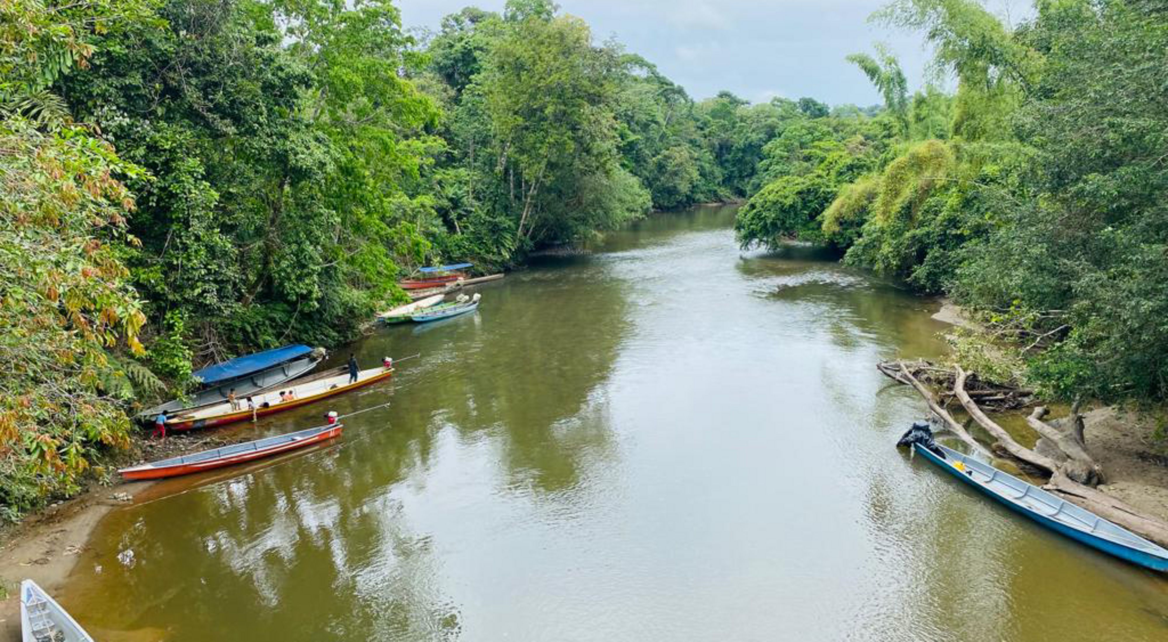
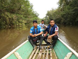
Along another series of rivers in the Ecuadorian Amazon, TNC worked with 33 communities of the Waorani Indigenous Nation and 47 communities of the Kichwa Indigenous Nation of Pastaza to create an extensive fluvial reserve through a process of free, prior and informed consent.
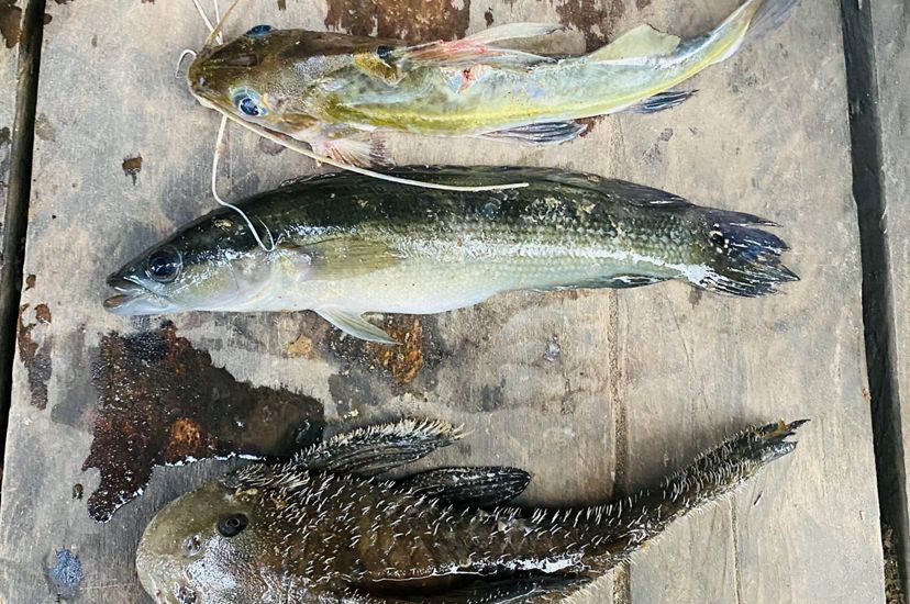
The Nushiño-Curaray-Villano Fluvial Reserve, named after the three rivers it spans, is over 371,380 hectares in size and rich with a diversity of aquatic habitats. Its main objective is to maintain river connectivity for 200 species of fish that serve as the primary source of protein for local residents. But it will also protect the area from threats like mining, oil spills and deforestation.


“It will allow us to monitor the rivers and require people to get the prior consent of the communities who live in the basin before any activities are carried out,” says Gilberto Nemquimo, who was the president of Waorani Indigenous Nation. “Rivers are sacred. They cannot be damaged, they cannot be destroyed, because our lives depend on them.”
Dialogue is critical to the success of projects like this, points out Gabriela Celi Checa, a TNC freshwater community-led conservation specialist who spent long hours in small boats, traveling from one remote community to another during the planning process. Her team hired people from the communities to translate at each of the planning workshops to ensure mutual understanding before decisions were made.
Quote: Gilberto Nemquimo
Rivers are sacred. They cannot be damaged, they cannot be destroyed, because our lives depend on them.
Over 60% of the Ecuadorian Amazon Basin is covered by the ancestral claims of Indigenous Peoples. “To promote an effective and durable freshwater conservation model, we must look to local and Indigenous communities who understand these fragile ecosystems,” says Celi. “Promoting effective participation and co-leading the process with Indigenous Peoples and local communities will ensure the implementation of strategies and conservation actions that are effective in the long term.”
Now that the fluvial reserve is recognized by the 80 communities, TNC is working with them to design a participatory management plan and to co-create a community-based monitoring system, a governance model led by the two Indigenous nations, and a financial scheme to improve well-being and reduce pressures on freshwater resources.
How We Work
The Nature Conservancy’s protection work is guided by its durable freshwater protection framework and the Voice, Choice, and Action (VCA) Framework.
A Model for the Region and Beyond
The creation of water protection areas and a fluvial reserve in Ecuador demonstrates the power of collaboration among government agencies, Indigenous leaders and conservation organizations.
“Hopefully, these remarkable achievements will inspire the protection of other free-flowing rivers and connected wetlands in the Amazon and beyond,” says Silvia Benitez, TNC’s freshwater manager for Latin America.


Global Insights Newsletter
Sign up to receive our Global Insights newsletter and other select content for thought leaders who believe that, together, we can build a better future for people and the planet. We address the sustainability issues of the moment and explore potential solutions—all in a five-minute read or less.

Related Reading
We Must Save Fresh Water to Save Ourselves
The Nature Conservancy joins others in pressing for urgent stewardship of our world's precious fresh water.
Conserving Fresh Water for Life on Earth
Freshwater systems are in trouble. But with a fresh approach, we can change the course for the better.
Supporting Local Voices, Choices and Action is Foundational to Conservation Success
A new study tests the principles of TNC's Voice, Choice Action framework and identifies important elements associated with successful community-based conservation projects.