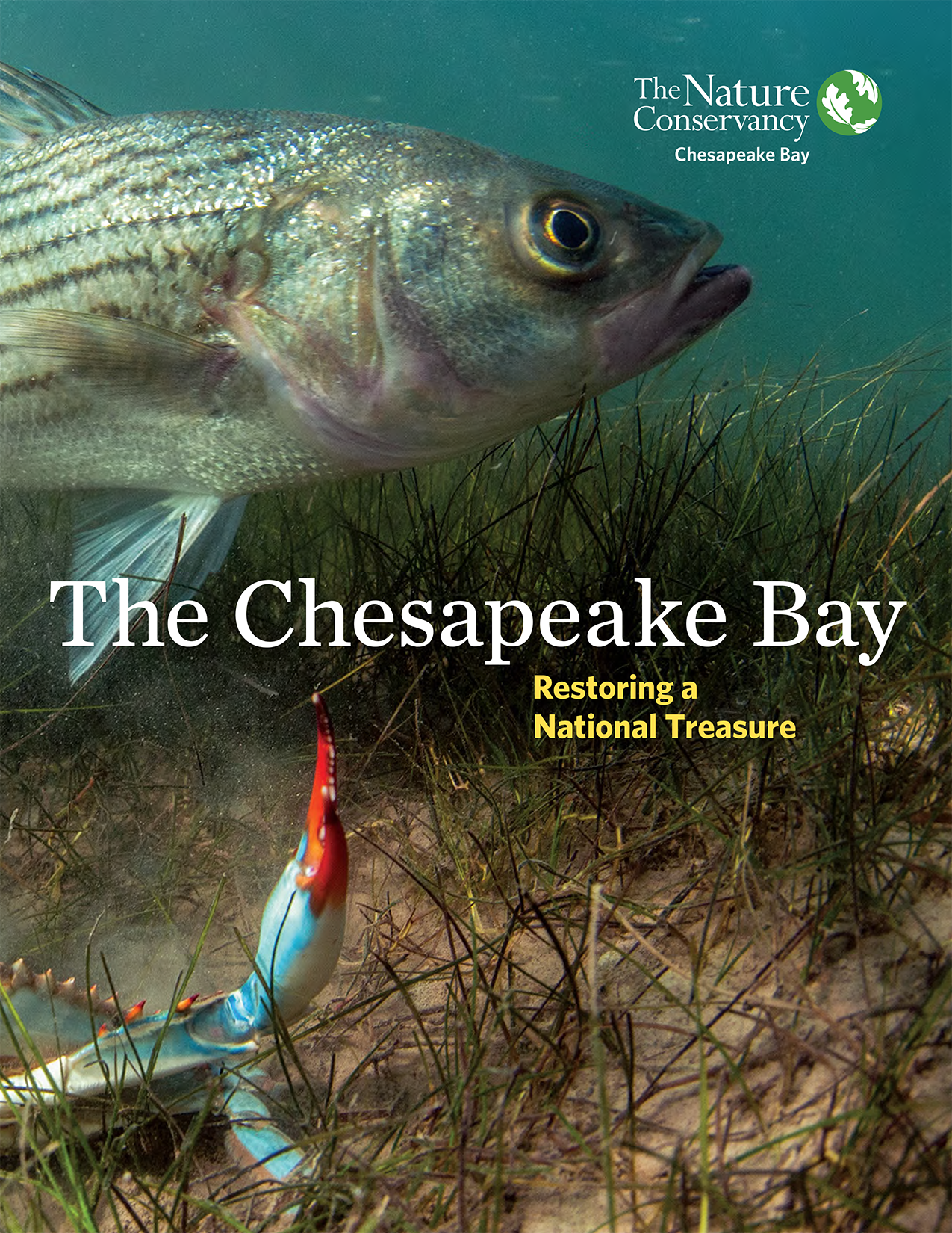
Chesapeake Bay
Securing clean water and protecting critical habitats in our nation’s largest estuary.

- Phone: 301-897-8570
-
Follow


Our goal is to restore a healthy Chesapeake Bay that supports over 3,600 species of plants and animals, thriving local communities, and sustainable industries such as fisheries, farming, and tourism.
One for the Bay
Help support cleaner water, healthier habitat & more abundant life in the Chesapeake Bay.
DonateThe Nature Conservancy is focused on conservation at the scale of entire ecosystems. As North America’s largest estuary, the Chesapeake Bay’s watershed—the area of land that feeds all the water draining into it—covers approximately 64,000 square miles and includes thousands of streams and rivers across six states and the District of Columbia.
Much of the Chesapeake Bay’s watershed lies within the Appalachians—another priority landscape for TNC. Due to their importance in tackling climate change and protecting biodiversity, we are committed to conserving these two globally important landscapes in this critical decade. And in order to succeed, we need your partnership and support.


Explore the Bay States
Learn more about our efforts across the watershed.
Delaware
TNC works in Delaware to restore wetlands, floodplains, and streams at the edges and downstream of agricultural fields, and works with trusted advisors and farmers to implement practices in field to keep nutrients growing food and out of our waterways. This improves water quality in local streams and rivers and downstream into the Chesapeake Bay.
Maryland/DC
TNC Maryland’s work in the Chesapeake Bay helps restore wetlands, forests, and coastal habitats across the estuary, which is especially critical in a state where roughly 90% of its more than 7,000 miles of shoreline borders the Bay.
New York
From the Bay’s northern headwaters, TNC works in New York to protect and restore aquatic habitats, supporting healthier ecosystems throughout the watershed.
Pennsylvania
TNC helps restore wetlands, floodplains, and streams at the edges and downstream of agricultural fields in Pennsylvania, and works with trusted advisors and farmers to implement practices in field to keep nutrients growing food and out of our waterways. This improves water quality in local streams and rivers and downstream into the Chesapeake Bay.
Virginia
In Virginia, TNC supports large‑scale oyster reef restoration and is restoring wetlands, floodplains, and streams in agricultural landscapes and fringing the Chesapeake Bay.
West Virginia
In West Virginia—part of the Bay’s Appalachian headwaters—TNC focuses on restoring forests, streams, and wetlands to improve clean water flowing into the Chesapeake Bay.


The Chesapeake Bay: TNC’s Newest Global Foodscape
The Chesapeake Bay was recently named as a priority landscape for TNC’s Global Regenerative Foodscapes strategy.
The stories below highlight the variety of ways that TNC is working across Delaware, Maryland/DC, New York, Pennsylvania, Virginia and West Virginia to protect and restore the Chesapeake Bay.
Restoring Oysters
Bringing Back an Icon

SOAR: Supporting Oyster Aquaculture and Restoration
Helping oyster farmers impacted by COVID-19 and the resulting economic downturn by purchasing surplus oysters and placing them on nearby oyster restoration projects.

Oyster Restoration in Virginia
Aggressive oyster reef restoration efforts are bringing a vital natural and economic resource back to Virginia waters.

Aquaculture by Design Chesapeake Bay
Can oyster aquaculture help make the Chesapeake Bay cleaner, faster?
Sustainable Farming
Promoting Clean Water

Agriculture in Maryland
Engaging with Maryland's largest industry to keep nutrients on our farms and out of our waterways.

Agriculture in Pennsylvania
Partnering with local farmers to ensure clean water, thriving habitats, and sustainable food sources.

4R Nutrient Stewardship
The PA4R Alliance brings together diverse partners to help farmers achieve Chesapeake Bay water quality goals.
Restoring Waterways with Farmers
Learn how TNC is working with local farmers to apply science-based stream, floodplain and wetlands restoration projects in Lebanon and Lancaster Counties.


Discover the Benefits of Manure Injection
Every poop counts! Learn how manure injection and nutrient management planners are helping farmers maximize manure nutrients and reduce nitrogen fertilizer costs.
Reducing Stormwater
Reducing Stormwater

Planning for a Rainy Day
Washington, D.C., combines regulations with a new credit market to keep polluted stormwater out of its rivers.

Ten Years in, D.C.’s Stormwater Credit Market is Thriving and Still Growing
Ten years ago, Washington D.C. established the Stormwater Retention Credit (SRC) market, a first-of-its-kind approach to stormwater management.

Green Infrastructure for Cities
NatureVest aims to help cities accelerate their use of green infrastructure to manage stormwater runoff.
Restoring Wetlands
Restoring Wetlands

The Pocomoke River: A Wild & Scenic Connector of Nature and Community Across Delmarva
Discover how the Pocomoke River, one of the wildest and most scenic waterways on the East Coast, connects communities, supports conservation and showcases the natural beauty of the Delmarva Peninsula.

Freeing a Trapped River
Celebrating 10 years of restoration, partnership and the largest ecological restoration in Maryland’s history.

In Water We Trust
The Virginia Aquatic Resources Trust Fund marks a quarter century of restoring wetlands and streams.

Pocomoke River: Restoration and Partnership
A healthy Chesapeake Bay is in our grasp. Partnership and collaboration is critical to restoring wetlands and floodplains at a meaningful scale.
Tackling Climate Change
Tackling Climate Change

Maryland's Legislative Priorities
We're striving for a greener, more resilient Maryland through policy solutions that work for people and the planet.

Climate Solutions
Advancing innovative, science-based solutions that match the urgency of the climate crisis.

Climate Change
Protecting and restoring healthy natural systems in Virginia to withstand a changing climate and rising seas.
Protecting Land to Protect the Bay


_Harold_Malde_4000x2200.jpg?crop=244%2C0%2C3510%2C2200&wid=1500&hei=940&scl=2.3404255319148937)


Resources
Download
Help us reach our 2030 goals for a healthier and more resilient Chesapeake Bay.
DownloadDownload
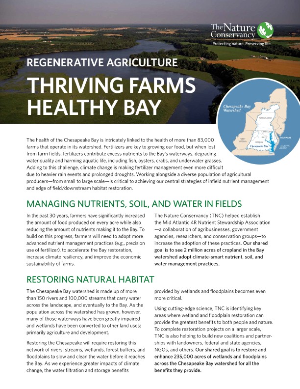
The health of the Chesapeake Bay is intricately linked to the health of more than 83,000 farms that operate in its watershed.
DownloadStay in Touch
Subscribe to Nature News, our monthly e-newsletter. Get the latest news and updates about our conservation efforts locally and around the world, delivered straight to your inbox.