
Midwest Road Trip No matter your interest, TNC has a wide variety of accessible preserves around the Midwest for you to explore. © pablohart/Getty Images Signature
From rolling prairies adorned with wildflowers to the lapping waves of lakes both Great and small, the Midwest is brimming with wildlife and landscapes that tell the story of the region’s rich ecological tapestry. Whether you’re an avid birdwatcher, a hiking enthusiast, or simply seeking the tranquility of nature, TNC’s nature preserves in the Midwest make an excellent excuse for a road trip any time of the year.
So pack your bags, set your sights on the open road and prepare to connect with nature in a way only the Midwest can offer.
Plan Your Trip
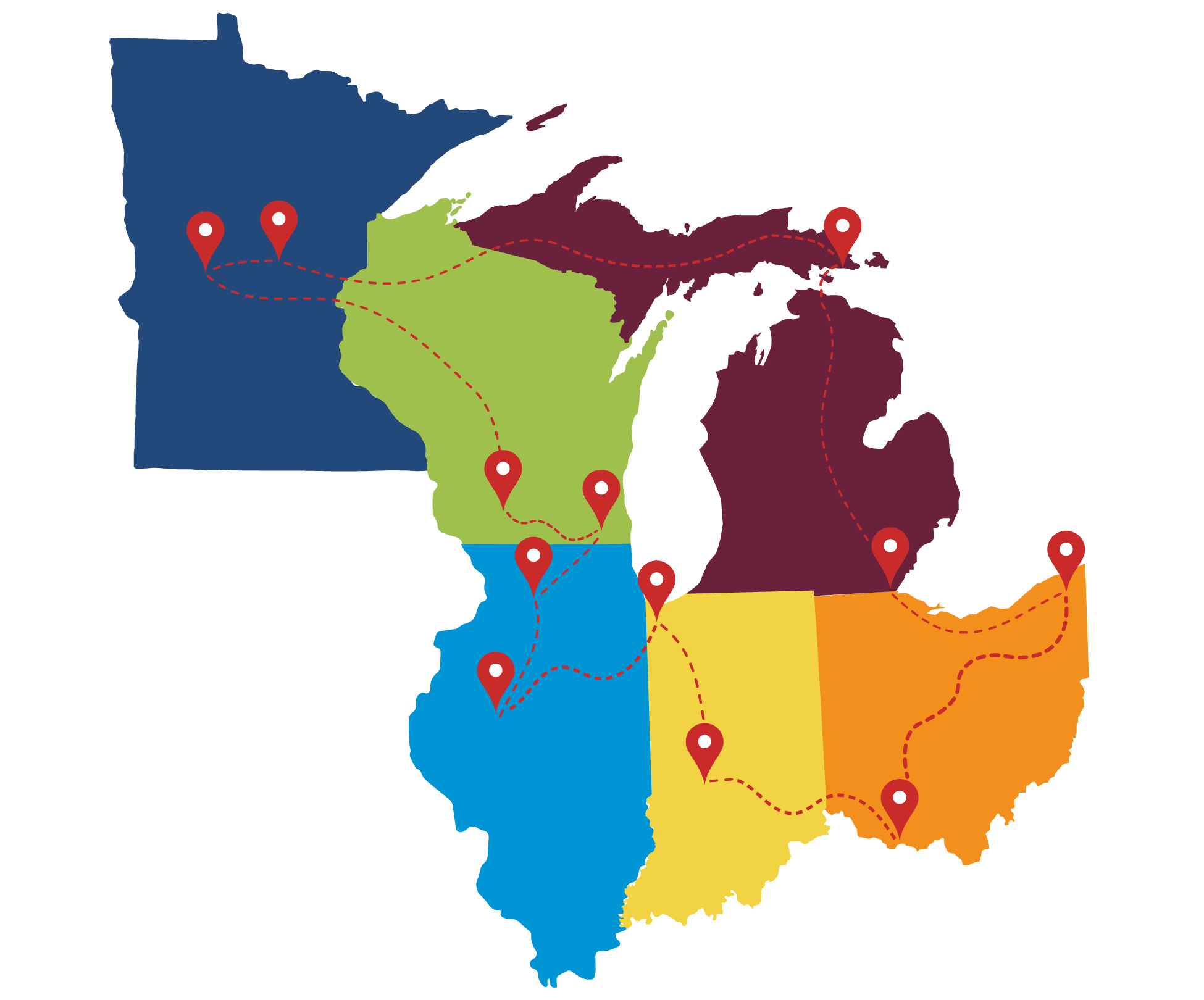
This Midwest road trip, which travels from Minnesota and loops back to Michigan's Upper Peninsula, takes you through jack pine savannas, desert-like prairies, rolling grasslands, unique wetlands, and, of course, lake shores.
Click the points on the map for a brief introduction to each state's highlights, then scroll down the page for a more detailed overview of each preserve on the map.
Minnesota
The two TNC preserves highlighted here feature a rare jack pine savanna and a high point in the state's prairie region that overlooks a pristine lake.
Wisconsin
In Wisconsin, find cacti blooming in the state's desert-like prairie, followed by a refreshing visit to one of Wisconsin's most pristine kettle lakes.
Illinois
In this state, you'll visit a rolling grassland where bison roam and lively wetlands that serve as a respite to hundreds of thousands of migratory birds

Indiana
In Indiana, swing by a free festival celebrating monarch butterflies, then travel down and hike one of the new trails at one of Indiana’s most scenic preserves.
Ohio
Experience Ohio's diverse natural beauty with a visit to the rolling Appalachian foothills followed by a stop at a conservation and recreation campus that's nestled within one of the largest protected wetland forests in the state.
Michigan
The final state in our road trip, Michigan takes us to a birder's paradise in a restored coastal wetland followed by a trek to the Upper Peninsula to visit the breathtaking rocky shores of Lake Huron.

Brainerd, MN
Paul Bunyan Savanna
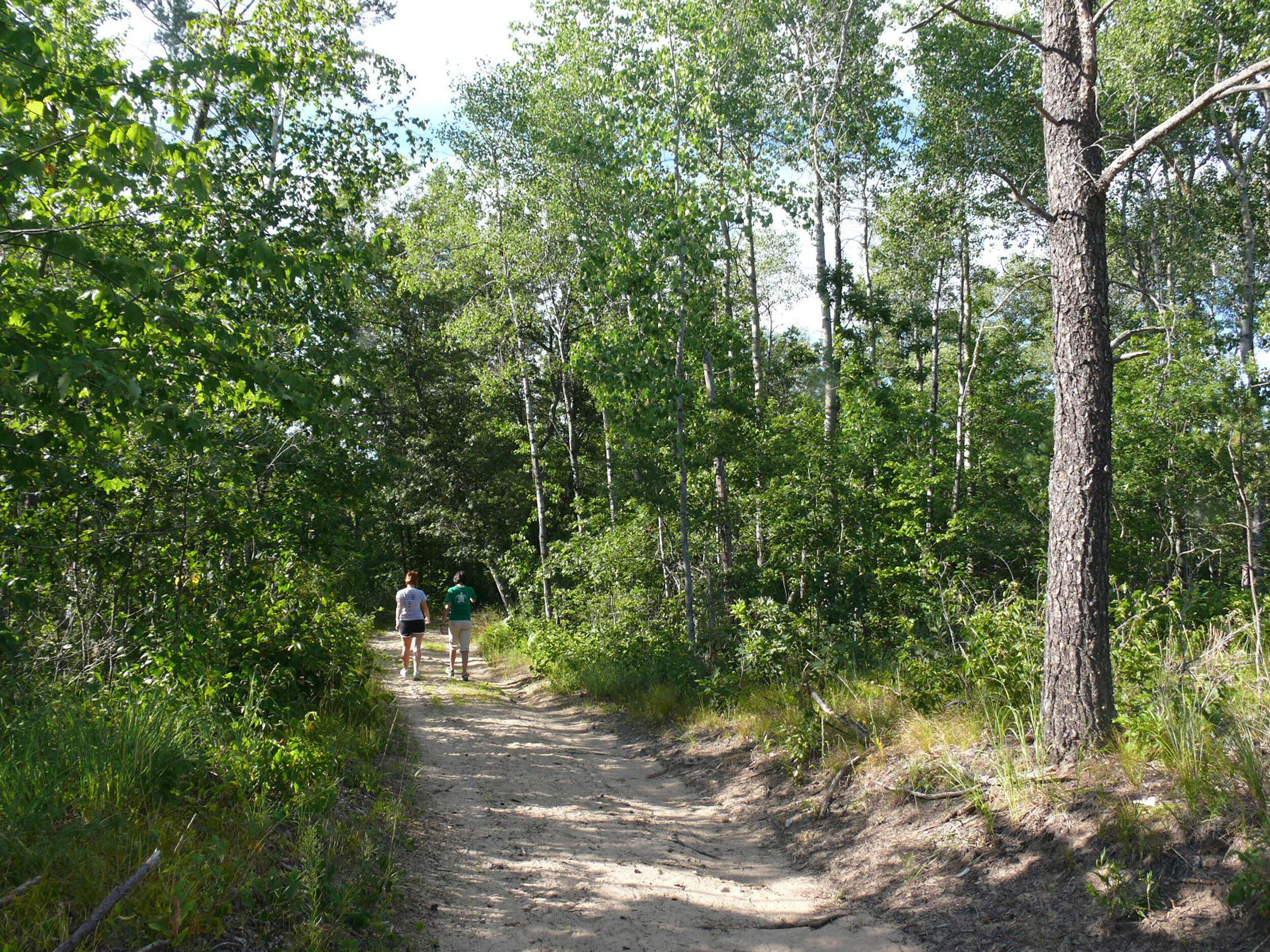
The Paul Bunyan Savanna is one of Minnesota's remaining jack pine savannas. Located near the railroad, it escaped development in the heart of Brainerd, a city of 14,000 in Minnesota lake country. The Nature Conservancy acquired the preserve in 1986.
If you stop at this 164-acre preserve on your summer road trip, enjoy the hiking trails maintained by the Northland Arboretum ski club! The preserve is located adjacent to the Paul Bunyan Trail, a popular walking, hiking and cycling trail. Keep an eye out for wildflowers like our state flower, the showy lady’s slipper, which blooms in June.
Located near Brainerd, MN in Crow Wing County
Directions
Follow State Highway 210/371 to NW Seventh Street. Go north on NW Seventh a few blocks to the adjacent Northland Arboretum entrance. Parking is available at the Arboretum for a $3 fee.
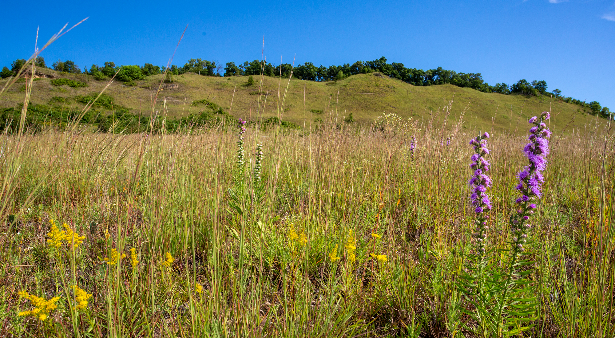
Near Ashby, MN
Seven Sisters Prairie
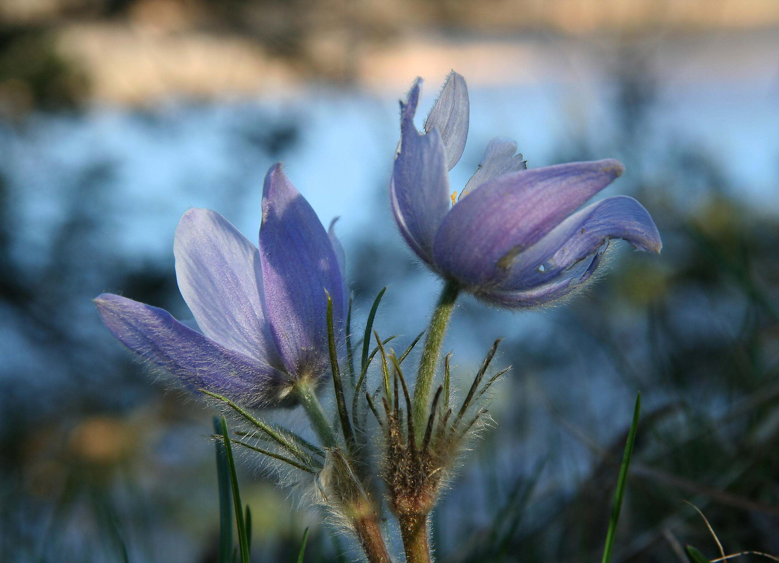
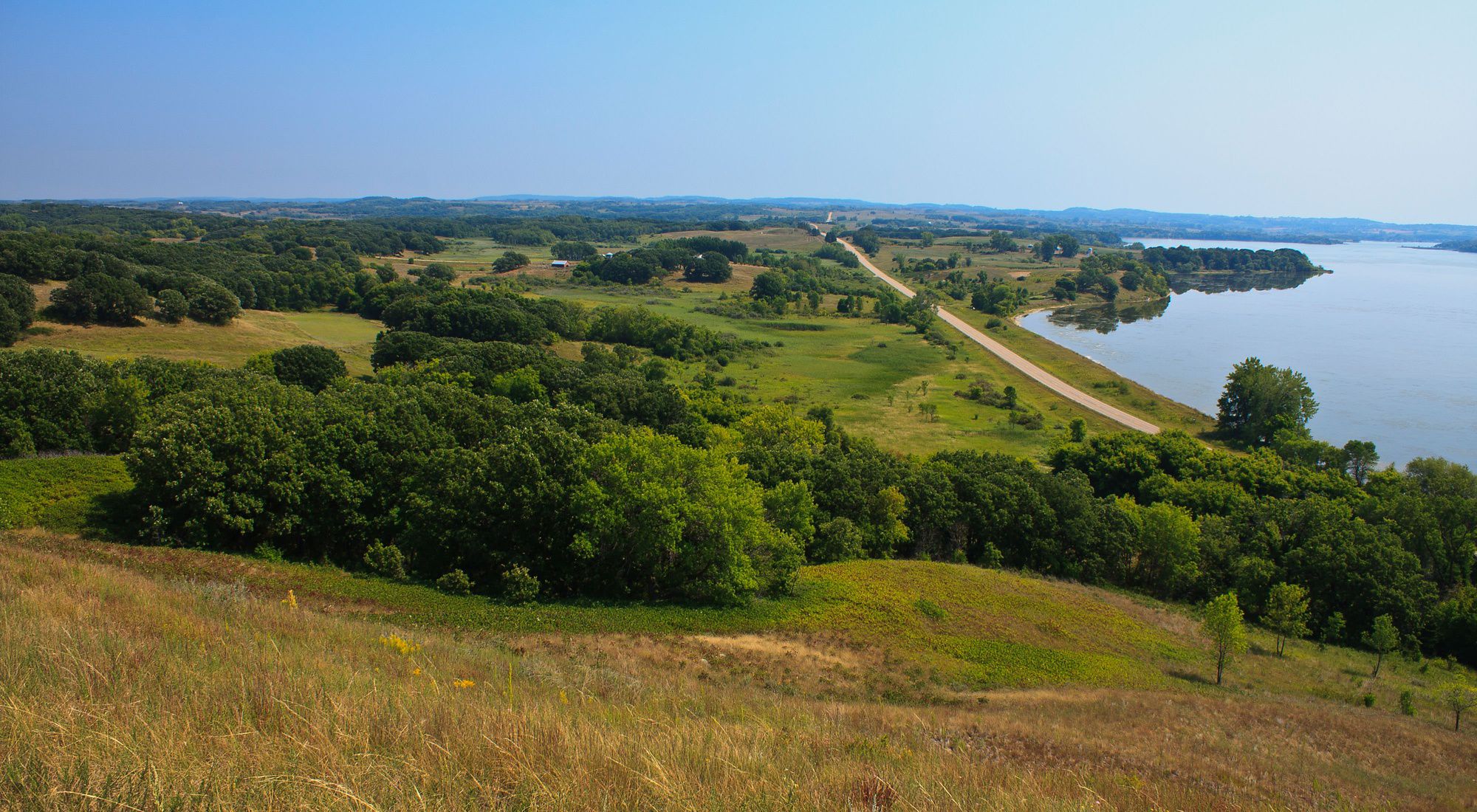
Climb to the top of the “mountain” at Seven Sisters Prairie for a panoramic view of the prairie hills and Lake Christina. The view is spectacular in the spring when the wildflowers bloom and in the fall when the hills turn russet and tan, and flocks of canvasback ducks cover the lake.
This enormous hill in the middle of Minnesota is, of course, not a true mountain, but it can feel like it as you climb 190 feet to the peak. Lake Christina is shallow, only about 4 feet deep on average, and is an important stop for migrating waterfowl. Bring your binoculars and see how many different birds you can spot!
Near Ashby, MN in Otter Tail County
Directions
Take the Ashby exit off I-94 and go north through town on Hwy 78. Seven Sisters Preserve is the notable ridge on the north side of the road about three miles east of Ashby, along the shore of Lake Christina. Park in front of the gated road leading into the gravel pit.

Get Inspired by Nature Near You
Sign up to receive monthly conservation news about your state chapter.

Spring Green, WI
Spring Green Preserve
Tucked between Highways 23 and 60 just northeast of its namesake town, the Spring Green Preserve is a unique gem well worth visiting. Known as the “Wisconsin desert,” this dry bluff prairie ecosystem features sandy soils that support prickly pear cactus, a variety of wildflowers and native grasses, tiger beetles, pocket gophers, and more. The prairie itself provides crucial habitat for declining grassland bird species.
Walk the trail from the parking lot off Jones Road up through the open prairie with sand dunes and dry grasses, into a black oak barrens, and then up to the top of the bluff to enjoy spectacular views of the Wisconsin River Valley.
Located in Sauk County, just north of Spring Green
Directions
From the intersection of US Hwy 14 and State Hwy 23 near Spring Green:
- Travel north on 23 for 0.5 mile to intersection with Jones Road on the right (east)
- Travel east on Jones Road for 0.75 mile; the preserve is on the left
- Turn left into a dirt access road marked Angelo Lane — you'll see it just past a driveway to a house trailer (fire #E5196A). Note: In rural areas, a fire number is akin to a house number.
Near Milwaukee, WI
Lulu Lake Preserve
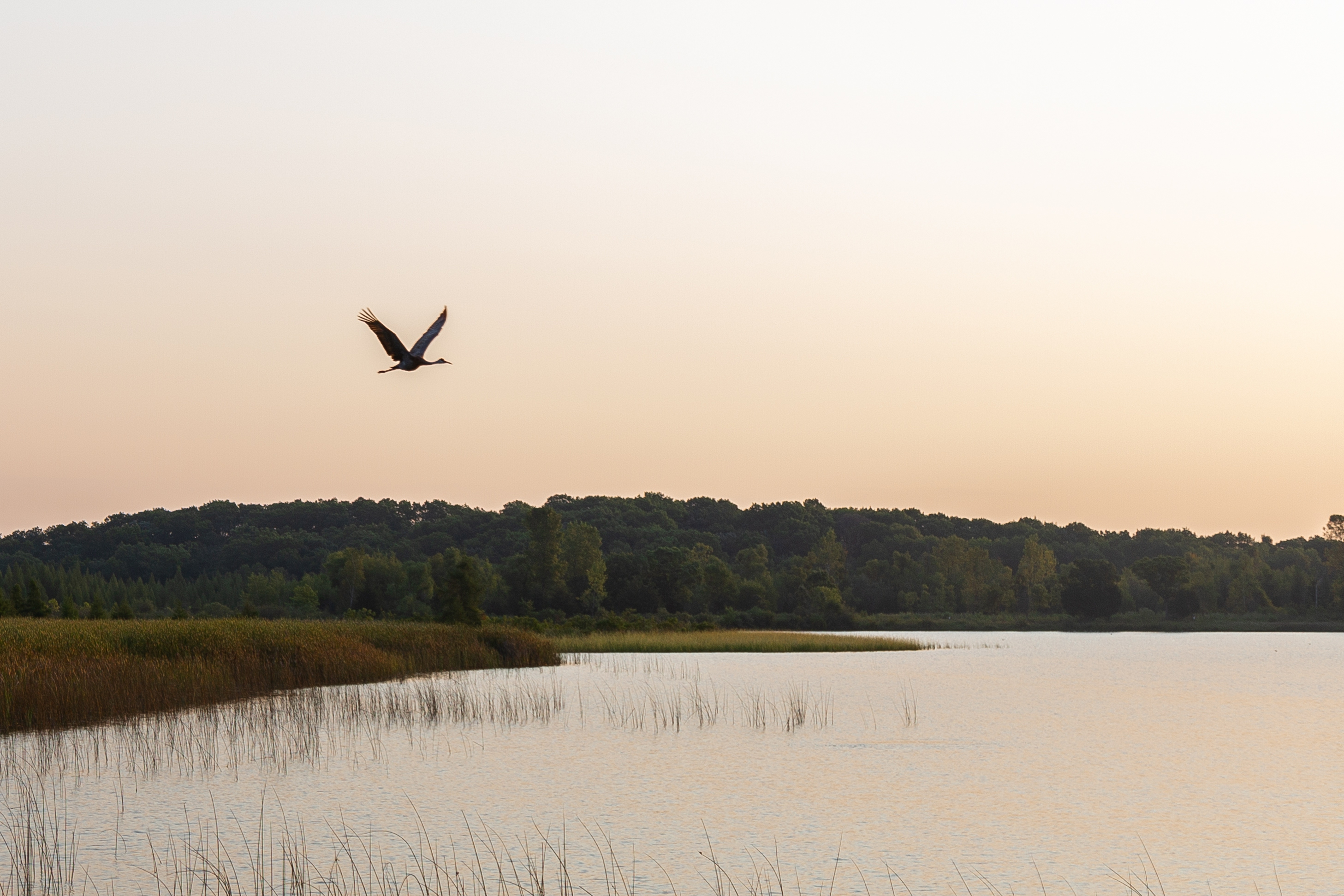
Just 45 minutes southwest of Milwaukee find the headwaters of the Mukwonago River and the jewel in its chain of lakes: Lulu Lake. Hike the trail system at the preserve or put in a canoe or kayak at adjacent Eagle Springs Lake and paddle down the connector to enjoy the crystalline waters and wild rice beds of Lulu Lake itself.
The preserve’s high-quality stream, wetlands, and oak openings provide habitat for rare fish and mussels and many native plants and animals. Come in spring for the ephemeral wildflowers, or summer and fall for pocket prairies in full bloom. A great place for birdwatching, you might catch osprey nesting, purple martens, sandhill cranes, warblers, and more.
Located 35 miles southwest of Milwaukee, WI
Directions
From Milwaukee (a 35-minute drive):
- Take I-43 south to East Troy, then take State Hwy 20 west to Cnty Hwy N.
- Take Cnty Hwy N north to Troy Center, where it will change to Nature Rd.
- Take Nature Rd. 1.5 miles north and turn right at a driveway marked N9564 — the number is clearly marked. This is a private road leading to the preserve.
From Madison (a 75-minute drive):
- Take US Hwy 12 about 8 miles past Whitewater to the junction of 12 and State Hwy 20.
- Go straight onto 20. At the intersection of 20 and Cnty Hwy J, continue straight on J to Nature Road at Troy Center.
- Turn left and take Nature Rd. 1.5 miles north
- Turn right at a driveway marked N9564 — this is a private road leading to the preserve.


Near Franklin Grove, IL
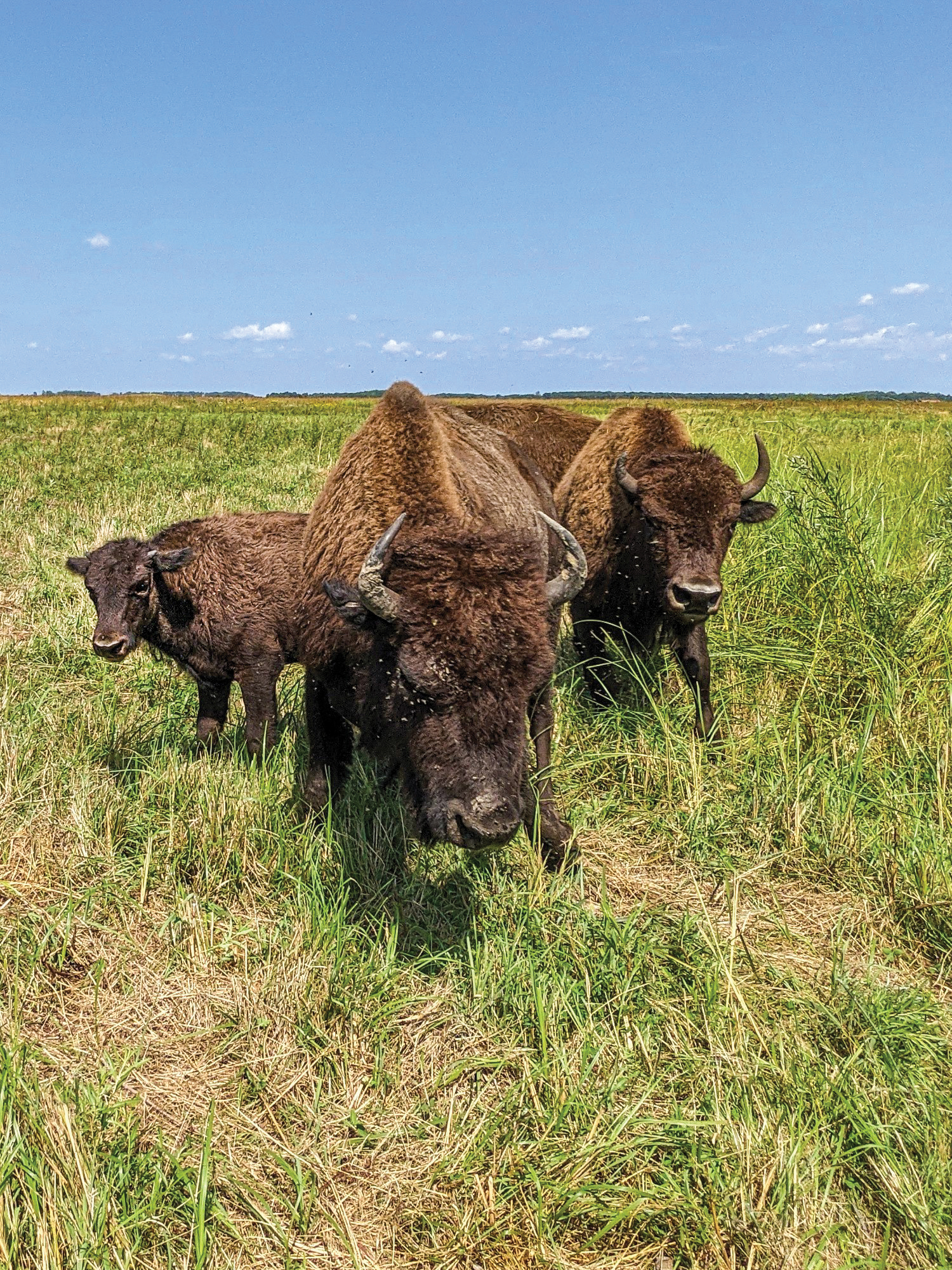
Nachusa Grasslands
Until recently, you had to travel to Wyoming or other western states to see wild bison roaming. Today, you can see these giant mammals—which weigh 1,000 to 2,000 pounds—in Illinois. Consisting of 4,000 acres of restored, remnant prairie, Nachusa Grasslands Preserve is home to a herd of about 100 bison that roam 1,500 acres of lush rolling hills.
Beyond bison-viewing, visitors of all ages can enjoy capturing nature photography, birdwatching and hiking five unique trails at Nachusa. From vast rolling meadows and lively wetlands to oak woodlands and savannas, visitors can explore the preserve’s diverse habitats home to more than 180 bird species and over 700 native plant species.
Start at the Visitor’s Center to get to know more about Nachusa’s history, ecosystems and restoration work. When you arrive at the Center, follow a gentle slope to a pavilion featuring interactive exhibits perfect for curious kids to discover the wonders of the preserve’s flora and fauna. A hand pump with potable water and two self-composting restrooms are also available at the Center. With water bottles refilled and bathroom breaks taken care of, you can hike around the Center or drive to one of five trailheads to begin your expedition!
Located near Franklin Grove, IL
Directions
From Chicago and points east:
- Take I-88 West (East-West Tollway)
- Exit at Route 251 North (Rochelle) to Route 38 West (To get on 38 West in Rochelle, you need to follow a few signs due to one-way streets.)
- Travel through Ashton and into Franklin Grove (approx. 16.5 miles), go two blocks past Casey's gas station and turn right (north) at Daysville Road/1700E (sign: Franklin Creek State Park)
- Travel 1.5 miles north to Naylor Road/1950 North, then turn left (west) and go 2.2 miles to Lowden Road/1500 East
- Turn right (north) and go one mile to entrance on left.
From South:
- Take I-39 to Route 38 West
- Then, follow previous directions. (Route 38 makes a few turns in Rochelle so follow signs.)
- From North (I-39):
- Take I-39, and exit at Route 64
- Go west towards Oregon, Illinois for 16 miles to Daysville Road/1700 East, which is just before Oregon
- Go left (south) on Daysville for 2.5 miles to Lowden Road/1500 East (just past LaVigna Restaurant)
- Turn right and continue southwards on Lowden Road for eight miles (you will pass Flagg and Stonebarn Roads) to entrance, on the west (right) side of the road.
Southwest of Peoria, IL
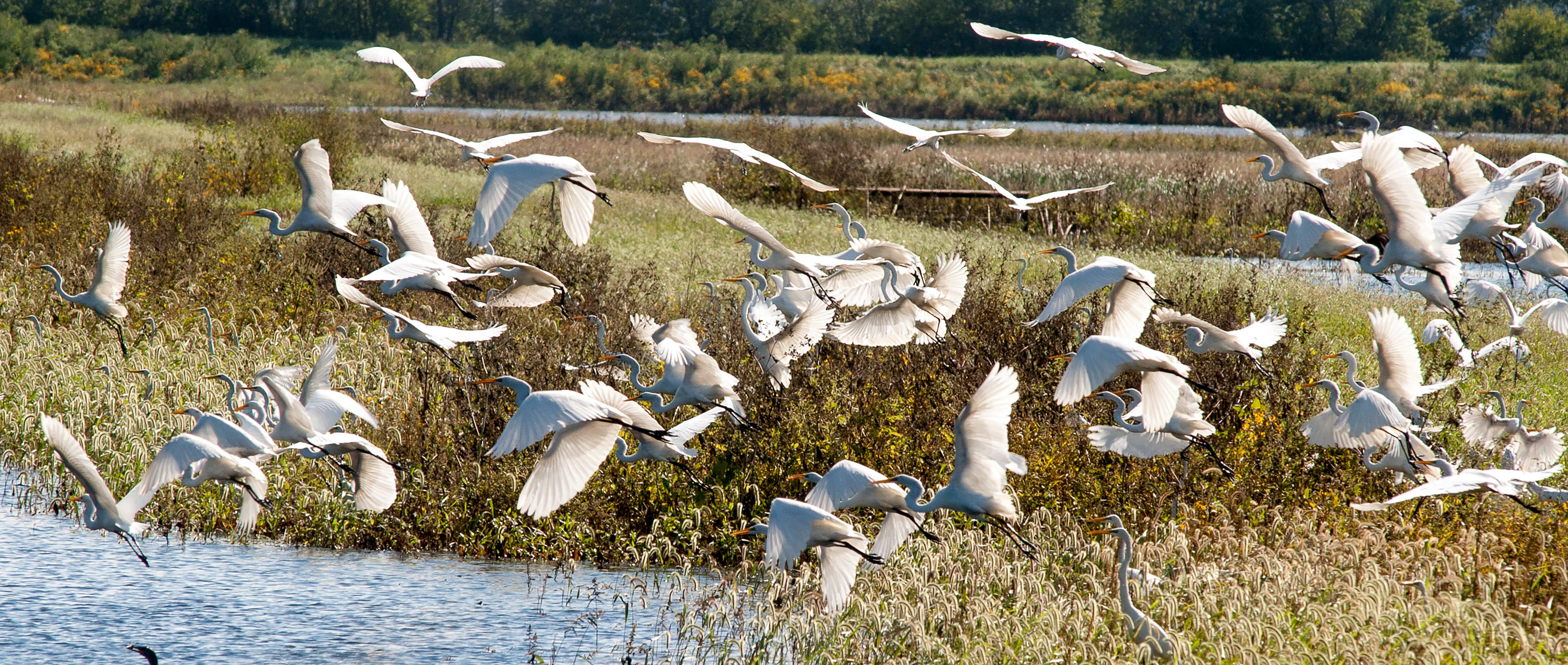
Emiquon
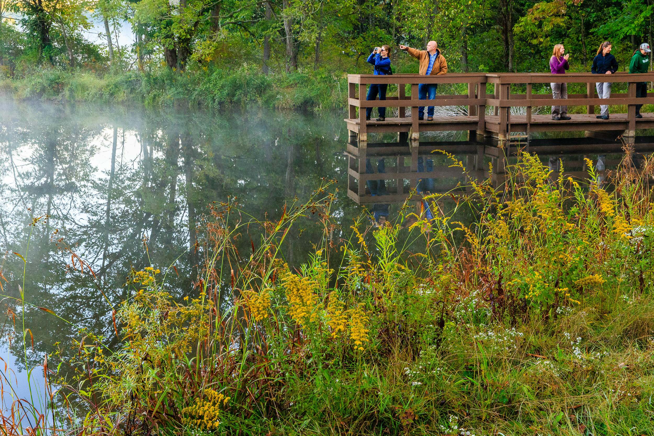
Have you ever seen a flock of 10,000 snow geese? At Emiquon Preserve, you can catch a glimpse of tens of thousands of migratory birds taking respite along their migration routes during spring and fall. Whether you tune in to our live migration camera at home or plan a trip out to admire the waterfowl in-person, Emiquon’s 6,000-acre wetland habitat is a must-visit spot for birders.
While migration season may be Emiquon’s busiest time, the preserve offers a wide range of recreational activities year-round, including hiking, birding, wildlife viewing, paddling, boating, hunting and fishing. The preserve offers ample parking and beautiful views of its wetlands on short trails that are easy for the whole family to use. Explore bustling wetland and restored prairie habitats and the diverse plant and animal species that call it home using the preserve’s hiking trails, kid-friendly observation decks, pavilions and boardwalks. Don’t forget to bring your binoculars for a chance to observe iconic wetland wildlife like river otters, softshell turtles, herons, egrets and more.
Located about an hour south of Peoria, IL
Directions
Parking lots are along the Illinois River Road National Scenic Byway (IL-78/97)
From Springfield: Take IL-97 through Havana. After crossing the Illinois River, merge right onto IL-78/97.
From Peoria: Take IL-24 west. Turn left onto IL-78/97 toward Havana.
From Chicago: Take I-55 south. Take exit 145 toward McLean. Turn right onto US-136. After crossing the Illinois River, merge right onto IL-78/97

East Chicago, IN
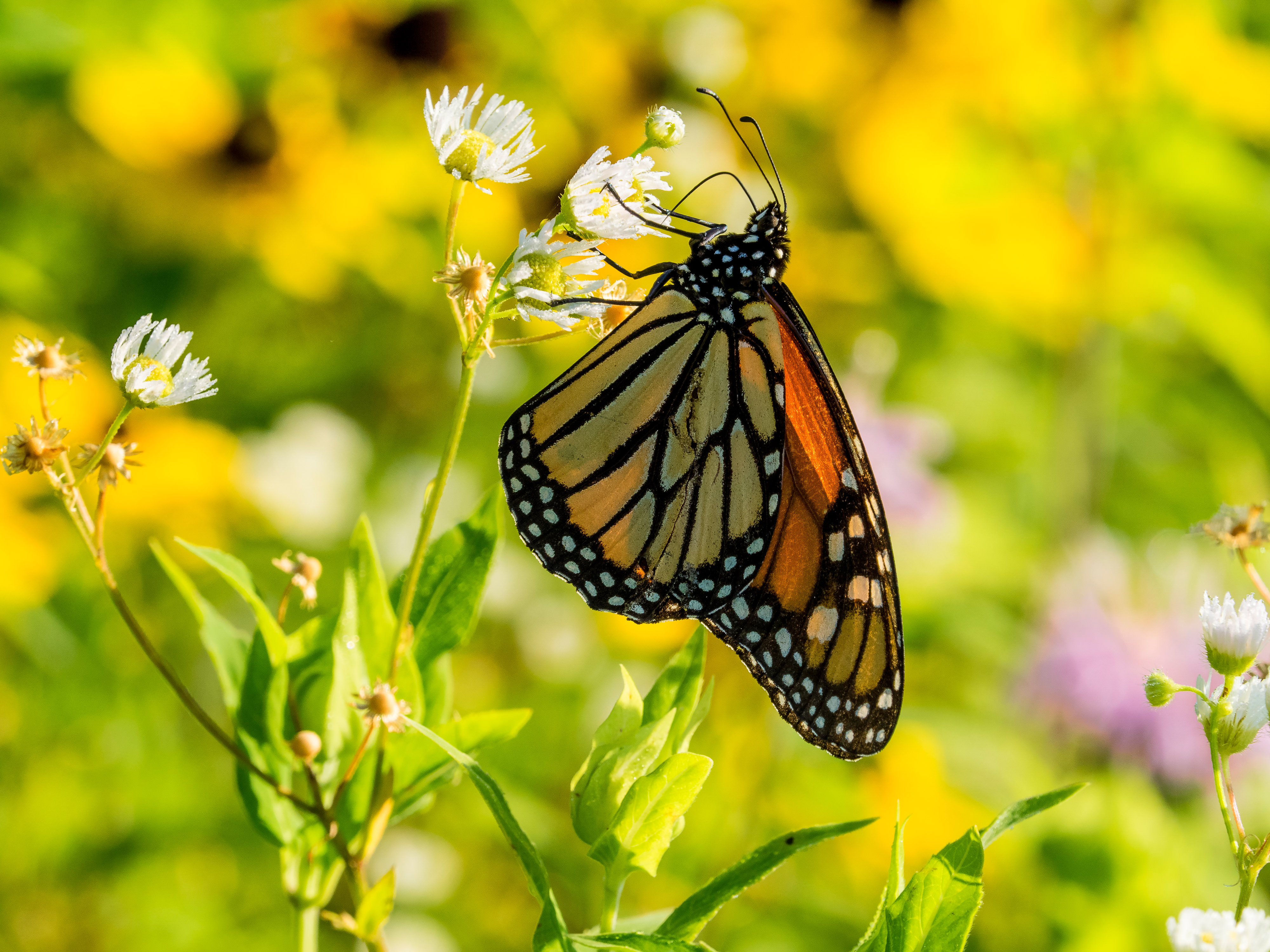
Festival de la Monarca
As the iconic orange and black monarch butterfly flutters on the fine line of being added to the Endangered Species List, we can see and celebrate them before they start their fall migration. They travel up to 100 miles per day as they make their way south, primarily to the oyamel fir forests of Michoacán, Mexico. At the end of summer, a generation of butterflies born in the United States and never been to Mexico flies on a 3,000-mile journey symbolic among many Mexican communities in the Midwest and eastern United States. The environmental factors that drive monarch butterflies southward also hold meaning for conservationists: Their migration is now threatened by temperature changes, habitat loss and other human impacts.
In East Chicago, TNC and its partners host a community event every fall to commemorate this journey. El Festival de la Monarca raises awareness and unites the surrounding community through educational activities, music, art and dance. This year’s event on Saturday, September 6, marks the celebration’s seventh anniversary. This unique, noncommercial event connects children and adults with nature they can relate to in a highly urban environment. Admission is free! And yes, you will see butterflies at this event as they’re released to join the migration to Mexico. Watch a video here.
Morocco, IN
Kankakee Sands
The Efroymson Prairie at Kankakee Sands in Newton County is 8,400 acres of prairies and wetlands. This restored prairie serves as a connecting piece between Willow Slough Fish and Wildlife Area, Beaver Lake Nature Preserve, Conrad Savanna Nature Preserve and TNC’s Conrad Station Savanna.
More than 600 species of native plants have been used to plant the prairies of Kankakee Sands, and as a result, the land is teeming with native wildlife. Kankakee Sands provides habitat for more than 240 bird species, including such rare species as the Henslow’s sparrow, northern harrier and least bittern.
Kankakee Sands is also home to 70 species of butterflies, including the state-endangered regal fritillary butterfly, and more than 900 species of moths! Dragonflies, bees, frogs, lizards, snakes, badgers and bison all hover, slither and roam at Kankakee Sands.
There are several trails that allow you to experience the preserve, including:
- The Prairie Overlook, Bison Overlook and Meadowlark Trails at our Bison Viewing Area prove there’s more to Kankakee Sands than just bison. New spotting scopes, however, make seeing the bison so much easier!
- A 1.5-mile loop trail over moderate terrain gently winds through Conrad Station Savanna’s black oak savanna, restored prairie and the former town of Conrad. Check out the old building foundations!
- The 2-mile Grace Teninga Discovery Trail takes you through a short grass prairie restoration to the top of a sand dune with 360-degree views of the surrounding prairie and Beaver Lake Nature Preserve.
- A 0.6-mile Wet Prairie Trail treats you to wildflowers, amphibians and an ephemeral pond. Hard to believe, but this area used to be a hideout for horse thieves and counterfeiters!
- Accessibility questions? Visit Birdability.org and search on any of these trails to learn about their accessibility.
You can also explore our Kankakee Sands Story Map to get truly prepared for your visit. Hope to see you on the trails at Kankakee Sands soon!
Ohio
Next up is Ohio, where we'll visit the expansive vistas of the Appalachian foothills and then head up north to explore a Great Lakes wetland community that's 12,000 years old.

West Union, OH
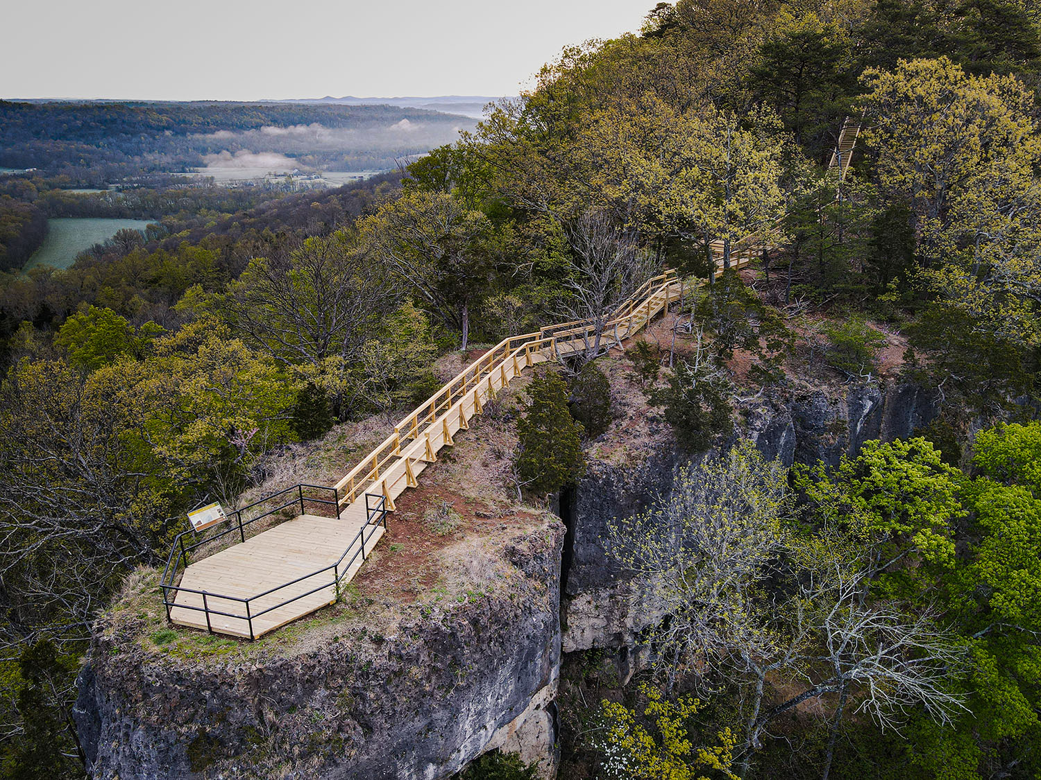
Edge of Appalachia Preserve System
The Richard and Lucile Durrell Edge of Appalachia Preserve System in southern Ohio hosts an extensive network of 27 miles of scenic hiking on five different trails that wind through rugged woodlands, prairie openings and clear streams. Each trail offers a unique glimpse of the state’s abundant flora and fauna, with more than 100 rare plant and animal species making their home within the preserve system. As you explore “The Edge,” keep an eye out for Cerulean warblers and other neotropical birds that abound during warmer months. The preserve also shelters endangered species like the Indiana bat, green salamander, and Allegheny woodrat.
Whether you’re hiking, birdwatching, paddling or simply enjoying the peaceful trails, the Edge of Appalachia offers an immersive nature experience for families. It’s a protected corridor for migratory birds and wildlife, making it an essential stop on any Midwest summer road trip. Notably, the Christian and Emma Goetz Buzzardroost Rock Trail offers one of Ohio’s most spectacular views that hikers can enjoy after a moderately difficult hike through a rugged forest. Looking for something a bit easier? Visitors to the E. Lucy Braun Lynx Prairie will enjoy exploring three interconnecting loop trails, with a combined length of 1.3 miles and no steep hills to climb.
Located near West Union, OH
Directions
From West Union:
- Turn left (east) onto State Route 125. Travel east on SR 125 for about 7 miles toward the village of Lynx.
- To visit Lynx Prairie, follow SR 125 into Lynx, then turn right (south) onto Tulip Road. Follow Tulip Road south .8 miles and turn left onto Cline Road. Follow Cline Road for .7 miles to the parking area and trail head. Public access to Lynx Prairie is available from a trail beginning in the east corner of the parking area.
- To visit Buzzardroost Rock, follow SR 125 toward the village of Lynx. Watch for the sign on the right as you go up a large hill. Turn right off SR 125. (Owned and managed by The Nature Conservancy and Cincinnati Museum Center)
- To visit The Wilderness Trail, follow SR 125 toward the village of Lynx. Take a left on Lynx Rd. then take the next left on Shivener Rd. (gravel). Parking lot at the end of Shivener Rd.
- To visit the Dr. George Rieveschl Jr. Creek’s Bend Overlook, and the Joan Jones Portman Trail, travel east on SR 125 about 6 miles, turn right (south) onto Waggoner Riffle Road and continue on Waggoner Riffle about 2 miles to Creek’s Bend Overlook. Parking area located on the right, behind the wooden fence.
Near Rock Creek, OH
Grand River Conservation Campus at Morgan Swamp
Covering more than 2,000 acres, Morgan Swamp Preserve in northeast Ohio is one of the largest privately protected wetland communities in the Buckeye State. The preserve is part of the larger Grand River Lowlands, a wetland system that originated around 12,000 years ago when a massive glacial lake deposited thick layers of silt and clay. These wetlands play a crucial role in maintaining the health of the state-designated Wild and Scenic Grand River, which serves as an important tributary to Lake Erie. Visitors can explore more than three miles of hiking trails revealing unique wetland, forest and wet prairie habitats. Keep an eye out for beavers and otters as you traverse this serene preserve.
Nestled within Morgan Swamp, the Grand River Conservation Campus offers an array of recreational opportunities for families. Here, you’ll find nature trails, an accessible fishing pier at Bliss Pond and a canoe/kayak launch on the Grand River. Families can enjoy a day of exploration, wildlife-watching and picnicking amidst the natural beauty. The campus also boasts a children’s playground and nature play area. The Dr. James K. Bissell Nature Center provides educational opportunities for those curious about the local flora and fauna, including summer programs for children and adults. Whether you’re hiking, birdwatching or simply immersing yourself in nature, Morgan Swamp promises an unforgettable experience for all ages.
Near Rock Creek, OH
Directions
LONG POND AT MORGAN SWAMP PRESERVE
From the north:
- From Interstate 90, travel south on State Route 534 for about 7 miles to its junction with State Route 166/Footville-Richmond Rd.
- Travel east on Footville-Richmond Rd. for 3.4 miles to the Morgan Swamp parking lot.
From the south:
- From U.S. Route 6, take State Route 45 north for about 3.2 miles to Footville-Richmond Rd.
- Travel west on Footville-Richmond for about 1.6 miles to the Morgan Swamp parking lot.
Visit the Grand River Conservation Campus
GRAND RIVER CONSERVATION CAMPUS AT MORGAN SWAMP PRESERVE
From the north:
- From Interstate 90, travel south on State Route 534 for about 7 miles to its junction with State Route 166/Footville-Richmond Road
- Travel east on Footville-Richmond Road for 2 miles to Windsor-Mechanicsville Road.
- Travel 1.8 miles south on Windsor-Mechanicsvile Road to Callender Road.
- Travel 1 mile east on Callender Road to 3973 Callender Road.
- Driveway on north side of road before (to the west of) bridge
From the south:
- From U.S. Route 6, take State Route 45 north for about 2 miles to Callender Road
- Travel west on Callender Road for about 1.5 miles to the 3973 Callender Road
- Driveway on north side of road before (to the west of) bridge
Michigan
The final stops on our Midwest Road Trip take us to Michigan to explore a birder's paradise, followed by a visit to the spectacular rocky shorelines at the northern tip of Lake Huron.

Monroe, MI
Erie Marsh Preserve
Located on western Lake Erie’s North Maumee Bay, Erie Marsh is a birder’s paradise. Representing 11% of the remaining marshland in southeastern Michigan, the preserve contains one of the largest marshes on Lake Erie and plays a huge role as a migratory stopover and nesting site for birds. Keep an eye out for shorebirds, waterfowl, land birds and, in the fall, raptors—not to mention other wetland locals like muskrats, water snakes, bullfrogs, and native fish who can now access new breeding and spawning areas for the first time in more than 60 years, thanks to a decade-long restoration project. The trail system, which follows a series of raised dikes that divide the wetland types, can take you through the middle of the marsh past the sulfur spring or out along the edge of Maumee Bay. Bring your binoculars, set up a spotting scope or keep your eyes peeled for the many wetland species you could encounter.
Near Monroe, MI
Directions
Preserve parking is available next to cottages owned by the Erie Shooting and Fishing Club.
From Monroe, Michigan:
- Take I-75 south of Monroe, to Exit 2 (Summit Road).
- Head southeast on Summit Road approximately one half-mile to the first place on the left where you can execute a U-turn to head north.
- Make the U-turn to head north on Summit Road.
- Follow Summit 0.2 miles to Bay Creek Road, turn right (northeast) on Bay Creek and follow it 0.8 miles to Dean Road.
- Dean Road will be the first road on the right. Turn right (east) on Dean and follow it until you see the Erie Shooting and Fishing Club cottages.
- Park here and head north on the trail to access the dike area trails.
Dudley Bay, MI
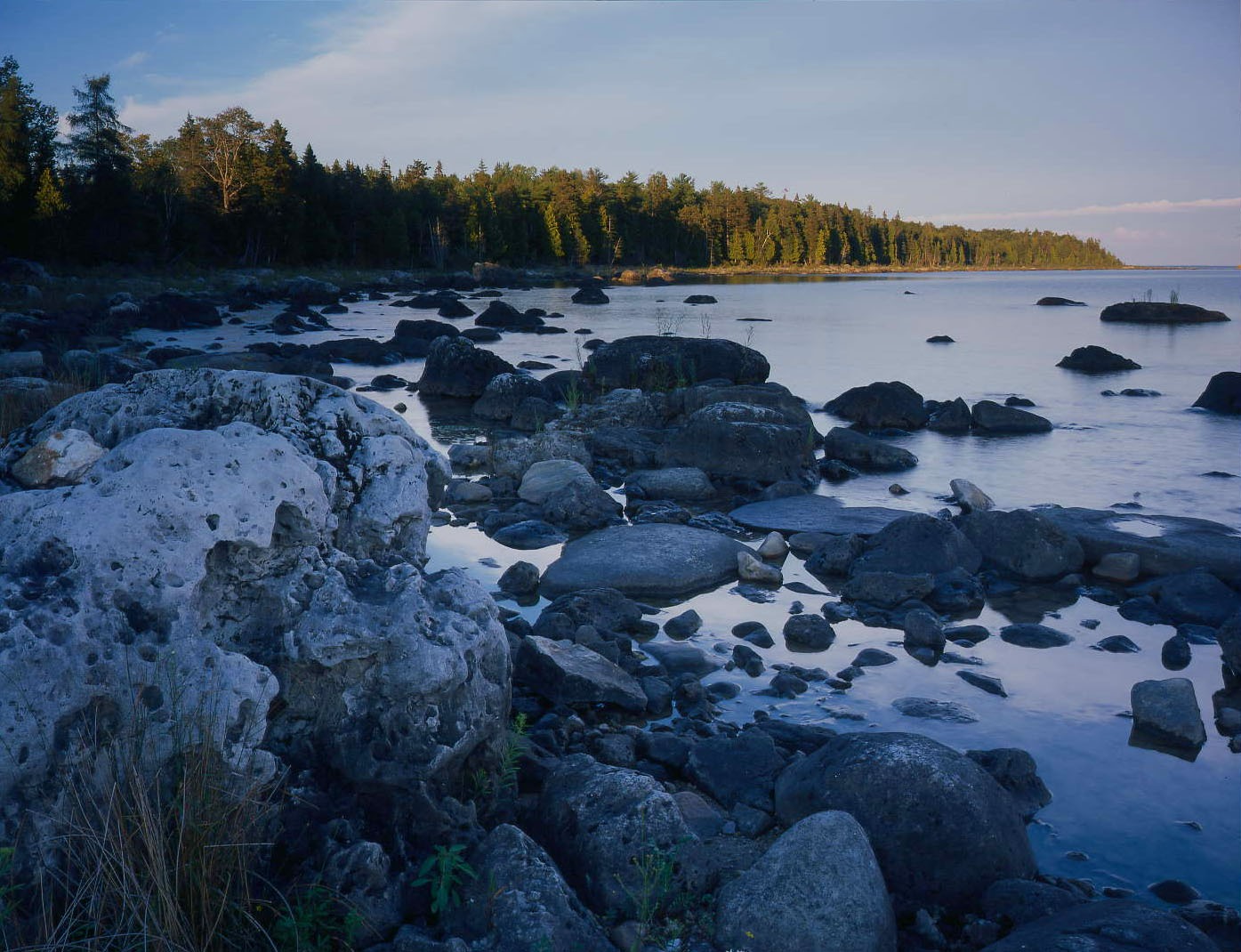
Carl A. Gerstacker Preserve at Dudley Bay
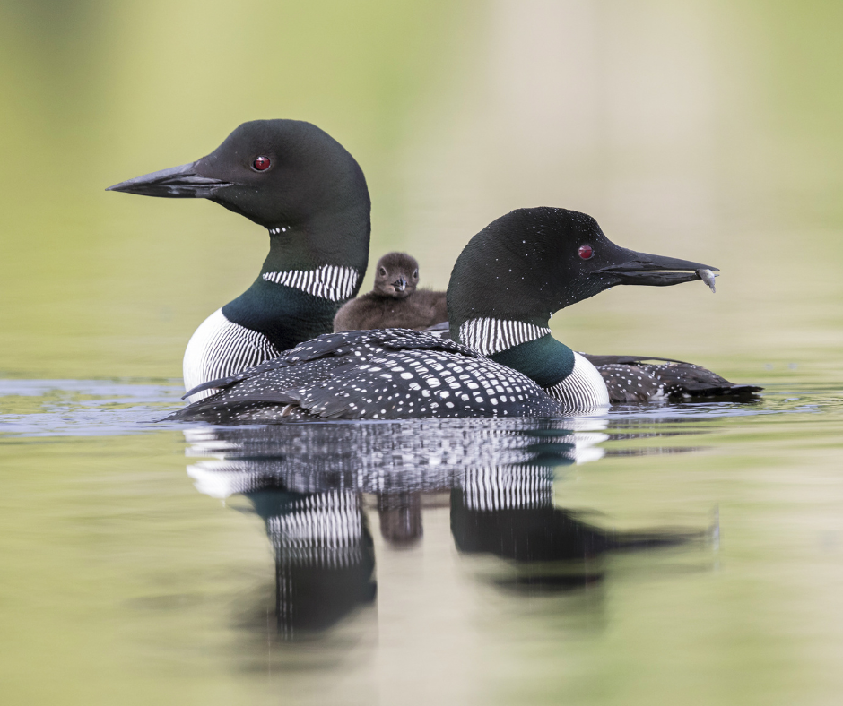
Perched at the northern tip of Lake Huron, Carl A. Gerstacker Preserve at Dudley Bay features one of the most spectacular limestone bedrock shorelines in Michigan. Enjoy five miles of beautiful shoreline across four bays on Lake Huron, two small islands, Big and Little Trout Lakes, and parts of two creeks. Carry in your kayak or canoe for a summer paddle on Lake Huron, take a beautiful autumn hike on the trails with the Travelstorys audio tour full of stories, fun facts, and historical notes about the preserve, or bring your skis and snow shoes for a winter visit. Throughout the year, watch and listen for a variety of animals, including the loon, pileated woodpecker, osprey, wolf, and migratory songbirds like the American redstart and magnolia warbler.
Visit Carl A. Gerstacker Preserve at Dudley Bay
Dudley Bay, MI
Directions
From Cedarville, Michigan:
- From the intersection of M-134 and M-129, travel east on M-134 12.4 miles to the Conservancy preserve sign on the left (north side of the highway). For trail access, turn left on the small road next to the preserve sign. The road continues a short distance to the trailhead.
- For lakeshore access, continue past the preserve sign for less than 1 mile to a large shoulder on the right (south) side of the highway. There is a second preserve sign here, and access by foot to Lake Huron.
Explore More

Great Lakes
The Nature Conservancy’s mission is to protect the lands and waters on which all life depends, and for more than 65 years, we’ve been working in the Great Lakes to do just that.

Great Lakes Northwoods
The Great Lakes Northwoods are a critically important landscape that filters and provides high-quality freshwater, maintains species biodiversity and naturally stores carbon.

Wet and Wild: The Weird, Wondrous and Wicked Cool Creatures in Midwest Wetlands
Wetlands support an incredible diversity of life. Yet they’re in danger: in some states, as much as 90% of wetlands have been destroyed.