Keeping Tabs on the Mississippi
A new “sentinel system” will monitor the Mississippi River and provide critical real-time data on water quality, navigational safety and flood risk.
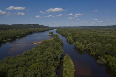
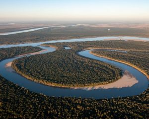
From its headwaters in Minnesota to its exodus at the Gulf, the Mississippi River and its tributaries flow across 1.245 million square miles. Reaching 31 U.S. states and two Canadian provinces, the river performs countless critical roles: supporting crops; transporting goods; creating vital wildlife habitat; and providing food, jobs and freshwater to millions of Americans.
Yet despite its ecological and economic importance, there’s a surprising amount of information we don’t know about the Mississippi. As scientists at The Nature Conservancy set out to assess their progress toward conservation goals along the river, they found pieces of the puzzle were missing.
“We had a simple question: Do we have the appropriate monitoring systems in place to determine whether we’re making progress on our goals for the Mississippi River basin, and to manage future challenges from climate change?” says Bryan Piazza, Ph.D., TNC’s Director of Science, Louisiana. “We brought together experts to explore this question, and we soon realized the answer was no.”
That answer became an opportunity. In 2020, The Nature Conservancy embarked on an ambitious five-year effort to design and fund a “sentinel system” to monitor the Mississippi River, from end to end and across the basin. The system will provide critical real-time data on factors such as water quality and sediments, navigational safety, and flood risk.

A River at Risk
Until now, information about the state of the Mississippi River has been collected by a patchwork of different agencies, hampered by a legacy of inconsistent funding. Some stretches of the river host ample monitoring stations that collect relatively rich data about factors such as nutrient runoff, sedimentation, and variations in river current and water levels. Other areas along the river remain poorly monitored, and communities in those regions are often more vulnerable to risks, such as flooding. What’s more, various monitoring agencies often use different data collection methods and the data are not standardized, making it hard to see the big picture.
Seeing that image clearly is more important than ever. The mighty Mississippi faces a host of threats. Invasive species such as Asian carp are altering river habitat and putting native species at risk. Runoff from farms and aging sewage treatment plants diminishes water quality, risking human health and pushing up water treatment costs. Such pollution also threatens the health of wildlife and contributes to a so-called “dead zone” in the Gulf, where low oxygen levels kill off fish and other marine life.


Climate change poses new and urgent threats. In the area near the mouth of the river, rising sea levels and sinking lands at the Gulf interface are destroying riverine and coastal wetlands. Those wetlands buffer coastal cities and towns from storms and floods and provide important habitat for wildlife—including commercially valuable fish species.
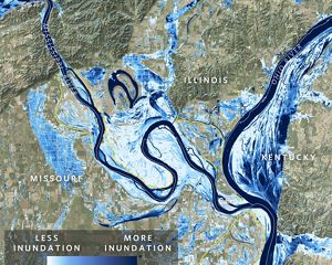
Flooding from the river also threatens people living along the river, even far from the coast. Scientists predict that floods will become more frequent, more intense, and last for longer periods as climate change intensifies. As we saw in 2022, periods of drought can also strain the river’s infrastructure and threaten ecosystems, businesses and communities.
On top of these challenges, changing river flows and the lack of real-time data contribute to maritime accidents. Amazingly, despite all the technology at our fingertips, boat captains still perform many critical calculations by hand.
“Captains can’t just click on a website to find out whether they can pass under a bridge as water levels go up and down,” Piazza says. “It’s a safety issue and has caused collisions that result in millions of dollars’ worth of damage to ships, dams, bridges and communities.”

Building a Sentinel System
To address those varied risks, decision makers need a reliable, up-to-date system that provides real-time information about conditions on the river. Spearheading that effort, TNC launched a collaborative project with dozens of partners and technical advisors, including the Environmental Protection Agency, the U.S. Geological Survey, the U.S. Army Corps of Engineers, the U.S. Fish and Wildlife Service, the National Oceanic and Atmospheric Administration/National Weather Service and academic institutions such as Tulane University’s Department of River-Coastal Science and Engineering.
The new Sentinel System will knit the existing patchwork of monitoring methods into an integrated whole. As a first step, TNC and partners identified existing monitoring stations that will require upgrades and mapped out locations where additional stations need to be added to fill in gaps. With a design in place, the coalition is now working to secure sustainable funding to support the creation and long-term maintenance of the system.
Quote
The Sentinel System will provide critical real-time data on factors such as water quality and sediments, navigational safety and flood risk.
Taxpayers are already paying generously for a subpar system. Over the next 25 years, the country will spend three-quarters of a billion dollars on the existing monitoring network. By investing just over a billion dollars in total, that system can be transformed into an effective and modernized tool—and, ultimately, save taxpayer dollars by optimizing the efficiency of the data that are collected.
“With a 32% increase in funding, we can upgrade and build upon the current system to create a sustainably funded system that meets our needs for managing water quality, flood risk and navigation safety into the future,” Piazza says. “We think that’s a small investment to make.”

The result will be a monitoring network that works for residents, businesses and decision makers throughout the river basin. Community leaders will have the necessary information to issue emergency flood alerts and adjust the management of their drinking water systems. An improved understanding of water flow and sediment transport will inform decisions about land use and conservation. Riverboat pilots will be able to access navigational guidance in real time. And agencies, conservation groups and other decision makers will have the data to evaluate how their policies and programs are affecting the long-term health and function of the nation’s most important river system.
The Sentinel System is designed to be modular and aligned with other monitoring efforts by states and other entities. Eventually, more types of monitoring data can be layered in, and an integrated data system will meet the needs of multiple users. Information about wildlife and ecosystem characteristics, for instance, could be included to help conservation organizations better protect the river habitat.
It’s hard to overstate the economic and ecological importance of the Mississippi River. To protect this dynamic waterway, we must invest in modern science.
“We need to see how the river is changing in order to adapt to the changes that climate change will bring,” Piazza says. “A Sentinel System will allow us to ensure that the Mississippi keeps meeting the needs of all the communities it touches.”
Stay Up to Date on Stories Like This One
Sign up to receive monthly updates on our work in the Mississippi River Basin.


