Southern Deltas
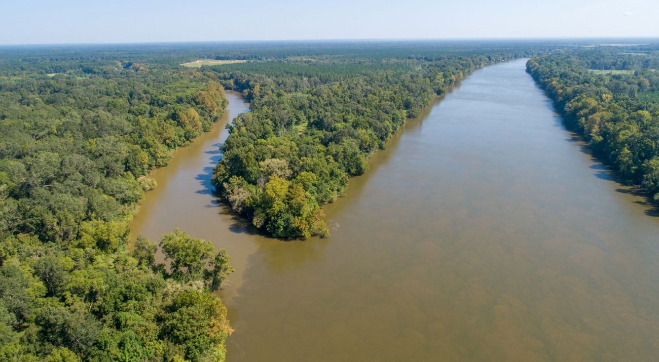
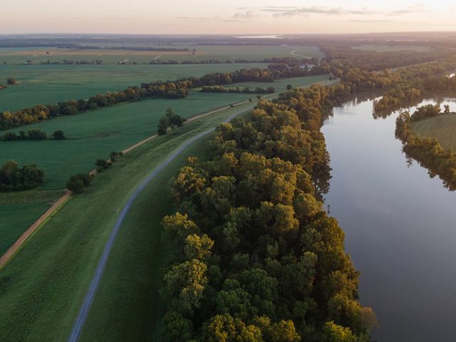
Stretching across the southeastern United States, the floodplains, rivers, streams and swamps of the Southern Deltas are among the most diverse places on Earth.
Make a Difference for Nature
We work in the most critical places so that we can have a lasting impact. Nowhere is that more true than right here in the Southern Deltas.
The Southern Deltas
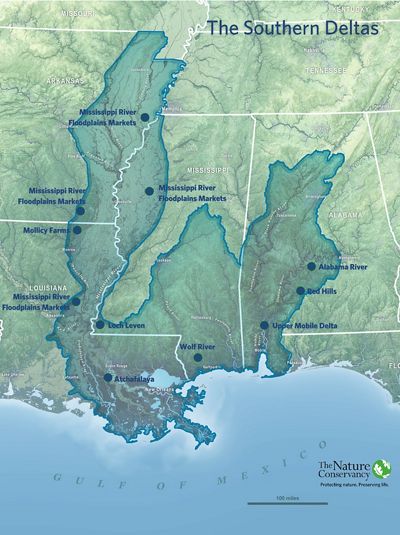
The Southern Deltas encompass the two largest river deltas in North America: the Mississippi River Delta and the Mobile-Tensaw Delta. Stretching across the southeastern United States, the floodplains, rivers, streams and swamps of the Southern Deltas are among the most socially and ecologically diverse places on the planet, and have some of the highest potential for sequestering carbon anywhere in the U.S. Yet this globally unique freshwater biodiversity exists alongside high vulnerability to the increased flooding and storms brought by the changing climate.
To protect this valuable and unique region, we are focused on restoring fully functioning floodplain forests, reconnecting rivers, and sequestering carbon to mitigate against climate change.
The Opportunity
We are working across the Southern Deltas and have identified key sites to invest in conservation and restoration actions. These projects will reshape the lands and waters within their boundaries, have meaningful impacts well beyond their borders, and unlock more opportunities for transformative conservation throughout the region.
Southern Deltas Ecology: Unique and Important
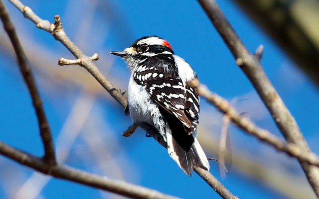
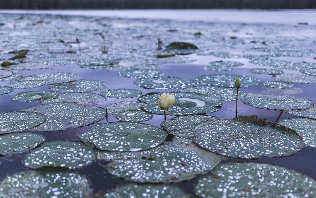
The Deltas’ extraordinary biodiversity lies in its massive floodplains, river systems, and swamps. The Mississippi and Alabama Rivers are the largest and second-largest river deltas in the U.S., home to more than two dozen threatened or endangered species.
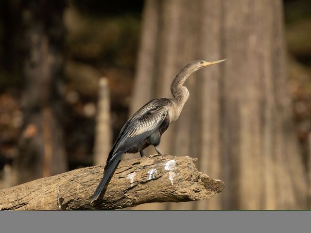
The Alabama River System is the most biologically diverse freshwater system in North America and one of the most biodiverse anywhere in the world, thanks to its dizzying diversity of mussels, snails, fish, turtles, and crawfish. Meanwhile, Louisiana’s Atchafalaya River Basin is the largest intact forested wetland in the continental United States, followed by the Big Woods in Arkansas.
These lands and waters are threatened largely because of human activities. Dams and levees built half a century ago have restricted the flow of water and the movement of species through the ecosystem. Human impacts on the Deltas also affect the Gulf of America, which depends heavily on healthy upstream floodplains.
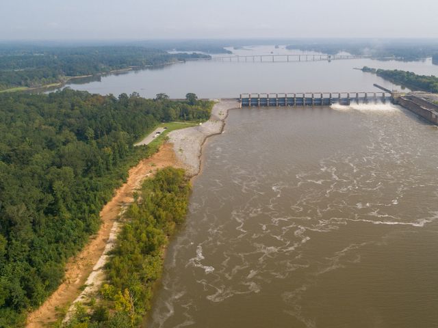
But these interconnected systems also present opportunities for significant progress. Large floodplain restoration projects have impacts that ripple into the Gulf and beyond. Reconnecting the Alabama and Cahaba rivers will once again allow fish passage to the Gulf of America. And reduced nutrient loads and healthier waters have positive implications hundreds of miles downstream.
Failure to protect and restore the Deltas could mean the loss of countless unique species found nowhere else in the world. Success could spell some of the most ecologically significant river reconnection projects in the history of the United States.
From Vulnerability to Opportunity
Alabama, Arkansas, Louisiana, and Mississippi are among the most socially vulnerable states in the nation. Long-term conservation and restoration success will require meeting those social and economic challenges head on.
Yet there is no shortage of will to engage in comprehensive conservation and restoration projects in the Southern Deltas. The region is marked by a strong sense of place and a deep connection between the people and their land.
Historic funding opportunities like the Deepwater Horizon Oil Spill recovery funds have demonstrated the incredible capacity of communities to achieve conservation goals when given access to resources. That funding has created opportunities to support science, government relations, land conservation, and on-the-ground restoration. And despite the highly restrictive nature of that funding, communities have achieved significant restoration successes in relatively short periods of time.
Southern Deltas Facts
- <10%:Portion of the Southern Deltas that is currently protected
- 500,000: Acres of land protected by TNC in the Southern Deltas over the last three decades
- 1.5 million: Acres in the Mississippi River basin TNC plans to conserve by 2030
- 75%: Portion of the Mississippi Delta developed for agriculture
- 10 Billion: Amount spent on crop insurance payments for rain and flood damage since 2015 in the Mississippi Delta
- 30%: Projected increase in precipitation in the Mississippi Delta between now and 2050
- 25: Square miles of floodplain reconnected to the Ouachita River in Louisiana
A Sustainable Future for the Southern Deltas
The foundation of an expansive, connected restoration of the Southern Deltas already exists. The need is clear—as is the willingness of communities to improve their neighborhoods and local environment. Diverse stakeholder groups have significant experience developing restoration plans and projects that, if supported, are achievable. Many of these restoration opportunities are “shovel ready,” with plans in place for moving forward. What remains is the lever to unlock these ambitious efforts.
That work must also be inclusive. Conservation decisions have historically been guided by predominantly white, male institutions and organizations. This strategy is not sustainable—especially in the Southern Deltas, where there is a long history of racial injustice, community action to overcome that injustice, and cultural innovation that reflects the African-American experience. This way of life is threatened by climate change, including the loss of entire communities to flooding and natural disasters.
It is impossible to address the biodiversity and climate challenges of the Southern Deltas without actively engaging and respecting the lives and problems of under-represented communities within its boundaries. TNC has established working relationships with Historic Black Colleges and Universities and Black-led foundations. There is a tremendous opportunity to learn from and work alongside diverse communities toward the same goal.
Working together and with adequate support, we can chart a new path for the future of the Southern Deltas.
Alabama
Upper Mobile Delta
The Mobile-Tensaw Delta—North America’s second-largest intact delta system—is one of the most ecologically diverse places on Earth. Nicknamed “America’s Amazon,” the delta is home to the largest number of freshwater fish species in the U.S. It’s also a vital site for conservation efforts in Alabama.
We have identified available tracts that will connect critical habitats between the Tombigbee and Alabama Rivers at the northern end of the delta. These tracts connect to protected state lands, offering additional critical riparian habitat along important river corridors. This “land between the rivers” is a priority in our resilient and connected landscapes network.
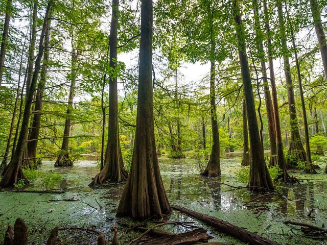
Acquiring the tracts would provide bank-to-bank protection, preserving corridors between the Gulf of America, the Mobile delta, and the upland rivers within the Alabama and Tombigbee Rivers systems. The Mobile-Tensaw Delta also represents the best opportunity for carbon capture projects in the U.S., outside of the Cumberland Plateau in the Appalachians.
Our target site in the Mobile-Tensaw Delta has been intensively managed for timber production and revenue for generations, providing a baseline to capitalize on for carbon sequestration. A forest carbon pre-feasibility study has been implemented on the property, providing evidence that the project would be financially, socially, and ecologically profitable.
Red Hills
The Red Hills region of southwest Alabama is a high-priority conservation area. Located among the steep rolling hills of the East Gulf Coastal Plain ecoregion, the Red Hills are characterized by steep bluffs and ravines associated with the Hatchetigbee and Tallahatta siltstone formations. The project will protect significant areas of mature upland and bottomland hardwoods, including longleaf pine and old-growth-rich hardwood forests. These tracts also contain bottomland forests along Big Flat and Limestone creeks, two tributaries of the Alabama River.
Over the last decade, we have assisted the state with acquiring more than 11,000 acres in this project area using State and Federal conservation funds. The current opportunity would protect an additional 20,500 acres that are contiguous with properties now owned by the state of Alabama. The protection of this entire ownership would include some 15 stream miles and associated bottomlands of Big Flat Creek, one of Alabama’s Strategic Habitat watersheds for the protection of freshwater biodiversity.
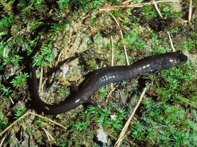
Conservation efforts in the Red Hills will protect habitat for a variety of imperiled species, including the threatened red hills salamander and the endangered Alabama pearlshell mussel. The success of this project will build momentum to protect additional habitat areas for the red hills salamander, building a case to the U.S. Fish and Wildlife Service to elevate funding priorities for the region.

Alabama River Restoration
The dams at Miller’s Ferry and Claiborne on the Alabama River effectively block the migration of fish up and down the Alabama and Cahaba Rivers. We are working with the U.S. Army Corps of Engineers and other local, state, and federal partners, as well as community members and other non-profit organizations, to plan, execute, and coordinate the construction of fish passage projects at these dams. The project will reconnect more than 100 miles of the Alabama and Cahaba Rivers—one of the most ecologically important waterways in the world.
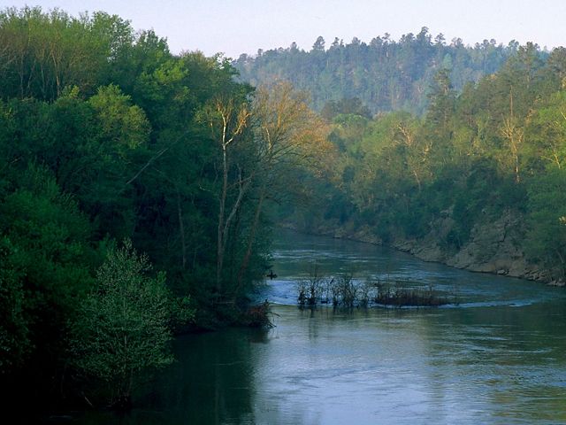
The Alabama and Cahaba rivers are iconic cornerstones of Alabama’s natural heritage. This unique river system hosts more species of fish, mussels, turtles, and birds than most states and countries. But habitat and species loss on the rivers is reaching a critical stage. Restoring these river systems will increase resiliency by allowing fish passage up and down the river, providing critical habitat for species growth and expansion.
Successfully reconnecting the rivers to the Gulf will safeguard coastal ecosystems and increase fish populations in the Gulf, increasing recreational value and economic impact. If successful, the project will be the most biologically important river restoration effort in U.S. history.
Louisiana
Atchafalaya River Basin
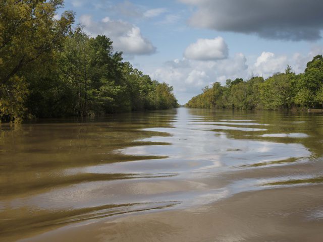
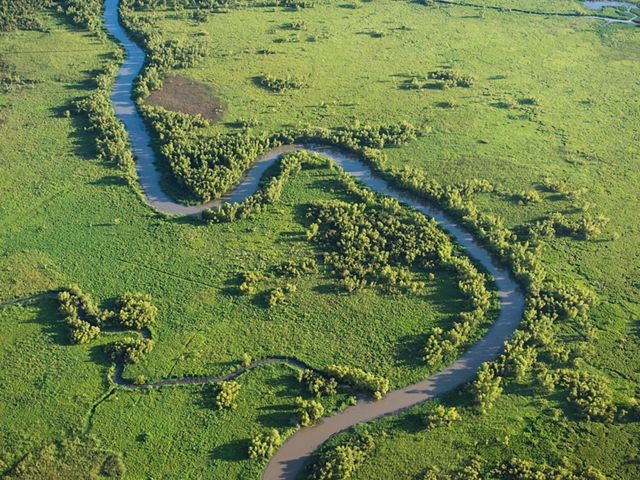
There is no place on Earth like the Atchafalaya River Basin. Its bottomland hardwood forests, productive marshes, and meandering waters sustain livelihoods based on natural resources, support complex habitats, and define the region’s history, culture, and heritage. As a portion of the Mississippi River flows through the basin, the water is filtered and cleaned, improving the natural health of the basin and habitats downstream to the Gulf. Yet just 7% of the Atchafalaya Basin’s 1 million acres are currently protected. Half of that protected area is available for logging, raising the stakes for conservation elsewhere in the landscape.
We are targeting more than 14,000 acres in the Atchafalaya Basin for acquisition, building on previous restoration work already completed in the region. To date, we have acquired and restored more than 5,000 acres in the basin. Such efforts connect upstream and downstream habitats and protect lands and waters that sustain a way of life for people and nature alike.

Markets for Mississippi River Floodplain Restoration
The Mississippi River Delta goes by many names, including the Lower Mississippi Alluvial Valley, Mississippi Alluvial Plain or just “the Delta.” Historically, the largest forested wetland ecosystem in North America, this 22-million-acre floodplain extends from the confluence of the Mississippi and Ohio Rivers at Cairo, Illinois, to the northern Gulf Coast Region, with a drainage basin encompassing 41% of the conterminous United States. The floodplain features a diverse and ecologically rich forested wetland ecosystem—one of the most productive in North America—and when restored helps filter out sediments and nutrients, provides temporary storage of floodwaters and provides carbon sequestration and extensive wildlife habitat.
The Delta today faces many challenges. These include more frequent and devastating floods, depleted aquifers, harmful nutrient and sediment levels in waterways and fragmented habitats. The results are catastrophic damage to crops and the ecosystem and escalating costs for farmers and landowners. TNC scientists estimate that mitigating the worst climate impacts along the Mississippi River requires reforesting 2 million to 3 million acres of floodplains by 2030.
To meet these daunting challenges, we, along with our partners, are researching, modeling and evaluating an innovative partnership utilizing private foundations and impact investments as capital to protect and restore marginal farmland. One historically successful tool is the Wetland Reserve Easements program or “WRE.” It is arguably the most significant and successful habitat restoration effort ever established in the Lower Mississippi Alluvial Valley (LMAV). Today, for example, well over 700,000 acres have been restored to functioning wetland habitat in the MAV of Arkansas, Louisiana and Mississippi. Established in 1990, the WRP/WRE now enjoys hundreds of thousands of acres of both flooded wetlands and developing bottomland hardwood forests.
Our strategy for the Delta uses a blended conservation finance approach to unlock private investment in floodplain reforestation using carbon sequestration, flood mitigation savings and timber management revenues to provide modest returns over time. An initial investment will demonstrate market viability by connecting landowners with parties interested in investing in reforestation and protection for climate adaptation and resilience objectives. We will then scale this across the Mississippi River Basin to achieve our goal of 1.5 million acres of conservation by 2030. A successful demonstration of the scalability of this project could unlock investments from corporate and private investors, establishing a new economic and environmental trajectory for the Mississippi Delta.

Arkansas
Markets for Mississippi River Floodplain Restoration
The Mississippi River Delta goes by many names, including the Lower Mississippi Alluvial Valley, Mississippi Alluvial Plain or just “the Delta.” Historically, the largest forested wetland ecosystem in North America, this 22-million-acre floodplain extends from the confluence of the Mississippi and Ohio Rivers at Cairo, Illinois, to the northern Gulf of America, with a drainage basin encompassing 41% of the conterminous United States. The floodplain features a diverse and ecologically rich forested wetland ecosystem—one of the most productive in North America—and when restored helps filter out sediments and nutrients, provides temporary storage of floodwaters and provides carbon sequestration and extensive wildlife habitat.
The Delta today faces many challenges. These include more frequent and devastating floods, depleted aquifers, harmful nutrient and sediment levels in waterways and fragmented habitats. The results are catastrophic damage to crops and the ecosystem and escalating costs for farmers and landowners. TNC scientists estimate that mitigating the worst climate impacts along the Mississippi River requires reforesting 2 million to 3 million acres of floodplains by 2030.
To meet these daunting challenges, we, along with our partners, are researching, modeling and evaluating an innovative partnership utilizing private foundations and impact investments as capital to protect and restore marginal farmland. One historically successful tool is the Wetland Reserve Easements program or “WRE.” It is arguably the most significant and successful habitat restoration effort ever established in the Lower Mississippi Alluvial Valley (LMAV). Today, for example, well over 700,000 acres have been restored to functioning wetland habitat in the MAV of Arkansas, Louisiana and Mississippi. Established in 1990, the WRP/WRE now enjoys hundreds of thousands of acres of both flooded wetlands and developing bottomland hardwood forests.
Our strategy for the Delta uses a blended conservation finance approach to unlock private investment in floodplain reforestation using carbon sequestration, flood mitigation savings and timber management revenues to provide modest returns over time. An initial investment will demonstrate market viability by connecting landowners with parties interested in investing in reforestation and protection for climate adaptation and resilience objectives. We will then scale this across the Mississippi River Basin to achieve our goal of 1.5 million acres of conservation by 2030. A successful demonstration of the scalability of this project could unlock investments from corporate and private investors, establishing a new economic and environmental trajectory for the Mississippi Delta.

Mississippi
The Wolf River and Mississippi Sound Region
The Mississippi Coastal Headwaters Project approach in Mississippi aims to protect and restore large, forested blocks in the headwaters of Gulf tributaries. The Nature Conservancy and its partners will leverage funds to acquire lands adjacent to or around existing conservation areas.
The effort is already underway at the Wolf River. Named for red wolves that once roamed this area, the Wolf River is the first designated state scenic stream in Mississippi and the site of one of the largest undeveloped tracts of land in south Mississippi. The property contains bottomland hardwoods, riparian streams with high carbon values, and upland industrial pine forest that will serve as one of the largest longleaf pine restoration sites in the southeast U.S. This tract is a regional conservation priority for coastal resilience, flood protection and storm hazard abatement. It contains high-quality habitat for rare species, including the threatened gopher tortoise.
We will leverage Deepwater Horizon NFWF Gulf Environmental Benefit Funds to assist in the acquisition. Adding this large protection anchor along the river will give greater weight to efforts to protect other sections of the river and connect areas already under some protection. The Biloxi River and the Little Biloxi River will also benefit from successful conservation work.

Secondary and Side Channel Reconnections
Among our many efforts to restore the Mississippi River system, we are collaborating with the U.S. Fish and Wildlife Service (USFWS) and the U.S. Army Corps of Engineers to restore side channels of the Mississippi River, upstream and downstream from the Grand Gulf Nuclear Power Facility near Port Gibson. Historically, the Army Corps established backfills in these channels to divert the flow and help move sediment downstream. During low-water events, however, the side channels become landlocked, reducing oxygen levels in the streams and leading to fish kills.
Since 2016, we’ve helped reconnect 15 miles of side channels, with a dozen more potential sites on our list to be excavated in the next several years. Restoring flows to these side channels will improve downstream water quality and benefit aquatic and terrestrial wildlife of concern, including threatened and endangered species such as the fat pocketbook mussel, the pallid sturgeon, and the interior least tern.
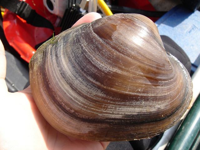
Research by USFWS and the U.S. Army Corp of Engineers Environmental Laboratory shows that recently completed side channel reconnections have positively benefited fish by improving shallow-water foraging and spawning habitat. Building on these prior efforts will further improve water quality and habitat, and provide safe, healthy recreational opportunities for residents and visitors.
Markets for Mississippi River Floodplain Restoration
The Mississippi River Delta goes by many names, including the Lower Mississippi Alluvial Valley, Mississippi Alluvial Plain or just “the Delta.” Historically, the largest forested wetland ecosystem in North America, this 22-million-acre floodplain extends from the confluence of the Mississippi and Ohio Rivers at Cairo, Illinois, to the northern Gulf Coast Region, with a drainage basin encompassing 41% of the conterminous United States. The floodplain features a diverse and ecologically rich forested wetland ecosystem—one of the most productive in North America—and when restored helps filter out sediments and nutrients, provides temporary storage of floodwaters and provides carbon sequestration and extensive wildlife habitat.
The Delta today faces many challenges. These include more frequent and devastating floods, depleted aquifers, harmful nutrient and sediment levels in waterways and fragmented habitats. The results are catastrophic damage to crops and the ecosystem and escalating costs for farmers and landowners. TNC scientists estimate that mitigating the worst climate impacts along the Mississippi River requires reforesting 2 million to 3 million acres of floodplains by 2030.
To meet these daunting challenges, we, along with our partners, are researching, modeling and evaluating an innovative partnership utilizing private foundations and impact investments as capital to protect and restore marginal farmland. One historically successful tool is the Wetland Reserve Easements program or “WRE.” It is arguably the most significant and successful habitat restoration effort ever established in the Lower Mississippi Alluvial Valley (LMAV). Today, for example, well over 700,000 acres have been restored to functioning wetland habitat in the MAV of Arkansas, Louisiana and Mississippi. Established in 1990, the WRP/WRE now enjoys hundreds of thousands of acres of both flooded wetlands and developing bottomland hardwood forests.
Our strategy for the Delta uses a blended conservation finance approach to unlock private investment in floodplain reforestation using carbon sequestration, flood mitigation savings and timber management revenues to provide modest returns over time. An initial investment will demonstrate market viability by connecting landowners with parties interested in investing in reforestation and protection for climate adaptation and resilience objectives. We will then scale this across the Mississippi River Basin to achieve our goal of 1.5 million acres of conservation by 2030. A successful demonstration of the scalability of this project could unlock investments from corporate and private investors, establishing a new economic and environmental trajectory for the Mississippi Delta.

A History of Successful Restoration
The Nature Conservancy’s long history in the Southern Deltas region has been filled with numerous successful, large-scale protection and restoration projects. For more than 30 years TNC has been the only non-profit working on the ground with communities on projects that provide solutions for both people and nature. In the Southern Deltas, the lives of people and their communities are intertwined with the health of the natural environment, and the task of saving both is complex and daunting. It requires restoring and retaining the function of the region’s natural systems while maintaining and enhancing the healthy and productive relationship of the region’s communities to its lands and water.
This approach works. Over three decades TNC has protected more than 500,000 acres of land in the Southern Deltas, including more than 100,000 in the Mobile-Tensaw Delta alone. More than 750,000 acres of former agricultural land has been reforested, and more than 300 jobs for young adults from vulnerable communities have been created. Since the BP oil spill, TNC has secured 80,000 acres of conservation land, built more than 200 acres of oyster reefs, completed more than 100 coastal restoration projects and planted 83,000 plants.
Mollicy Farms
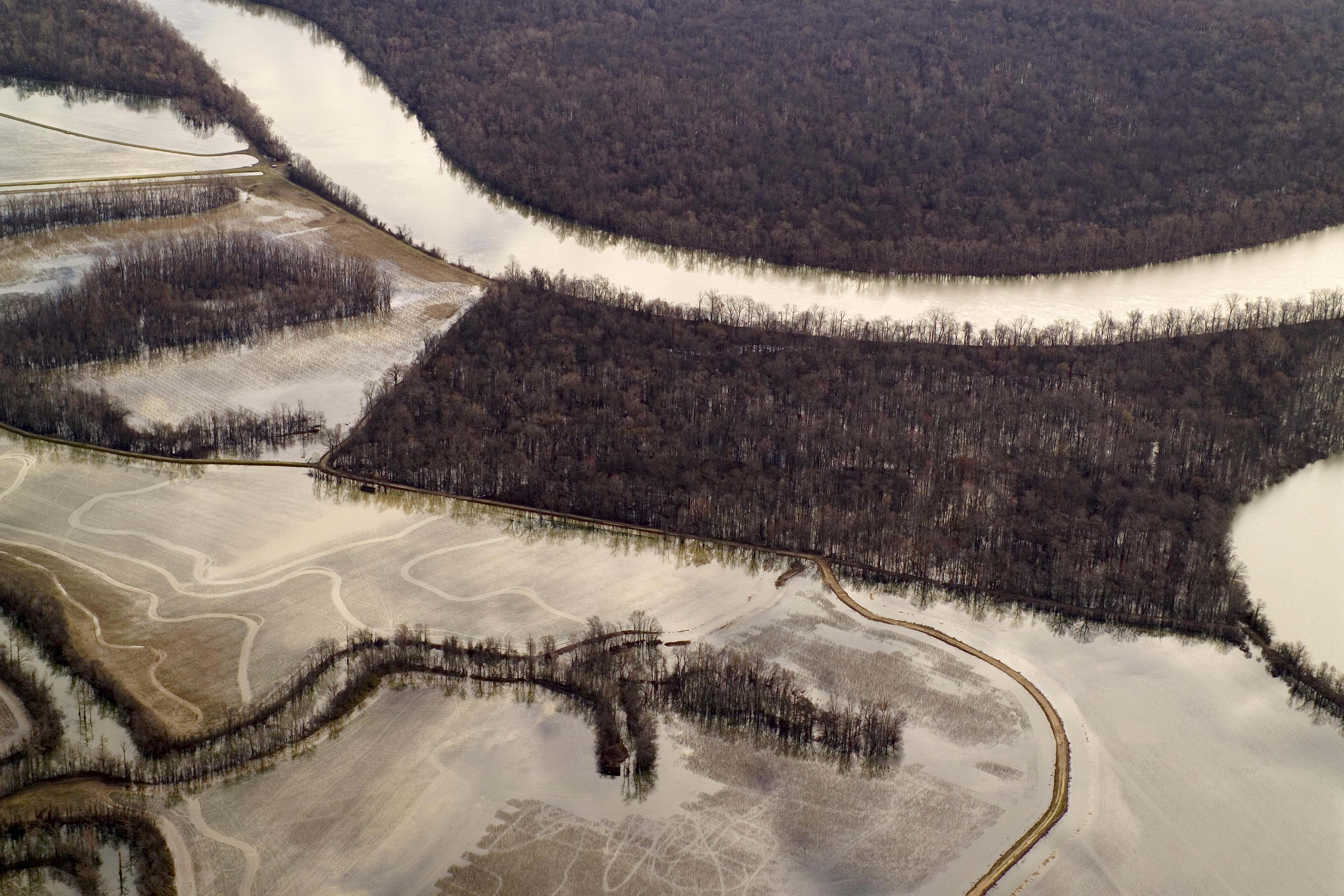
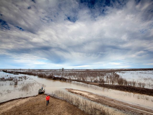
Mollicy Farms, Louisiana, was once part of a vast hardwood forest seasonally inundated by the Ouachita River. In the 1960s, it was cut off by a levee so the land could be farmed. Working with the U.S. Fish and Wildlife Service, we have engaged in restoration efforts at Mollicy Farms since 1998.
From 2012 to 2015, in the largest floodplain restoration in the Mississippi River Basin to date, we reconnected 25 square miles of former floodplain back to the Ouachita River. The $4.5 million restoration project removed portions of a 17-mile-long levee at Mollicy Farms to create new bayous and restore the hydrology of the floodplain. The large-scale effort helped alleviate downstream flooding, improved water quality, and restored critical fish and wildlife habitat.
In 2021, we conducted flood pulse monitoring to learn more about the site’s improved hydrology and inform future conservation efforts. Looking ahead at this important site, we are pursuing additional work to address headcutting along the newly created Mollicy Bayou.

Loch Leven
Historically, the Mississippi and the major rivers that feed it would flood seasonally into the surrounding lands. Floodplains absorbed some of the floodwaters, sparing those downstream. But centuries of development along the river have altered those natural floodplains. As climate change intensifies flooding in the Mississippi River Basin, existing levees are no longer sufficient to protect communities.
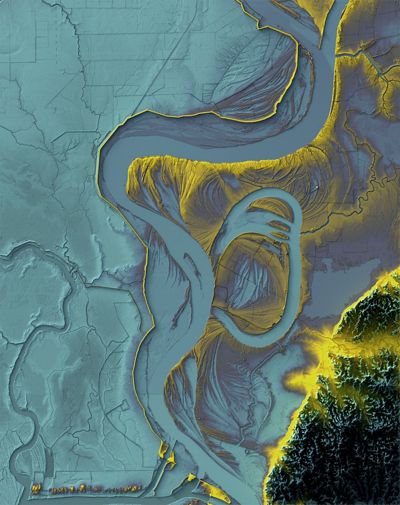
In Loch Leven, Mississippi, we, along with our partners, are working with landowners to restore floodplains. In 2020, with help from TNC and other partners, landowners reconnected water flow to Loch Leven, a former farm situated in the middle of an oxbow. Phase 1 of that project restored 6,000 acres of easement-protected wetlands. In phase 2, we will match and leverage federal funding to restore and enhance 3,400 acres of bottomland hardwood-forested wetland.
The restoration effort will install 28 water control structures, add low-water crossings, and remove and reconstruct interior levees to allow for restored hydrology within easement acres. These efforts will improve water quality through sediment and nutrient reduction, 28 trillion gallons of flood storage capacity within Loch Leven, restored hydrology to 3,400 acres of bottomland hardwood forested wetlands, and groundwater recharge opportunities for the severely depleted underlying Mississippi Alluvial Aquiver. Other benefits include fish passage and shallow water spawning opportunities for freshwater fish species and improved habitat for waterfowl and wading birds.
Make a Difference for Nature
We work in the most critical places so that we can have a lasting impact. Nowhere is that more true than right here in the Southern Deltas.
More on the Region
Upper East Gulf Coastal Plain
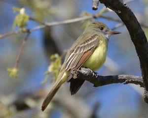
Locally known as the Tunica Hills, this area covers about 120 square miles, but is one of the most diverse regions in Louisiana.
Protecting Farmland and Water Quality in Alabama
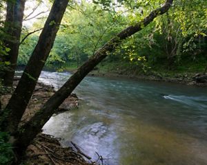
Farm Bill funding helps Alabama farmers adopt key stream conservation practices.

Mississippi Alluvial Plain
Some 4.4 million forested acres remain in the historic floodplain of the Mississippi River—often in small fragments—providing vital habitat for black bears, songbirds, alligator snapping turtles and abundant game species.