Delaware's Coastal Resilience Roadmap
Explore how we are creating resilient future for Delaware’s coastline.
A Resilient Future for Delaware’s Coastline
Rich in tradition and natural beauty, the Delaware Bayshore holds a proud history of families living, working and recreating along the coast. Today, these vital ecosystems are threatened by climate change and sea level rise, putting biodiversity and human communities at risk. Recent non-partisan polling found that over 60% of Delawareans are concerned about these impacts and believe that more action is necessary while 89% support protecting more coastal wetlands and forests in the First State.
Working with our broad network of partners, The Nature Conservancy has developed this roadmap as a guide to a healthy future for the Bayshore. This framework, which was built with stakeholder feedback and science-based conservation principles, outlines a series of recommendations and resilience strategies for coastal communities. Through innovative collaboration and forward-thinking policies, we can advance climate-friendly initiatives, conserve farmland, preserve habitat for iconic species like the horseshoe crab and the migratory red knot and ultimately support the livelihoods of all those who call this region home.
Our actions today will have a lasting impact on Delaware for generations to come. Thank you for being part of this journey with us. Together, we find a way.
Executive Summary

Delaware’s coastal areas and residents face an existential threat in the form of sea level rise (SLR) resulting from climate change. The City of Lewes tidal gauge has already recorded over 13 inches of SLR from 1919 to 2016 and the Delaware Sea Level Rise Technical Committee predicts an additional 9 to 23 inches of SLR by 2050.
SLR, especially in combination with more frequent and more extreme weather events like we’ve been experiencing, will have profound impacts on Bayshore residents’ way of life in the form of flooded roadways, homes, farm fields and other infrastructure.

In fewer than 50 years, nearly 7,000 Delawareans statewide could lose their homes to climate change-induced flooding and sea level rise.
Additionally, the Bayshore is an important stopover site for migratory birds including the red knot, which travels thousands of miles from South America to the Arctic each year. The Bayshore’s beaches are home to one of the largest spawning aggregations of horseshoe crabs in the world and its tidal marshes are important breeding grounds for many more native and threatened species. Climate change and SLR are combining to threaten the delicate ecological balance of these invaluable natural habitats.
This roadmap identifies strategies that will increase the resilience of the Bayshore’s coastal ecosystems and vulnerable human communities. It will also build awareness and support for nature-based solutions (which restore, mimic and/or enhance the function of natural systems) and develop a coalition of highly engaged partners aligned on a vision for the Bayshore that considers the present and future impacts of SLR.
The roadmap uses The Nature Conservancy’s equitable and science-based Conservation by Design planning framework to identify nature-based solutions and policy approaches appropriate for the region. In driving toward recommendations and theories of change, the process was informed by facilitated workshops and community conversations with external partners including coastal restoration practitioners, municipal planners, elected officials and Bayshore residents.


With adaptation and resilience in mind as desired outcomes, the roadmap proposes a wide-ranging suite of activities based around four key strategies:
-

Protecting coastal habitat migration space.
-

Enhancing and restoring the ecological function of coastal habitats.
-

Increasing community resilience to coastal flooding.
-

Promoting climate-considerate policies.
While the long-term sustainability and success of this project will ultimately be measured by maintaining healthy, productive coastal ecosystems along the Bayshore, intermediate success will be determined by strengthening the network of stakeholders working collaboratively to address the impacts of SLR. Success will also lie in the ability to secure future funding to implement protection and conservation strategies. The recommendations outlined herein reflect a unique opportunity for Delaware’s coastal stakeholders and elected leaders at a critical moment.
With proactive management and thoughtful policy actions, the Bayshore’s vital habitats will continue to provide essential services for both people and nature long into the future.
Introduction


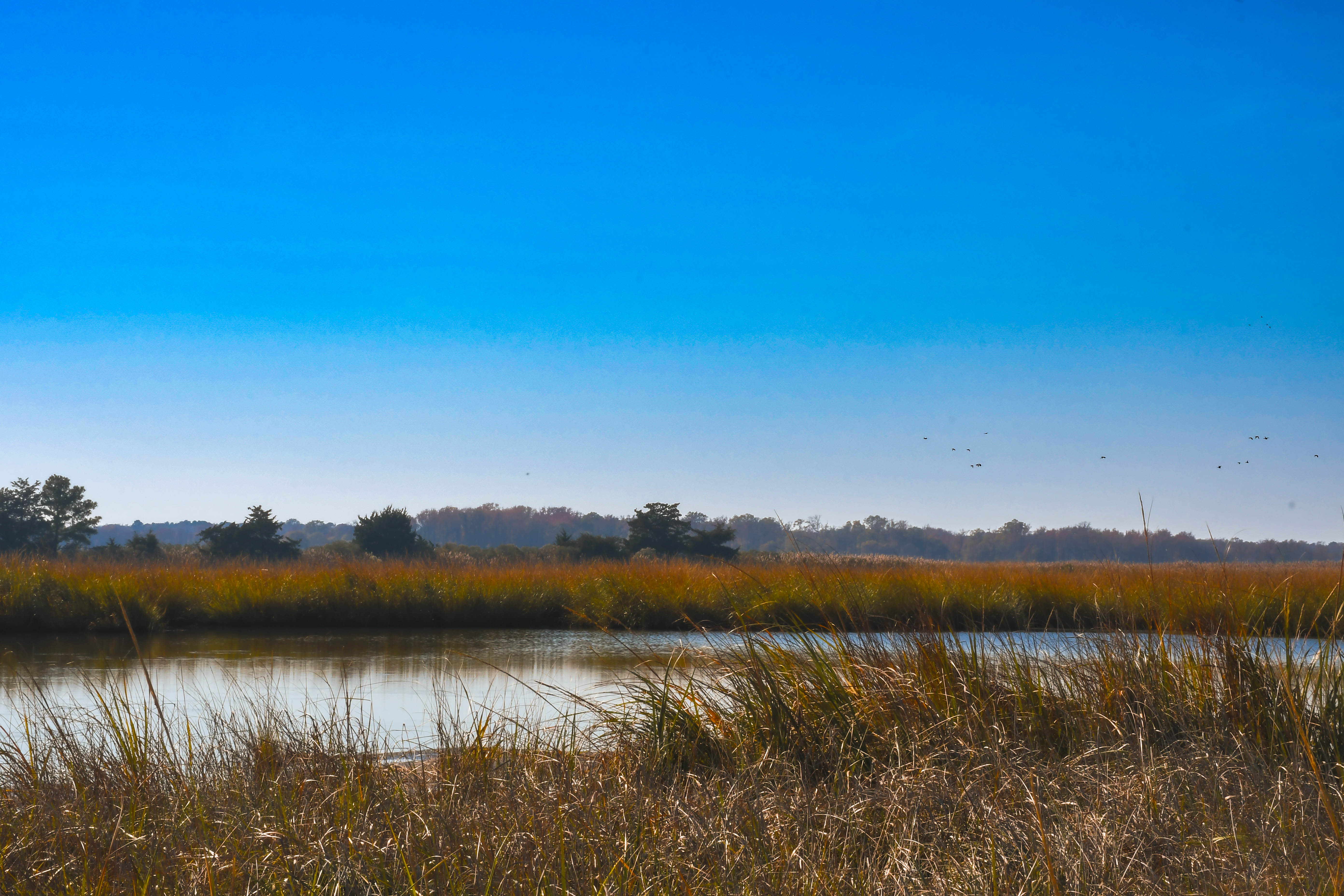
Extending from New Castle south toward Lewes within the Delaware River watershed, the Delaware Bayshore features more than 50 miles of tidal shoreline supporting productive habitat along with numerous coastal communities. Originally and currently inhabited by the Lenape indigenous tribe, the Bayshore has historically provided abundant natural resources to its residents. Upon European settlement, trading posts and small colonies were established to utilize the Bayshore’s extensive network of waterways with coastal towns like Leipsic and Bowers becoming significant hubs for maritime industry. Over time, some of the Bayshore’s tidal habitats were altered by conversion to farmland and/or ditching for mosquito control.
Today, the region can be characterized as predominantly rural and agrarian, as opposed to more urbanized portions of the Delaware River watershed such as northern New Castle County. The Bayshore contains a mixture of large tidal marshes, sandy beaches, coastal forests, productive farmland and private residences. Visitors are drawn to the area by the beaches, birdwatching, fishing and hunting. More recently, the Bayshore’s natural beauty and its landscapes have been recognized for their importance and thus preserved by policies aimed at curbing additional conversion and loss. In 2021, Route 9 was designated as the Delaware Bayshore National Scenic Byway by the Federal Highway Administration.
While past efforts to maintain the ecological and cultural qualities of the Bayshore have been largely successful, the region remains vulnerable to climate change and sea level rise (SLR). Intensifying storms and increasing temperatures have already negatively impacted coastal habitats, residents and farmland. Forecasts indicate that the frequency of these events will increase in the years to come.

As the lowest mean-lying state in the country, Delaware is experiencing some of the highest levels of sinkage on the Atlantic Coast. The coupling of rising seas and disappearing land amplifies the magnitude of coastal flooding along the Bayshore and elevates the urgency of planning for these changes. Future SLR scenarios project profound alterations to Delaware’s coastal landscape.
On the other hand, a 2017 analysis led by The Nature Conservancy’s Eastern Conservation Science Team identified the Bayshore as one of five sites within the northeast United States with the highest potential for coastal resilience. The combination of threats and opportunities puts Delaware’s coastal managers at a crossroads. While habitats including salt marshes, beaches and dunes are undoubtedly threatened by SLR, careful and proactive management holds the potential to steward their migration inland. This migration would allow these habitats to not only persist, but even potentially expand in extent, thus continuing to provide essential ecosystem services to both people and nature.
Habitat Features
Tidal Marshes
Bayshore tidal marshes support biodiversity by providing spawning refugia for fish. They also offer flood protection for humans by attenuating storm surge, storing floodwater, filtering pollutants and sequestering carbon. As such, they are crucial for effective coastal resilience.
Tidal marshes can be categorized into two vegetation zones determined by their frequency of flooding. High marsh is irregularly flooded (usually less than once per day) while low marsh typically floods twice per day. The difference in tidal inundation is reflected in the type of vegetation present. Healthy high marsh predominantly supports meadow cordgrass (Spartina patens) while low marsh is usually dominated by smooth cordgrass (Spartina alterniflora). Each marsh type provides unique habitat and must be considered as components of a healthy coastal ecosystem in this region.

Beaches & Dunes
The Bayshore’s beaches provide outstanding recreation for residents and visitors. They also serve as crucial habitat for spawning horseshoe crabs, one of the natural world’s most spectacular and ancient phenomena. From early April through early June, the crabs crawl onshore from deep Atlantic waters to spawn under full and new moons, just as they have for 450 million years.
Horseshoe crabs are critical for sustaining migratory birds each year. The iconic red knot, for example, flies from its wintering grounds in South America to the Arctic each spring, stopping in Delaware to fuel up on horseshoe crab eggs. Without adequate sustenance, the red knot cannot complete its journey.
In this way, the futures of the two species are linked. If horseshoe crab populations drop due to coastal pressures from climate change and habitat loss, the red knot will face a critical food shortage.

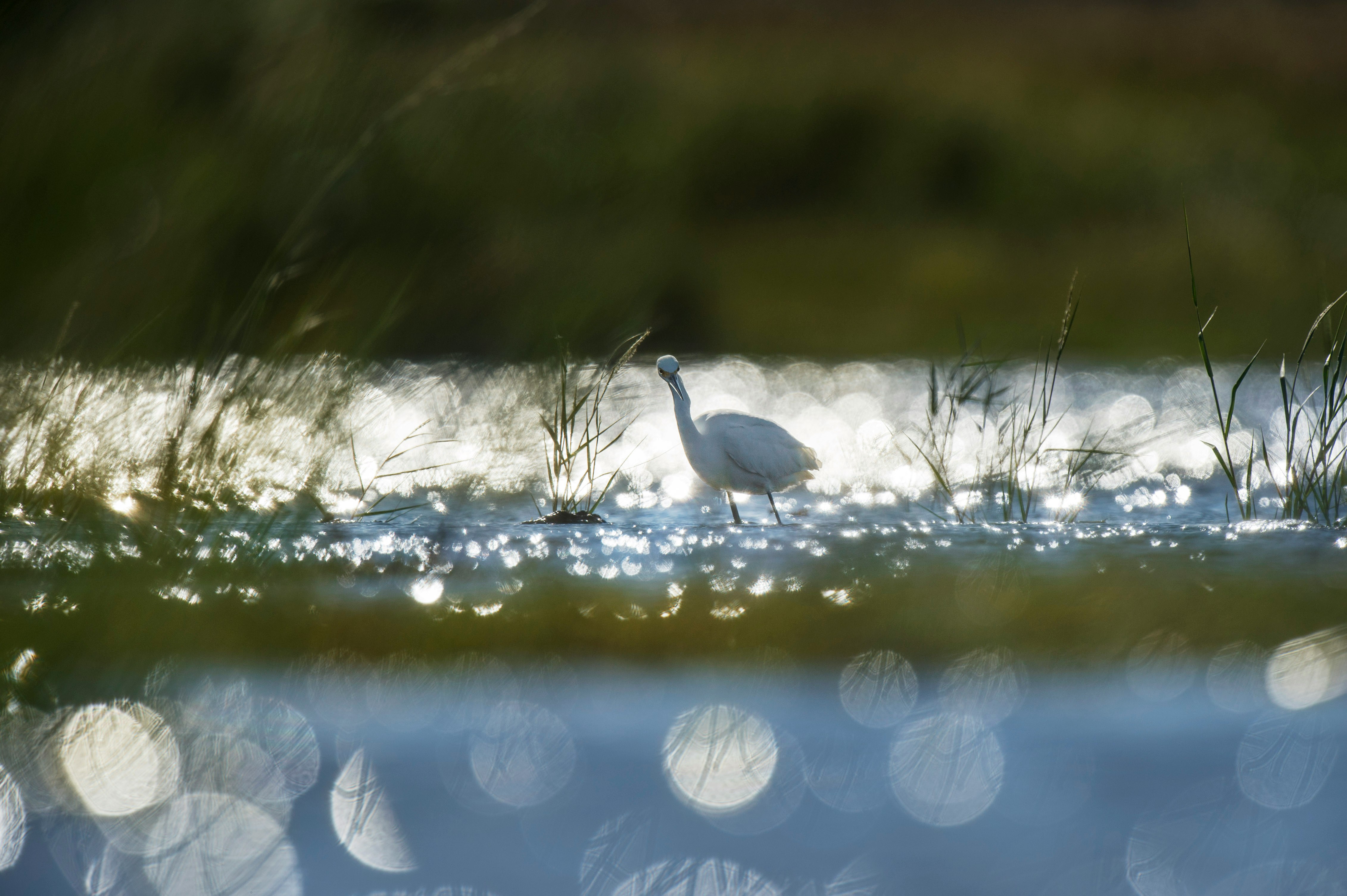
Migratory Birds
The Bayshore is an important stopover site for migratory birds along the Atlantic Flyway. Each spring, hundreds of thousands of shorebirds such as the red knot, semipalmated sandpiper and ruddy turnstone flock to the Bayshore alongside other migratory waterfowl.
In recognition of the significant ornithological value of this region, both the Audubon Society and Birdlife International recognize the Bayshore as an Important Bird Area of global significance.
Additionally, the Bayshore’s tidal marshes are important breeding habitat for saltmarsh sparrows and eastern black rail, both species that are considered highest priority by the Atlantic Coast Joint Venture, a regional partnership that collaborates to restore and sustain native bird populations and habitats from Maine to Florida.
Our Recommendations

1. Protect Coastal Habitat Migration Space
As sea level rise occurs, important tidal coastal habitats will need to shift inland and upland into new areas. This strategy proposes to engage coastal landowners to preserve these habitat migration areas as open space, ensuring they remain suitable for marsh migration. TNC has created a framework to assist in prioritizing areas with its recently released Delaware Conservation Blueprint and recommends strategic expansion of existing conserved areas, like the national and state wildlife areas. Additionally, it is important to address funding and capacity constraints among land protection partners across the state through increased partnership and coordination.
-
- Loss or conversion of coastal habitats (including salt marshes, beaches, dunes and associated ecotones) due to SLR
- Coastal ecosystem migration corridors are under threat of development and fragmentation, leading to “coastal squeeze”
- Loss of services provided by the full range of coastal ecosystems, including wave and storm surge attenuation, flood storage, nutrient sequestration and carbon storage
-
- Establish the enabling conditions to align and accelerate land protection in coastal ecosystem migration corridors by leading collaborative science and planning efforts to focus partner and agency efforts; addressing funding constraints for land acquisition through partner-coordinated federal, state and private funding proposals; securing funding and capacity for long-term management; and building capacity for land transactions across partners
- Strategically expand the boundaries of Bombay Hook and Prime Hook National Wildlife Refuges (NWRs) to allow space for coastal ecosystems and adjacent upland habitats to migrate inland in response to SLR
- Advance opportunities through Natural Resources Conservation Service (NRCS) programs or other mechanisms to protect and incentivize the transition of non-productive agricultural land impacted by SLR-related inundation or intrusion to coastal ecosystem migration corridors
-
- Delaware Land Protection Coalition Conservation Blueprint is used as a guidance document for future open space protection
- Delaware land protection organizations collaborating to protect land that falls within shared priorities
- NWR managers and partners have identified priority marsh migration corridors adjacent to the existing refuges
- Agricultural lands within coastal areas are protected with easements through existing federal and state programs
-
- Practitioners are aligned on a vision for land protection in Delaware, fostering greater collaboration
- Expansion of Bombay Hook and Prime Hook Refuge acquisition boundaries allows conservation partners to begin protecting land for ownership and management by the U.S. Fish & Wildlife Service (USFWS) to facilitate marsh migration
- Existing non-federal land protection investments are leveraged with federal conservation programs for additional protection
-
- State and federal land managers
- Non-profit environmental conservation groups
- Landowners within priority marsh migration areas
-
Land protection has been used along the Delaware Bayshore for decades to preserve critical coastal habitats that support biodiversity and human communities. Due to SLR and its related impacts, however, these previously conserved habitats are now threatened and need to shift inland to remain within their ecological niches.
Since much of the area landward of the coastal marshes lacks extensive existing hard infrastructure (such as large buildings or dense residential developments), this land is suitable for inland marsh migration. The intent of the protection strategy is to ensure that areas forecasted to become inundated under future SLR projections remain available for future marsh migration through engagement with local landowners who are willing to preserve their land as open space.
Activity: Establish the enabling conditions to align and accelerate land protection in coastal ecosystem migration corridors by leading collaborative science and planning efforts to focus partner and agency efforts; addressing funding constraints for land acquisition through partner-coordinated federal, state and private funding proposals; securing funding and capacity for long-term management; and building capacity for land transactions across partners
There is a clear need for agreement on a conservation vision for the Bayshore amongst land protection partners in Delaware. This approach will need to identify critical wildlife habitats across the state and provide a framework to guide future efforts while recognizing the impacts of climate change.
In partnership with the Delaware Land Protection Coalition (DLPC), a group of conservation-focused organizations led by the Delaware Center for the Inland Bays, The Nature Conservancy developed the Delaware Conservation Blueprint in late 2024. The Blueprint provides a detailed breakdown of protected lands, conservation opportunity areas, urban land, farm land and areas facing projected sea level rise by 2050. The Blueprint is intended to serve as a clear, actionable guide to inform future land protection strategies and funding.
Activity: Strategically expand the boundaries of Bombay Hook and Prime Hook National Wildlife Refuges (NWRs) to allow space for coastal ecosystems and adjacent upland habitats to migrate inland in response to SLR
Bombay Hook and Prime Hook NWRs were originally established in the 1930s and 1960s, respectively, as sanctuaries for migratory birds and waterfowl. Refuge managers at Bombay Hook estimate that 2,000 acres of salt marsh have already been lost to SLR and erosion since the 1970s. This phenomenon highlights that these refuges have lost some of their foundational habitats due to factors outside of their control.
As coastal habitats shift inland in response to SLR, it has become necessary for refuges to shift as well in order to continue managing and stewarding important breeding and wintering habitats. Both refuges have some flexibility in acquiring adjacent lands outside of their existing acquisition boundaries, provided local landowners are willing. The first step would be to identify priority areas and whether modification to the existing boundaries is necessary.
Activity: Advance opportunities through Natural Resources Conservation Service (NRCS) programs or other mechanisms to protect and incentivize the transition of non-productive agricultural land impacted by SLR-related inundation or intrusion to coastal ecosystem migration corridors
Farmland holds significant economic and cultural value in Delaware, with agriculture remaining the state’s top industry. Yet saltwater inundation and intrusion caused by climate change are negatively impacting the productivity of some coastal farms. Under current climate forecasts, farmland conversion to marsh is likely to continue across coastal Delaware. Any loss of productivity will force farmers to make difficult decisions about the future of their land.
This activity proposes using existing agricultural land easements at the state and federal levels to allow current coastal farms to remain in agricultural production while feasible, then progressively convert to marsh as saltwater inundation and intrusion occur. This strategy avoids the alternative possibility that existing farmland would be converted to another land use, such as residential development, which may occur if an easement is not held on the land.
2. Enhance Resilience and Restore Ecological Function of Coastal Habitats
Due to historical alteration of coastal habitats and increasing rates of climate change, these areas are currently less resilient and adaptable to sea level rise. This strategy proposes to both restore existing marshes within priority migration corridors that provide critical habitat for biodiversity while also increasing collective understanding of how productive, native tidal wetlands can transition into various upland habitats as they become inundated.
-
- Coastal habitats have been historically altered and converted, leaving them less productive and less resilient to climate change
- Facilitation of salt marsh migration into different upland habitat types is poorly understood
-
- Identify, enhance and restore priority marshes within migration corridors
- Implement management practices on transitional lands to set the stage for marsh migration
-
- Priority marshes are identified for restoration, increasing both their productivity and resilience to climate change
- Best practices are established for facilitating marsh migration onto different upland habitats
-
- Priority marshes are more resilient to sea level rise
- Coastal habitat managers are setting the stage for marsh migration by preparing transitional upland habitats
-
- Coastal habitat managers, e.g. U.S. Fish and Wildlife Service, Delaware Department of Natural Resources and Environmental Control (DNREC)
- Environmental non-profits in Pennsylvania, Delaware and Maryland
- Universities
-
Long before the recognition of the threats that climate change and SLR pose to salt marshes, many of the habitats in and along the Bayshore had been historically altered by methods such as ditching or conversion to farmland. The long legacy of alteration has left these coastal marshes less resilient to future climate change impacts and less ecologically productive.
At the same time, in current projected scenarios, the effects of climate change will progress at an increasing rate over time, testing the ability of coastal habitats to naturally adapt. While the Bayshore region has been modeled to have relatively high resilience to SLR, actual results will likely vary by site and local conditions. It remains uncertain if tidal habitats can migrate inland as suggested.
Managers at Delaware’s National Wildlife Refuges report that as upland habitats become inundated by saltwater, the first wetland plant to colonize this new area is typically an invasive subspecies of Phragmites australis. As this plant establishes itself, it blocks other high marsh plants that provide important habitat for priority conservation species like the Saltmarsh sparrow. If managing for native high marsh habitat in transitional zones is a priority for a landowner, then interventions in this area are necessary.
Activity: Identify, enhance and restore priority marshes within migration corridors
Given the resource-intensive nature of restoring or enhancing tidal habitats, it is unrealistic to advocate for the restoration of all altered marshes within the Bayshore. Therefore, it is important to first prioritize where such interventions may maximize impact and be feasible to implement. This activity recommends convening coastal habitat practitioners to identify priority marsh migration corridors and degraded marshes while also considering the ecological needs of the area and opportunities for enhancement.
When considering a marsh restoration project, the project team recommends taking an ecosystem approach as detailed in recent guidance from the National Oceanic and Atmospheric Administration (NOAA) and the U.S. Fish and Wildlife Service.
Activity: Establish best practices for facilitating marsh migration onto different upland habitats
Along the Bayshore, various habitat types and land uses abut the coastal marshes. As sea levels continue to rise, these upland habitats will become salt-intruded and give way to tidal habitats. From the ocean side, tidal marshes are drowning and converting to open water as sea levels rise. Thus, coastal habitat managers have expressed a desire to promote the expansion of tidal habitat into these transitional zones. However, there are many unknowns about the specific mechanisms for establishment of wetland plants in these areas. This activity proposes to study marsh migration as it occurs on different upland habitat types and land uses, while also testing various techniques to promote this migration. Ideally, coastal managers will increase their understanding of marsh migration and begin to agree upon a set of best practices for promoting adaptation onto different upland habitats.
3. Increase Community Resilience to Coastal Flooding
As coastal flooding increases, either by intensifying storm events or sea level rise, it is important that residents and infrastructure are able to adapt. This strategy recommends expanding adoption of nature-based solutions, or adaptation projects that utilize the function of natural systems to address societal challenges while providing environmental benefits, which can be incentivized through increased participation in FEMA’s Community Rating System and increased dialogue between residents and local governments at the municipal, county and state levels. The strengthened lines of communication will not only help residents and communities plan for future climate scenarios but also connect technical resources, especially for areas with limited government administrative capacity.
-
- Increased flooding of roadways and other infrastructure in coastal communities driven by rising seas and storm events
- Lack of sufficient dialogue between residents and coastal land managers
- Lack of awareness and utilization of nature-based solutions
-
- Explore increased participation in the Federal Emergency Management Agency (FEMA) Community Rating System
- Increase dialogue between residents and governments at the municipal, county and state level
- Increase investment in nature-based solutions
-
- An analysis of socially vulnerable and climate-vulnerable residents of coastal Delaware
- Practitioners and managers agree on appropriate long-term investments in nature-based solutions to address flooding
- An assessment of the potential benefits and costs of participating in FEMA’s Community Rating System
-
- Coastal residents are benefitting from new nature-based solutions and reduced flood risk
-
- Resilient and Sustainable Communities League (RASCL)
- FEMA and DNREC
- Coastal residents
- Municipal, county and state planners
-
The effects of climate change are being felt by Delaware’s communities in the form of increasingly intense flooding events that threaten lives, property and local economies.
To help coastal communities adapt to these challenges in a manner that benefits both people and nature, a greater focus on nature-based solutions (NbS) is recommended. NbS is a broad term for conservation projects that are designed to restore, mimic and/or enhance the function of natural systems, helping address societal challenges while providing environmental benefits.
Some NbS used to reduce flood risk have already been implemented within this region, like dune and wetland restoration, rain gardens and living shorelines. It is important to recognize that although many of these practices reduce small-scale nuisance flooding, they are typically not designed to mitigate flooding during extreme weather events such as large storms or hurricanes.
Activity: Explore increasing participation in the FEMA Community Rating System
The Federal Emergency Management Agency (FEMA) maintains a National Flood Insurance Program (NFIP) Community Rating System (CRS) which incentivizes communities to take flood risk reduction actions. Many communities, however, face significant challenges complying with the technical aspects of CRS reporting requirements. Barriers to participation—such as time, staffing and data analysis capacity—make it difficult for some communities to initiate or maintain enrollment in the program. Furthermore, the CRS manual is technical and challenging for many communities to work with given limited local technical expertise.
Investing in additional resources and technical assistance for NFIP communities to support program participation could aid in greater adoption of flood risk mitigation. Furthermore, developing resources that educate communities about the CRS program’s requirements and benefits (including cost savings to residents) could help low-capacity communities better understand how to obtain credits. Part of this assessment would look at ways to support low-resourced communities to increase enrollment and advance their natural hazard mitigation activities.
One possible model would support a regional CRS program that helps multiple municipalities or counties enroll and advance mitigation activities across a broad area. CRS categories including open space preservation, floodplain management and stormwater management provide opportunities to recognize and integrate NbS into future resilience of communities and increase the regional resiliency of the state.
Activity: Increase investment in nature-based solutions (NbS)
Beaches and dunes along the Delaware coastline protect inland public and private infrastructure against rising tides and storm surges by serving as a bulwark against coastal erosion. Beach nourishment remains a common approach to counteract sand loss caused by storms and wave action. While this provides near-term protection for coastal communities, it comes with significant costs, requiring frequent maintenance and replenishment. Furthermore, its effectiveness may diminish over time as sea levels continue to rise, prompting the need for supplemental long-term interventions such as open space protection that supports functioning floodplains.
Methods that focus on water storage, conveyance and infiltration should be considered along the Bayshore. Additionally, strategic communications will be needed to disseminate key information about NbS to decision makers and influential audiences. As highlighted throughout this roadmap, existing partnerships and new coalitions will be necessary to implement and advance such measures.
Activity: Increase dialogue between residents and governments at a municipal, county and state level
Greater coordination and communication are essential to advancing statewide climate change responses and adaptation planning. The level of climate preparedness varies significantly across communities, often depending on the priorities and bandwidth of local leadership. Small incorporated towns, in particular, face challenges due to extremely limited resources and budgets.
Additionally, many communities within the targeted project area fall outside city boundaries and depend upon the county government for services. County governments—which shoulder numerous responsibilities for land use, emergency response, public safety and more—can also lack the staffing and resources needed to effectively engage and support residents with climate planning. Addressing these gaps will require concerted efforts to strengthen intergovernmental collaboration, ensure equitable access to resources and build capacity at all levels of governance.
The Resilient and Sustainable Communities League (RASCL) is a collaborative network made up of state agencies, universities and non-profits including TNC. RASCL is committed to providing technical expertise and support to Delaware communities that will increase their capacity to adapt and respond to environmental changes and thus would be an ideal partner to help advance this strategy.
Delaware must also prioritize the development of a robust flood management strategy and decision-making process that intentionally engages a broad range of stakeholders. This approach should include those who stand to benefit from, or be impacted by, adaptation measures, particularly governments and communities.
A critical first step will be to leverage existing resources for residents such as DNREC’s Delaware Flood Planning Tool and the Individual Adaptation Decision and Planning Tool. Communities and governments must also consider a comprehensive array of adaptive strategies with a careful evaluation of tradeoffs, including the protection of existing infrastructure, the potential need for relocation and, in some cases, the decision to decommission and shutter certain facilities.
The Nature Conservancy’s Flood Adaptation Hierarchy, which aims to keep people and infrastructure safe by protecting floodplains, is one framework that could potentially serve as a useful approach to informing and influencing the transition to a new risk management paradigm. The model provides guidance on equity in flood adaptation decision-making and highlight impacts, resources and community voices as important dimensions for consideration. Implementing this framework through an iterative process would allow Delaware communities to prioritize pre-emptive risk reduction over defense against threats.
4. Promote Climate-Considerate Policies
The Bayshore faces rising waters, habitat loss and growing community risks within a complex legal and regulatory framework. This strategy recommends addressing these challenges, which require a coordinated, multi-level approach that brings together federal, state, county and local expertise. Leveraging diverse funding opportunities, advancing climate adaptation through key legislative measures, and advocating for actionable resilience strategies (especially for vulnerable communities) and regulatory modernization are necessary to support adaptation. Expanding open space funding and strengthening interagency coordination will further bolster Delaware’s climate resilience efforts.
-
- Lack of coordinated and consistent climate change planning among state, county and local governments and lack of technical assistance hindering the development and implementation of effective, unified strategies
- State open space funding has not kept pace with escalating real estate values, resulting in limited capacity to protect critical lands, with state funding mechanisms lacking the flexibility to adapt to emerging challenges and opportunities associated with climate resilience and preservation efforts
- State cabinet-level strategies and regulations have not been adequately updated to reflect current climate change forecasts, creating a gap between existing policies and the urgent, data-driven actions required to mitigate and adapt to the accelerating impacts of climate change
-
- Engage with DNREC and partners to advocate for climate adaptation planning that is actionable, data-driven and addresses the need for increased community resiliency, infrastructure adaptation and natural habitat preservation
- Embed climate change considerations into state, county and local planning processes to ensure alignment and coherence in addressing climate-related challenges
- Enhance the requirements for local climate planning and the provision of technical assistance to support local governments in developing and implementing effective climate strategies
- Increase state open space funding to reflect current real estate market values and introduce greater flexibility in funding mechanisms to adapt to evolving climate resilience and preservation needs
- Develop a comprehensive climate resilience strategy across cabinet-level agencies, ensuring alignment with updated climate forecasts while modernizing regulations to reflect current and projected climate realities while enabling proactive and effective responses to environmental challenges
-
- Local, county and state plans consistently acknowledge and incorporate the future impacts of climate change, ensuring alignment and proactive strategies to address evolving environmental challenges
- Increased funding and expanded opportunities for technical assistance are made available to local governments, empowering them to implement effective climate adaptation and mitigation measures
- The Delaware General Assembly revises the state open space funding formula to better reflect current real estate values, with DNREC and conservation organizations collaborating more closely to prioritize and coordinate open space projects to maximize their impact
-
- Communities are better equipped to respond to and prepare for the impacts of climate change, fostering resilience and minimizing disruption to residents and local economies
- Increased efforts to ensure the preservation of more open spaces and critical habitats, safeguarding biodiversity and enhancing the state’s natural climate resilience
- Delaware has strengthened its coordination and response to climate change, effectively reducing risks to infrastructure, communities and natural habitats while promoting sustainable development and conservation
-
- DNREC, Delaware Department of Agriculture and the Delaware Office of State Planning
- Delaware counties, municipalities and federal agencies
- Non-governmental organizations
-
The Bayshore exists within a complex legal, regulatory and policy framework that requires coordination across boundaries and communities. The issues identified in this report—rising waters, loss of habitat and increasing risk for communities—require an “all-hands” approach that leverages federal, state, county and local expertise alongside funding opportunities. As we use a public policy lens to plan for today and a more resilient future, we must ask:
- Are we putting new communities in harm’s way for short-term gain?
- Are we offering established communities a suite of options to respond to rising waters?
- Are we are investing millions in infrastructure such as roads and bridges that will eventually be underwater?
Adaptation policy focuses on responding to environmental changes rather than solely addressing human contributions to those changes. These priorities aim to create a comprehensive and actionable approach to climate adaptation that increases the resiliency of Delaware’s communities and ecosystems.
Activity: Engage with DNREC and partners to advocate for climate adaptation planning that is actionable, data-driven and addresses the need for increased community resiliency, infrastructure adaptation and natural habitat preservation
Delaware has recently taken steps toward climate preparedness in passing two landmark bills: House Bill 99 (Climate Change Solutions Act) and Senate Bill 237 (County and Local Planning for Climate Change). These legislative measures represent a new front in the state’s work on sustainability and community resilience.
The Climate Change Solutions Act mandates that DNREC create a Climate Action Plan with community input by November 2025. While the current Climate Action Plan, published in 2021, laid the initial groundwork for climate action, the new plan is required to address:
- The state’s current and future vulnerability to climate change risks including impacts on human health, infrastructure, agriculture, water resources and natural resources
- An assessment of whether existing federal, state and local resilience strategies are sufficient to address vulnerabilities
- Proposed additional resilience strategies if current efforts are insufficient to address risks
- The impacts of climate change on vulnerable communities, ensuring that greenhouse gas reduction strategies do not disproportionately fall on overburdened populations
- Updates to key climate indicators, such as sea level rise, precipitation and temperatures
Advocating for the DNREC Climate Action Plan, which incorporates actionable data-driven strategies tailored to Delaware’s specific climate vulnerabilities, is important for addressing critical areas such as community resilience, infrastructure adaptation and natural habitat preservation. It is also particularly critical to engage overburdened and climate-vulnerable communities, ensuring they have meaningful opportunities to contribute and shape the plan.
Activity: Embed climate change considerations into state, county and local planning processes to ensure alignment and coherence in addressing climate-related challenges
The DNREC Climate Action Plan also serves another critical purpose: It informs county and local comprehensive planning. Under Senate Bill 237, state law now requires that climate change be included in the comprehensive plans of counties and municipal governments with populations over 2,000 people. These 10-year plans must be submitted to the Office of State Planning for approval and must articulate growth strategies and zoning requirements that carry legal authority.
Before this legislation, there were no explicit climate change requirements in state law, although the state’s Office of Planning did require general considerations. SB 237 closes this gap by requiring that future land use decisions account for impacts like rising seas and stronger storms. The new provisions require counties to implement risk reduction strategies addressing property, agriculture, infrastructure and natural resources; encourage housing development away from flood-prone areas; promote land restoration and wildlife corridors; and reduce reliance on auto-centric development patterns with greater consideration of evacuation routes.
Comprehensive plans are developed through a public process that can take up to two years, with the updated Kent and Sussex County plans due in 2028 and New Castle County’s plan due in 2032. While the legislation represents a significant step forward in helping governments make informed decisions to safeguard communities and resources for future generations, the successful development of these plans will depend heavily on robust public input and engagement.
Advocacy efforts should focus on promoting specific actionable recommendations and reducing building and zoning in areas threatened by sea level rise and flooding. Attending public meetings, serving on subcommittees and submitting comments will all help inform and shape these plans. Actively engaging overburdened communities and those most vulnerable to SLR will ensure their needs and perspectives are central to planning and decision-making.
Delaware should also consider enhancing and expanding specific climate resiliency planning requirements for municipalities. Currently, only municipalities with populations over 2,000 people are required to address climate change, and even then, these requirements are framed in very broad terms. To build stronger local resilience, state, county and local governments—along with public and private partners—should be engaged in a thoughtful and collaborative dialogue about expanding these requirements with clear, actionable guidelines. By doing so, Delaware can strengthen community preparedness, encourage proactive measures and foster long-term sustainability in the face of evolving climate challenges.
Finally, additional funding is needed to provide technical assistance for local climate resilience planning. Developing effective climate adaptation strategies is inherently complex, relying on evolving scientific insights and often requiring specialized expertise. Consulting services can be prohibitively expensive for governments with modest budgets. By allocating additional resources, Delaware can ensure that local governments are equipped to develop robust and actionable adaptation plans. Such support would empower municipalities to better navigate the challenges of climate change, fostering resilience and long-term sustainability at the community level.
Activity: Increase state open space funding to reflect current real estate market values and introduce greater flexibility in funding mechanisms to adapt to evolving climate resilience and preservation needs
Delaware’s open spaces are indispensable for wildlife, recreation and climate resilience. These areas play a crucial role in mitigating flooding by curbing development in vulnerable zones, creating pathways for coastal ecosystems to migrate inland and serving as buffers against sea level rise. However, projections indicate that Delaware could lose 46% of its current open space to SLR by 2050, making their preservation more urgent than ever.
The Delaware Open Space Program, managed by DNREC, has been the largest single annual investor in open space acquisition in the state. By statute, this program has allocated $10 million each year from the realty transfer tax, restricted for use by four state government agencies. However, since the year 2000, open space funding has fluctuated dramatically, with several years receiving no allocations.
This inconsistency has resulted in the loss of an estimated $68 million in potential protection opportunities. Additionally, the statutory funding amount has not been adjusted for inflation since its inception, even as land prices have skyrocketed.
While the state government’s open space strategy has primarily focused on acquiring land near existing public lands for government agencies, there is benefit to creating a more flexible and adaptable state funding model that will also leverage private dollars.
The new funding model could change state open space funding from a flat $10 million annually to a percentage of the realty transfer tax, with a guaranteed minimum floor of $20 million annually. The resulting increased funds would be allocated as follows:
- 60% to DNREC for state-level conservation initiatives
- 40% to counties, local governments and non-governmental organizations through a competitive application process
The Delaware conservation community could also benefit from a cohesive open space and land acquisition strategy. The Delaware Land Protection Coalition Conservation Blueprint helps in this regard by comprehensively analyzing open space, sea level rise and wildlife habitats across Delaware, providing a detailed breakdown of protected lands, opportunity areas, urban areas and farmland facing projected sea level rise by 2050.
The Blueprint analysis also prioritizes Delaware’s key habitat types, including beaches, dunes, coastal forests, tidal and freshwater marshes, small rivers and associated forested floodplains and wetlands. It considers factors such as habitat size, connectivity, proximity to protected areas and potential marsh transition zones. Therefore, the Blueprint could be used to inspire a statewide land conservation strategy to protect additional acreage, facilitate marsh migration and safeguard iconic species.
Activity: Develop a comprehensive climate resilience strategy across cabinet-level agencies to ensure alignment with updated climate forecasts and modernize regulations to reflect current and projected climate realities, enabling proactive and effective responses to environmental challenges
While the HB 99 Climate Action Plan advances resilience efforts in specific areas, Delaware should also consider completing a comprehensive regulatory review to determine if policies are aligned with long-term climate goals, reducing risk and sufficiently leveraging federal and state funding opportunities. There may be regulations that were created decades ago that inadvertently increase community risk by exacerbating flooding or drainage issues.
A broader strategy should also task each state agency with reviewing its policies and programs through the lens of climate resilience. While state agencies already focus on climate mitigation efforts—particularly around reducing greenhouse gas emissions—a more comprehensive review is needed to assess how each agency will respond to the multifaceted challenges posed by climate change.
The Governor’s Cabinet Committee for State Planning (Del. Code tit. 29 § 9101) provides an existing framework for interagency cooperation and could evolve even further to play a pivotal role in coordinating statewide efforts on climate change resilience and sustainability. By aligning its goals, Delaware can develop a unified and effective approach to address both immediate and long-term climate challenges.
Methodology

Outreach & Engagement
The University of Delaware’s Institute for Public Administration facilitated and documented the partner workshops and community conversations and teamed up with TNC to develop a partnership engagement workplan. This workplan included an equity analysis to ensure that traditionally marginalized residents and those representing overburdened communities were recognized.
The workplan aimed to build authentic community connections and engage different perspectives in the discussion. Engaged parties included residents of coastal areas, local governments and practitioners at the county, state and federal levels.
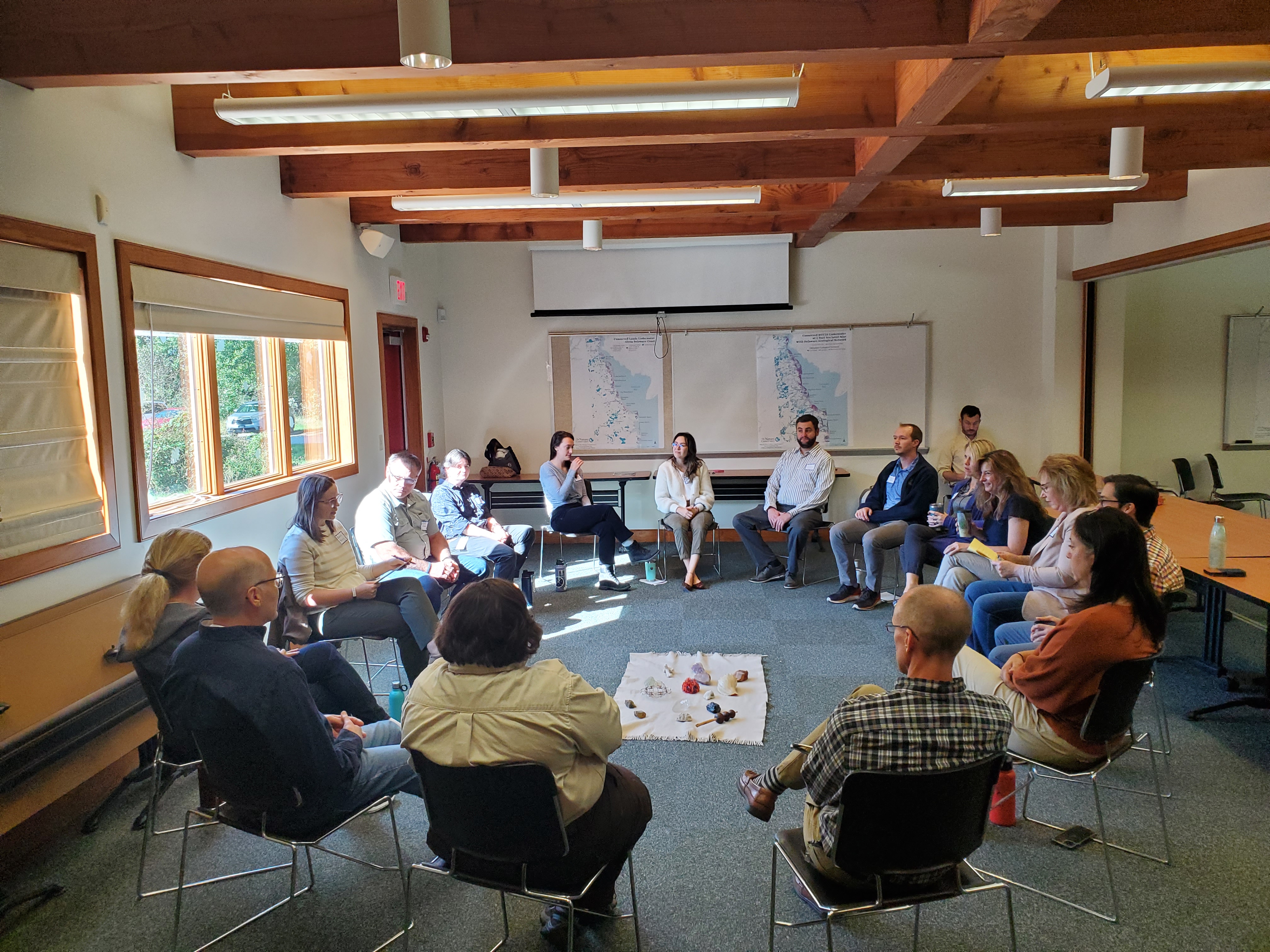
Bayshore Partner Workshops
During 2023-2024, a series of three partner engagement workshops were held to gather input from community members, practitioners and managers about the challenges and opportunities for coastal resilience. The goal of the workshops was threefold: to identify the most significant challenges and threats to both ecological integrity and coastal communities; to co-create new interventions that address these threats and challenges; and to increase trust and collaboration among practitioners and communities in this geography.
The first workshop was a facilitated conversation intended to uncover challenges and opportunities related to coastal resilience within the project area. The human-centered design of this workshop ensured that participants had the opportunity to contribute and listen to one another, thus fostering trust and drawing attention to the specific challenges and needs of disadvantaged communities.
During the second workshop, the team presented interpretations of the conversations to date, including feedback from the first workshop. Individual conversations with practitioners and residents were also illustrated in a situation analysis diagram for further feedback and discussion. This workshop aimed to create shared understanding of socio-ecological systems and identify areas for positive change.
At the final workshop, the team presented candidate strategies for review based on information gathered from previous workshops and community conversations. Participants at this workshop ranked candidate strategies, prioritizing them based on their readiness and potential impact.
Small-format meetings helped build relationships between coastal residents, conservation practitioners and public officials by helping all to better understand the challenges faced by coastal communities within Delaware. In addition to informing the roadmap’s recommendations, these meetings helped strengthen lines of communication between all parties.
Theory of Change
A theory of change (ToC) describes a sequence of activities, outputs and intermediate results that are expected to lead to a desired outcome. It shows a causal pathway from the current to the desired situation and articulates underlying assumptions that can be tested. The ToC expresses the objectives and goals of a strategy, names the assumptions that are inevitably embedded in the vision for the impact and identifies intermediate results as early indicators of progress.
The ToC model is composed of 5 key components:

Looking Ahead
A vision for the Delaware Bayshore: Together, we can create a healthier, more resilient future for our vital coastal ecosystems.

For Delawareans, the overarching message is clear: Make way for water.
The best available science suggests that coastal areas along the Delaware Bayshore which have not historically been vulnerable to flooding will experience even greater inundation from sea level rise. Intense climate change-driven storm events are already here and are likely to grow even more frequent. A resilient coast is one that is well-equipped to absorb and buffer these events while protecting human infrastructure and critical wildlife habitat, and that is what we must strive to achieve.
This roadmap presents multiple recommendations and approaches for securing a healthy and thriving future for the Bayshore. The project team hopes that the multi-pronged strategies outlined herein may serve as a durable and adaptable framework for the First State’s coastline and tidal areas.
Achieving a healthier Bayshore will rely upon the ability to secure future funding to undertake the proposed protection and conservation strategies as well as a willingness to learn, adapt and test new approaches as warranted. In the years ahead, TNC and its partners will explore and, when possible, implement these activities, including expanding capacity for outreach to landowners and facilitating greater coordination with practitioners and managers in key locations such as Delaware’s national wildlife refuges.
Ultimately, long-term success will hinge on the durable strength of our partnerships, particularly within the Bayshore communities whose livelihoods stand to be directly impacted by climate change in the years ahead. The decisions we make collectively today will shape the future of Delaware’s landscapes for people and nature tomorrow.
An additional note on strategic migration:
As rising sea levels and increasingly extreme weather events threaten our communities, a comprehensive approach that includes diverse policy and program solutions will be essential to addressing these challenges. Strategic migration (also known as managed retreat) is one possible option. Legitimate concerns persist about the long-term feasibility of elevating roads or fortifying homes indefinitely, as such measures may eventually become physically unviable and/or financially unsustainable.
In some cases, relocating human communities further inland may prove necessary. However, migration strategies come with significant challenges, particularly for historically overburdened and vulnerable populations. While this report does not delve into the specifics of strategic migration, it is critical to acknowledge its importance and complexity. Any such efforts undertaken in the future must prioritize equity and community input, carefully considering the timing and manner of relocation, the potential disruption of community ties and the resources and services required to help families integrate successfully into new environments.
-
The Nature Conservancy gratefully acknowledges support from the Longwood Foundation in developing the Delaware Bayshore Coastal Resilience Roadmap.
The project team thanks TNC Pennsylvania/Delaware Executive Director Lori Brennan and the Board of Trustees for their leadership on this work. The roadmap was authored by Will Helt and completed with significant contributions from TNC staff including Chris Arnott, Mari-Beth DeLucia, Keith Fisher, Marc Healy, John Hinkson, Emily Knearl, Trent Knoss and Jacob Leizear in partnership with staff from the University of Delaware’s Institute for Public Administration including Martha Narvaez, Sarah Marshall, Kathy Murphy and Lori Spagnolo.
The project team thanks all of the Delaware residents, community leaders and elected officials who took time to share their experiences living on the Bayshore and, in some cases, even welcomed the team into their homes. Project workshop participants were personally invited to attend and represented the following organizations: Delaware Department of Agriculture, Delaware Department of Natural Resources and Environmental Control, Delaware Department of Transportation, Delaware Emergency Management Agency, Delaware Office of State Planning Coordination, Delaware Sea Grant, Kent County, Partnership for the Delaware Estuary, Resilient and Sustainable Communities League, Sussex County and the U.S. Fish and Wildlife Service.

For More Information
To learn more about the roadmap or request additional information, please contact Director of Oceans and Coasts Will Helt: william.helt@tnc.org
Download