
The White River in Indiana
The Nature Conservancy is working with partners and farmers to improve and protect the White River.
Attention Farmers in White River Headwaters!
New Cost-Share Funding is Available!
Contact your SWCD today!The value of a clean and protected White River to our communities, wildlife and economy cannot be overstated.
Where is the White River?
About 30% of Indiana’s population—2 million people in cities including Indianapolis, Anderson, Muncie, Noblesville, Fishers and Carmel—live within the Upper White River Watershed.
The White River flows in two forks (East Fork and West Fork) across most of Central and Southern Indiana, creating the largest watershed contained entirely within the state.
Why is The Nature Conservancy working on the White River?
The waters of the White River flow to the Wabash—the largest river in Indiana—and ultimately downriver to the Gulf, carrying unwelcome souvenirs downstream: nitrogen and phosphates from agricultural fertilizers, cattle waste and polluted urban stormwater runoff.
Extremely elevated phosphorus and nitrogen levels in the water lead to harmful algal blooms in the Gulf. Those algae use up the oxygen in the water, meaning immobile species like shrimp, clams and oysters can’t escape and will die.
TNC is working with the agricultural community to increase the adoption of soil health practices, such as planting cover crops, which help keep agricultural fertilizers and sediments from entering waterways. Only 1-3% of the agricultural land in the White River watershed is planted in cover crops, compared to about 10% for the rest of the state.
Promoting Cost-Share in the Watershed
-

Giving Billboards a Second Life
TNC worked with local partners to install billboards in the White River watershed, garnering interest about the cost-share programs. The billboards were then recycled into useful pouches that are being distributed in the watershed!
Why is Soil Health important?
Working to continually improve soil health does more than ensure farmers have fertile fields to plant crops in—it also means cleaner water. Healthy soils help to filter nutrients and other contaminants out of water before it reaches streams or groundwater sources by allowing the water to infiltrate and move through the soil instead of flowing across the soil’s surface. This helps to replenish groundwater supplies which can be used by crops during drier periods and by municipalities or homes who draw from groundwater rather than rivers or streams.
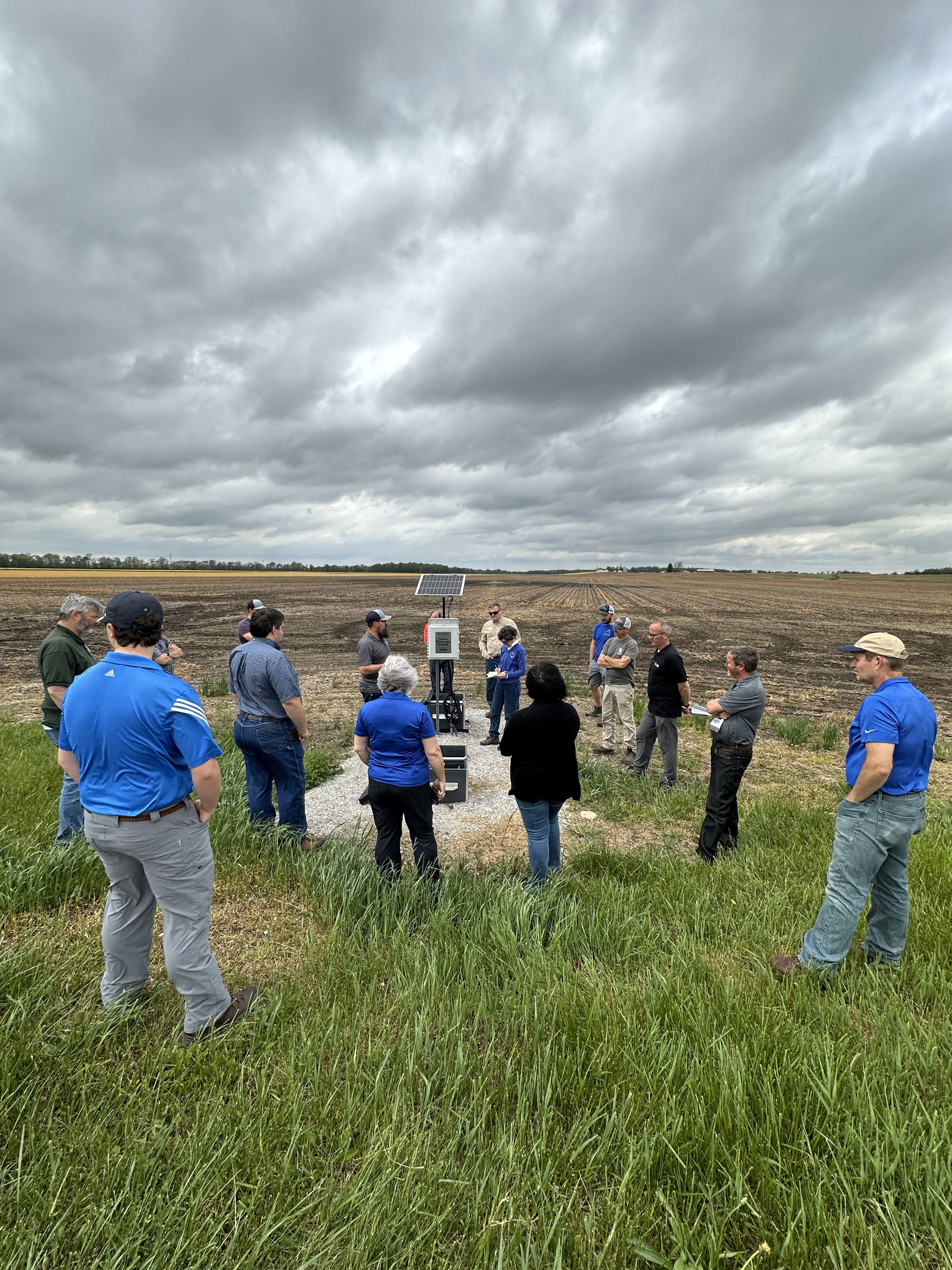
Leading at the Farm Field's Edge
A farmer’s daily task list is long, including field activities, maintaining equipment, purchasing decisions for next year’s crop, marketing this year’s crop and conservation practice management. To help lighten this load, while also benefitting water quantity and quality, TNC has initiated an innovative project with Fairholme Farms in Henry County.
Fairholme Farms and TNC have partnered to establish a regenerative agriculture showcase farm. Our goal is to engage farmers, landowners, agencies and agricultural partners on sustainable practices. The current collaboration is focused on synergizing water management and drainage improvements.
TNC and Fairholme are installing a variety of edge of field practices to better manage water and to filter nutrients and sediments from water before it leaves the farm fields. One of these practices is drainage water management, a practice in which the outlet from an underground drainage system is intercepted by a water control structure that effectively functions as an in-line dam. The structure can be adjusted to hold water in the field, reducing the overall amount of drainage water and 46% of nitrogen lost downstream.
Nearly all tile outlets across the Midwest are completely uncontrolled, thus allowing water and any nutrients to flow unchecked into our waterways. Technological developments now allow for the automation of these structures, and a farmer can quickly and easily manage water across their farm via a computer or smartphone.
A series of these structures is currently being installed at Fairholme Farms to demonstrate and champion implementation. This is a timesaver for the farmer and a win for cleaner water.

Meet Sarah Reilly
Sarah Reilly joined TNC in early 2023 as the White River project director. In her role, Sarah coordinates TNC’s water quality improvement work in the West and East Fork White River basins in Central Indiana with our partners, which include federal, state and local agencies, as well as private companies and other nonprofits.
A Hoosier native, Sarah hails from a family farm in Randolph County near the headwaters of the White River. She began her career in conservation on a HUC10 watershed project in Illinois. As needs and grant funding evolved, she transitioned from the watershed project to administrating a statewide cover crop initiative in partnership with the National Fish and Wildlife Foundation and many SWCDs across Illinois.
Sarah is happy to be back home again in Indiana and working in the watershed where she was born and raised!
Do you have questions for Sarah about TNC's White River work? Contact her at sarah.reilly@tnc.org.
Meet Danielle Randles
Danielle Randles joined TNC in 2024 as the regenerative agriculture manager. In her role, Danielle is creating a regenerative agriculture demonstration network across Central Indiana. This network will feature five farms showcasing edge-of-field drainage practices to be used for educating various stakeholders on these conservation practices to increase their implementation.
Danielle is an Indianapolis native that grew up near a tributary of Eagle Creek and now resides on the near east side by Pogue’s Run. Her journey to agriculture was sparked by yearly trips to the Indiana State Fair which led to an Agricultural Engineering degree from Purdue. After several years in water resources and hydraulic engineering, Danielle transitioned to managing an urban flower farm and goat dairy. As Regenerative Agriculture Manager, she combines her love of water and agriculture into a role focused on conservation through relationships.
Danielle and her husband spend their time outdoors at farmers markets, u-pick farms, parks and preserves. In 2024, they celebrated visiting all of Indiana’s state parks. She also volunteers as a Master Gardener, teaching classes at the Indianapolis Public Library.
Do you have questions for Danielle about TNC's Regenerative Agriculture work? Contact her at danielle.randles@tnc.org.
Our partners
A variety of local partners, such as Soil and Water Conservation Districts, municipalities, universities, private firms and more work alongside TNC to leverage investment and implement conservation on the ground. The Indiana State Department of Agriculture, United States Department of Agriculture and Indiana Agriculture Nutrient Alliance are also key partners.
Funders such as the Nina Mason Pulliam Charitable Trust, Ball Brothers Foundation, George and Francis Ball Foundation, Cummins, Corteva, CenterPoint Energy Foundation and the Sherman and Majorie Zeigler Foundation ensure this work is possible by providing resources and funding.
Working with partners and funders who are invested in the White River watershed and the work TNC does allows for the greatest impact on the landscape.
-
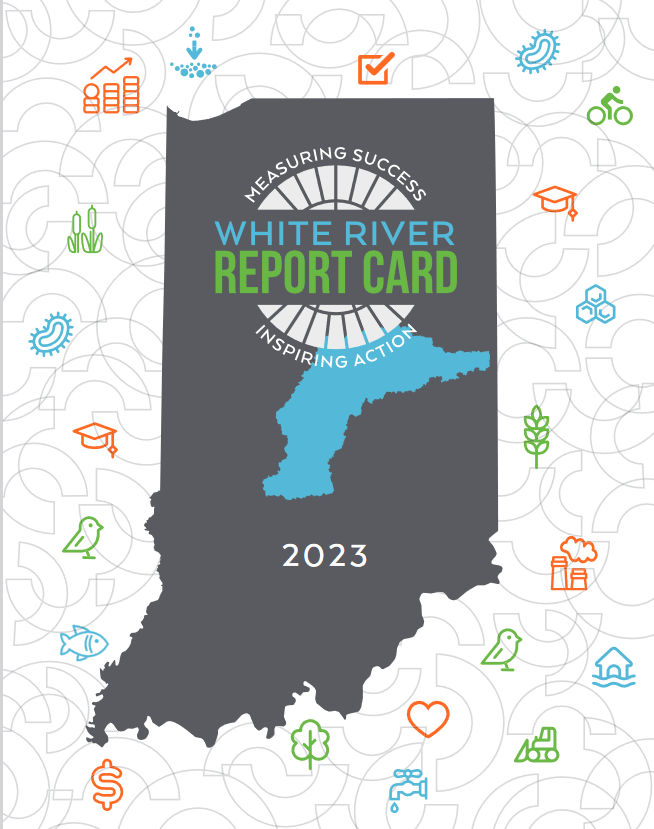
White River Report Card
The Report Card provides a baseline understanding of community and ecosystem conditions. It will be used to broadly communicate important thresholds, increase public awareness and inform decision-makers to improve the health of the watershed. Learn more about the White River Report Card
Indiana Waterways Stories

Big Pine Creek
TNC is working in the Big Pine Creek watershed to improve water quality through the targeted implementation of conservation practices that reduce the runoff of fertilizer and sediment.

Low Head Dam Removal
For the last two years The Nature Conservancy has been leading a team to remove two low head dams from Big Indian Creek in southcentral Indiana.

Freshwater Mussel Tagging
The Nature Conservancy is restoring freshwater mussels in the Wabash River watershed. Good for mussels, good for a healthier river!