Getting Smarter about Solar Siting
New analysis brings a conservation mindset to renewable energy development in Maine.

Dan Coker taps “enter” on his keyboard and wheels his mouse to land the pointer on a particular spot centered on one of the two large computer monitors spread before him. Coker is The Nature Conservancy in Maine’s senior spatial scientist, and he’s demonstrating a newly developed data layer created using a geographic information system, or GIS.
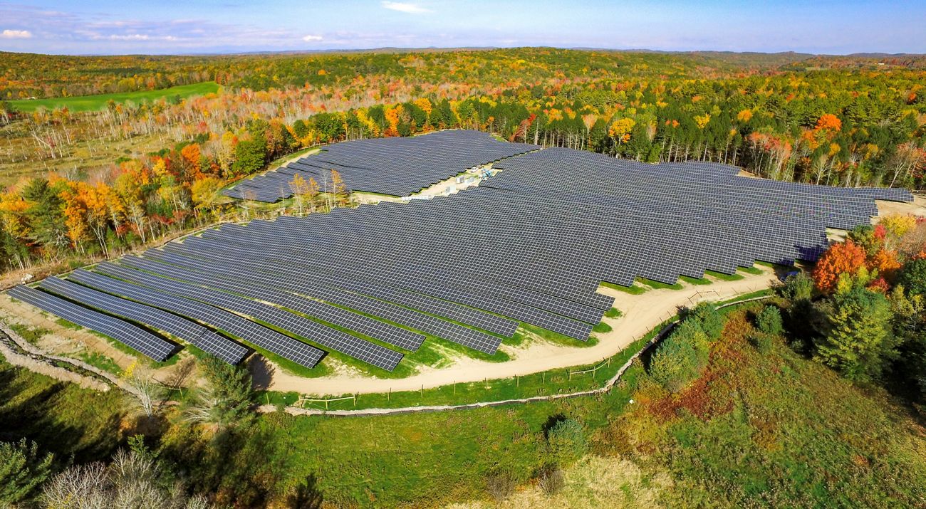
“We wanted to help speed growth and development in solar energy, but in a way that keeps intact the large natural areas Maine is known for,” says Coker. “One way is to map the most important and connected habitats and provide guidance and incentives for solar developers to avoid those places.” Renewable power, including solar, is critical for addressing the climate crisis. But to maximize the benefits from solar, it is important to avoid fragmentation of lands that contribute the most to carbon storage and climate resilience. By doing careful siting, solar can create a positive reinforcing effect by reducing emissions and protecting habitat.
When developers and regulators currently consider suitability of a site for solar development, they look at many important factors—things like wetlands, rare and endangered species, visual impacts and other site-specific information. But this site-specific information can sometimes miss the bigger picture. How does a specific location fit into the larger landscape? How will a solar project affect the biodiversity and climate resilience of an entire area?
At the same time, the Maine Department of Environmental Protection (MDEP) is seeking to make the permitting process for well-sited solar projects faster and easier. That’s why MDEP looked to TNC to support the analysis and mapping needed to propose a new permit-by-rule for solar facilities that incorporates this bigger picture. The permit-by-rule would streamline the permitting process for projects that avoid the best-connected landscapes, as long as they meet other important environmental requirements, creating an incentive to develop in places that have the least impact on connected and resilient habitats.
“Underpinning it all is the concept that species need to be able to move around the landscape,” continues Coker. “That’s why we’re working to help maintain large blocks of habitat, with a variety of pathways that connect them. That way, plants and animals can move around the landscape as conditions change, both locally and across longer distances.”
This is the concept of “Landscape Connectivity.” TNC scientists have developed a rigorous, complex analysis that maps the most resilient and connected places across the country. But while this work is useful for showing large-scale patterns for conservation planning, it doesn’t provide results at the level needed for understanding the best sites for solar development from a habitat connectivity perspective.
Finding the Right Scale
The challenge here in Maine was to apply the concepts of this Resilient Connected Network science in a simple, easy-to-understand, and definitive way that can be used at the scale of solar siting in the state.
Samantha Horn, TNC in Maine’s director of science, joins Coker at the computer to describe how the new GIS data layer works.
Quote: Samantha Horn
“The fact is, we’re going to need lots of renewable energy very soon, and it’s going to be really important to make smart, informed decisions about how and where to do that.”
“When we think about landscape connectivity and maintaining the integrity of our natural lands, we start by thinking about what is fragmenting them—what is breaking the connections,” Horn explains. “And for many species, it is roads, development, traffic and all the effects these can have on species movement and ecology. So, the basic unit of our analysis is a concept called the ‘undeveloped habitat blocks.’”
Coker spins his mouse wheel and zooms into the map, revealing a series of tinted shapes.
“It’s designed to show the patterns of natural areas that are distant from development, like major roads, structures, gravel pits—things like that,” he says.
The tinted shapes are undeveloped habitat blocks, but there’s more to it than that. A single road, for example, might form a relatively minor obstacle, and analysis behind the new data layer can recognize that. Coker and Horn also determined a “core” minimum size that species need by analyzing regional population patterns and species resource requirements. Smaller shapes in a different tint represent areas that can act as stepping-stones between the larger blocks.
When put together, the new data layer will provide an important tool to help nudge solar development toward already fragmented landscapes and away from the key areas of connected habitat which serve as highways for species that need to migrate, and also as reservoirs of biodiversity.
Mapping the Future
Recognizing the infrastructure needs that will be required for a clean energy future, TNC convened a series of meetings, beginning in Fall 2020, with a stakeholder group representing environmental nonprofits, renewable energy developers, electric utilities, consumer advocates and other energy sector stakeholders. The focus of the Maine Utility/Regulatory Reform and Decarbonization Initiative (MURRDI) was to identify common ground in charting a path for Maine to modernize its electric grid to help meet the state’s decarbonization requirements established in 2019—while maintaining safe, reliable, resilient, secure and affordable service.
In Spring 2021, the MURRDI group issued consensus-based recommendations for steps to plan, build and operate the electric grid needed to meet Maine’s recently established climate and energy requirements. A crucial, overarching recommendation is that Maine should adopt a holistic, long-term grid planning process. This first phase of this grid planning process will be getting underway later this year, thanks to Governor Mills and the Legislature, which passed a new grid planning law last legislative session.
The new data layer can also help that process move forward with planning and investment decisions that are not just consistent with Maine’s climate and energy requirements—but also the needs of our natural world.
“The fact is, we’re going to need lots of renewable energy very soon,” says Horn. “And it’s going to be really important to make smart, informed decisions about how and where to do that.”
Get Updates About Our Climate Progress
Sign up to receive monthly emails with conservation news and updates from Maine. Get a preview of Maine's Nature News email.


