Top 10 Best Views in Minnesota
Explore some of the most stunning views and vistas from across the North Star state!
Just 1,699 feet separates the top of Minnesota from the bottom. Despite our modest topography, we have some terrific natural overlooks. And since you might not be able to get out to see all of them, allow us to bring some of Minnesota’s best views to you!
Keep scrolling to see our list of top 10 best views in Minnesota.

Celebrate the best of Minnesota’s nature!
Get the latest news, photos and opportunities near you. Check out a sample Nature News email.
Virtual Tour of Minnesota’s Best Views
Click on the images to see them in full size.
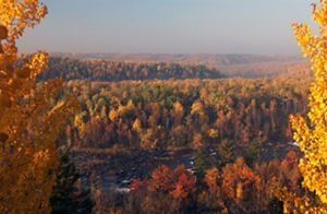
Oldenburg Point: View from Oldenburg Point overlook at Jay Cooke State Park in Minnesota. © Paul Stafford, Explore Minnesota
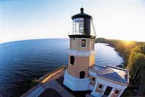
Split Rock Lighthouse: View of Lake Superior from Split Rock Lighthouse in northeastern Minnesota. © Joe Michl, Courtesy of Minnesota Historical Society
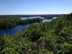
Miner’s Mountain: View from Miner’s Mountain in Cuyuna Country State Recreation Area. © Greg Breining
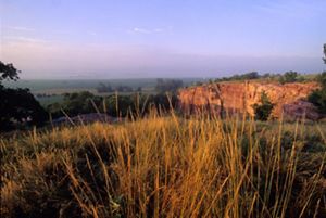
Blue Mounds State Park: Sioux quartzite rock and prairie grasses and flowers at Blue Mounds State Park near Luverne, Minnesota. © Paul Stafford, Explore Minnesota
1. Eagle Mountain, Superior National Forest
Hike the 3.5-mile trail to the top of Eagle Mountain, 2,301 feet above sea level, and you’ve reached the rooftop of Minnesota. To the southeast, beyond forests and rocky ridges, rests majestic Lake Superior. Because much of this out-and-back trail is within the Boundary Waters Canoe Area Wilderness, hikers will find this trek particularly rugged compared to non-wilderness area trails. If you’re able to get out and access this trail safely, be sure to come prepared for a difficult day hike.
📍 Ancestral Lands of the Anishinaabe & Dakota Bands of the Očeti Šakówiŋ

2. Mt. Josephine Overlook, Susie Islands
This vantage point provides spectacular views of Lake Superior’s characteristic forests and ridges as well as the 13 Susie Islands. On a clear day, Michigan’s Isle Royale is also visible! The largest island, Susie Island, was protected wholly by The Nature Conservancy in 1991 and returned to the Grand Portage Band of Lake Superior Chippewa in 2017, where it continues to be managed in its natural state.
Quote: Tribal Chairman Norman Deschampe

The Nature Conservancy recognized that it could help our people accomplish a long-term goal and, at the same time, ensure that the islands will be protected.
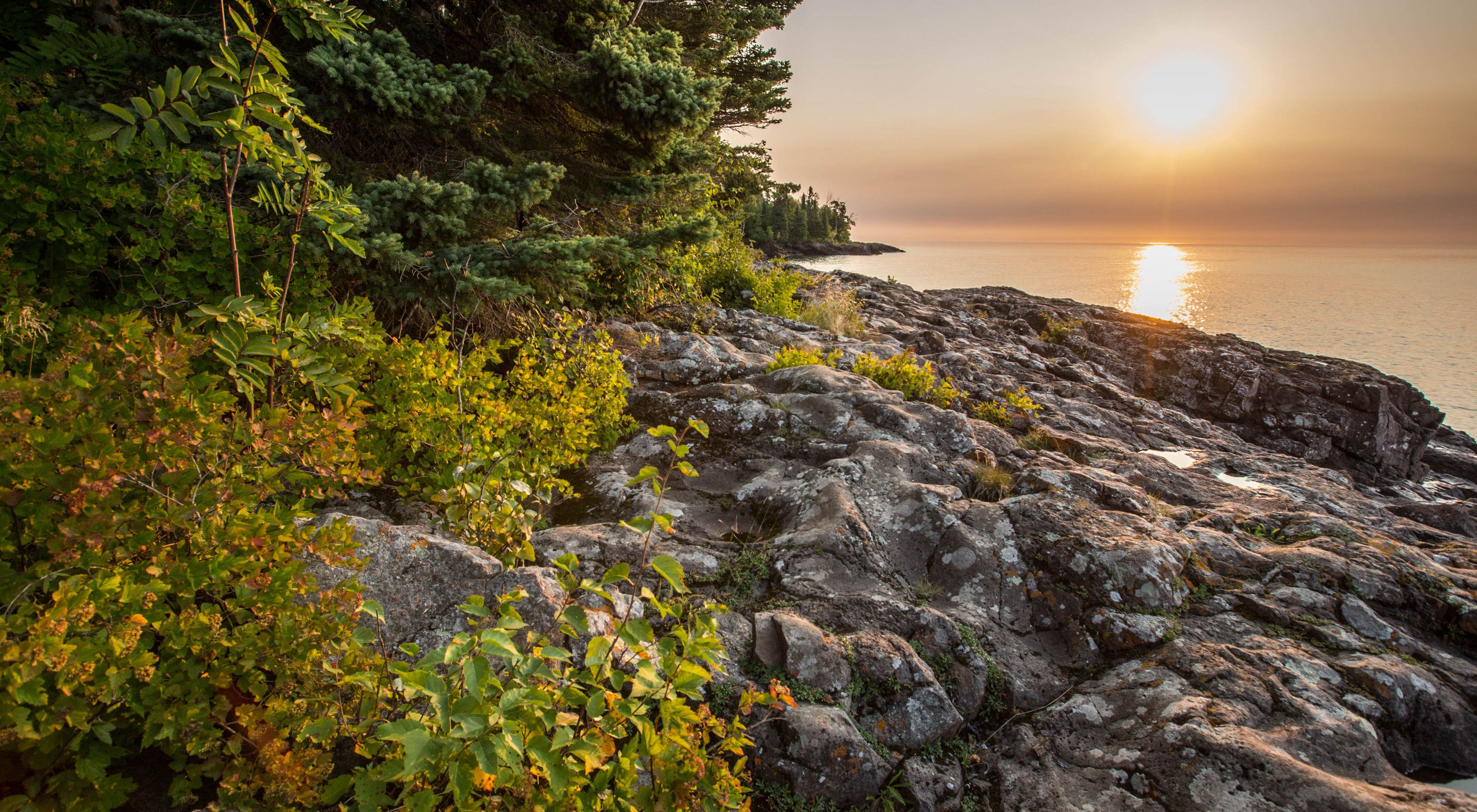
3. Split Rock Lighthouse
Arguably the most picturesque lighthouse on Lake Superior, panoramic views of Lake Superior, the rocky shore, Palisade Head, Carlton Peak and Oberg and Leveaux mountains can be seen from the top.
📍 Ancestral Lands of the Anishinaabe

4. Oldenburg Point
The St. Louis River cuts deep into layers of slate and greywacke, creating a jagged landscape of outcrops and rushing whitewater. The best view of this area is from the observation post on Oldenburg Point in Jay Cooke State Park. If you want a closer view, try the Park’s swinging bridge.
The largest tributary to Lake Superior, the St. Louis River flows from its headwaters in the Northwoods and forms a 12,000-acre freshwater estuary—like none other in the Great Lakes.
📍 Ancestral Lands of the Anishinaabe & Dakota Bands of the Očeti Šakówiŋ

5. St. Croix State Park Fire Tower
See the forest bottom to top by climbing the 100-foot-high fire tower in St. Croix State Park. Interpretive signs guide the way as you pass from the habitat of ground-dwellers, through the shrub layer, into the canopy, and finally above the treetops.
📍 Ancestral Lands of the Anishinaabe & Dakota Bands of the Očeti Šakówiŋ


From the Blog
Read the latest on how we’re ensuring the future for healthy prairies in the Cool Green Science blog.
6. Seven Sisters Prairie
Although “the mountain” of TNC’s Seven Sisters Prairie rises only 190 feet above nearby Lake Christina, it provides great views of the prairie hills. The view is spectacular in the spring when the wildflowers bloom and fall when the hills turn russet and tan, and flocks of canvasback ducks cover the lake.
While you’re up there, take a pause and look for migrating waterfowl and other birds! Lake Christina’s average water depth of four feet allows a profusion of water plants to grow, and these nourish large flocks of canvasback ducks. Other bird species that inhabit the preserve include the Baltimore oriole and the larksparrow.
📍 Ancestral Lands of the Dakota Bands of the Očeti Šakówiŋ
Learn more about Seven Sisters and explore more Places We Protect in Minnesota and beyond!


7. Inspiration Peak State Wayside Park
Minnesota author Sinclair Lewis described the view from Inspiration Peak as “a glorious 20-mile circle of some 50 lakes scattered among fields and pastures, like sequins fallen on an old paisley shawl.” It’s an easy quarter-mile walk to the peak, some 400 feet above the surrounding countryside.
📍 Ancestral Lands of the Dakota Bands of the Očeti Šakówiŋ

Mississippi River Headwaters
Check out what TNC in Minnesota is doing to protect the headwaters of the iconic Mississippi River.
8. Great River Bluffs State Park
Near Minnesota’s southern border, the Mississippi River splits the high bluffs and pools into sprawling backwaters. The overlooks in Great River Bluffs State Park, 500 feet above the river, offer great vantage points. Keep an eye out for bald eagles, wild turkeys and a variety of migrating birds when you visit!
Some other great nearby spots to take in the scenery of the Mighty Mississippi include Frontenac State Park and Weaver Dunes Scientific and Natural Area (SNA).
📍 Ancestral Lands of the Meskwaki, Sauk and Dakota Bands of the Očeti Šakówiŋ


9. Blue Mounds State Park
Atop a ridge of quartzite, Blue Mounds State Park offers a sweeping view of the prairie extending south into Iowa and west into South Dakota. When you are finished with that view, take in the sight of the park’s bison grazing on prairie grasses.
📍 Ancestral Lands of the Dakota and Nakota Bands of the Očeti Šakówiŋ


10. Miner’s Mountain, Cuyuna Country State Recreation Area
During World War I and II, 20 to 30 mines operated on the Cuyuna Iron Range. The mines have since become deep, clear lakes. The view from atop 200-foot-high Miner’s Mountain offers a spectacular view of nature slowly reclaiming the land.
📍 Ancestral Lands of the Anishinaabe and Dakota Bands of the Očeti Šakówiŋ

📍 Land Acknowledgements Courtesy of Native Land and TNC’s Indigenous Peoples & Local Communities Team
Related Stories

Top 10 Nature Places To Take Your Kids in Minnesota
Looking for something fun for the whole family? These are the top 10 BEST places for kids to explore in and around the Twin Cities.

Restoring Minnesota’s Peatlands for Climate & Water
Peatlands cover only about 3% of Earth’s surface yet globally store an estimated 30% of all land carbon, and in Minnesota, we have more peat than any state other than Alaska.

Guides to Prairie Restoration in Minnesota
Grazing, wildlife habitat or improving water quality and quantity, The Nature Conservancy has steps to take to achieve your restoration goals.