One Fish, Two Fish, Red Fish…Few Fish?
New ways of mapping fish habitat are offering hope for a sustainable way forward.
The first question people ask when they come to Charleston is where to get the best seafood,” says Mike Lata. As chef and partner at Charleston hotspots FIG and The Ordinary, Chef Lata is a good person to ask.
“Fresh, local seafood is a strong part of our robust tourism here in the Lowcountry, and Charleston specifically,” he explains. “Without it, our food would suffer, our restaurants would suffer, our culinary identity would suffer.”
Despite its widespread appeal, the future of South Carolina’s seafood is far from certain. Once-thriving species are becoming scarce, while the ocean that sustains them is increasingly crowded by energy development, shipping lanes and other uses.
Five years in the making, The Nature Conservancy’s South Atlantic Bight Marine Assessment (SABMA) is poised to help change that dynamic. This pioneering ocean-mapping report is a powerful new ally for South Atlantic fish—and the many people, like Chef Lata and other Lowcountry business owners, who depend on them.
How Many Fish Are in the Sea?
One of the core safeguards for South Carolina’s ocean fish is the “essential fish habitat” designation, which recognizes an area’s key role in growing new fish. While the label alone doesn’t trigger legal protection, it does highlight that area for future protection and can reduce its chances of being developed.
Essential fish habitat designations protect the areas in which fish hatch, feed, live and reproduce. The problem? They’re based on incomplete data.
Currently, the South Atlantic Fisheries Management Council monitors fish populations in two ways. First, they survey the types and number of fish in known areas of fish habitat. Second, they look for trends in reported commercial and recreational catches. Together, these numbers decide whether a species is categorized as “healthy” or “overfished.”
“The way the law is written today, if a species is deemed ‘overfished,’ the season ends abruptly. That puts fleets out of business,” says Chef Lata.
The Missing Link: Studying and Protecting Fish Habitat
“The Council’s current methods are a critical step toward balancing fish growth and harvest, but they don’t give the whole picture,” says Mary Conley, the Conservancy’s South Atlantic marine conservation director.

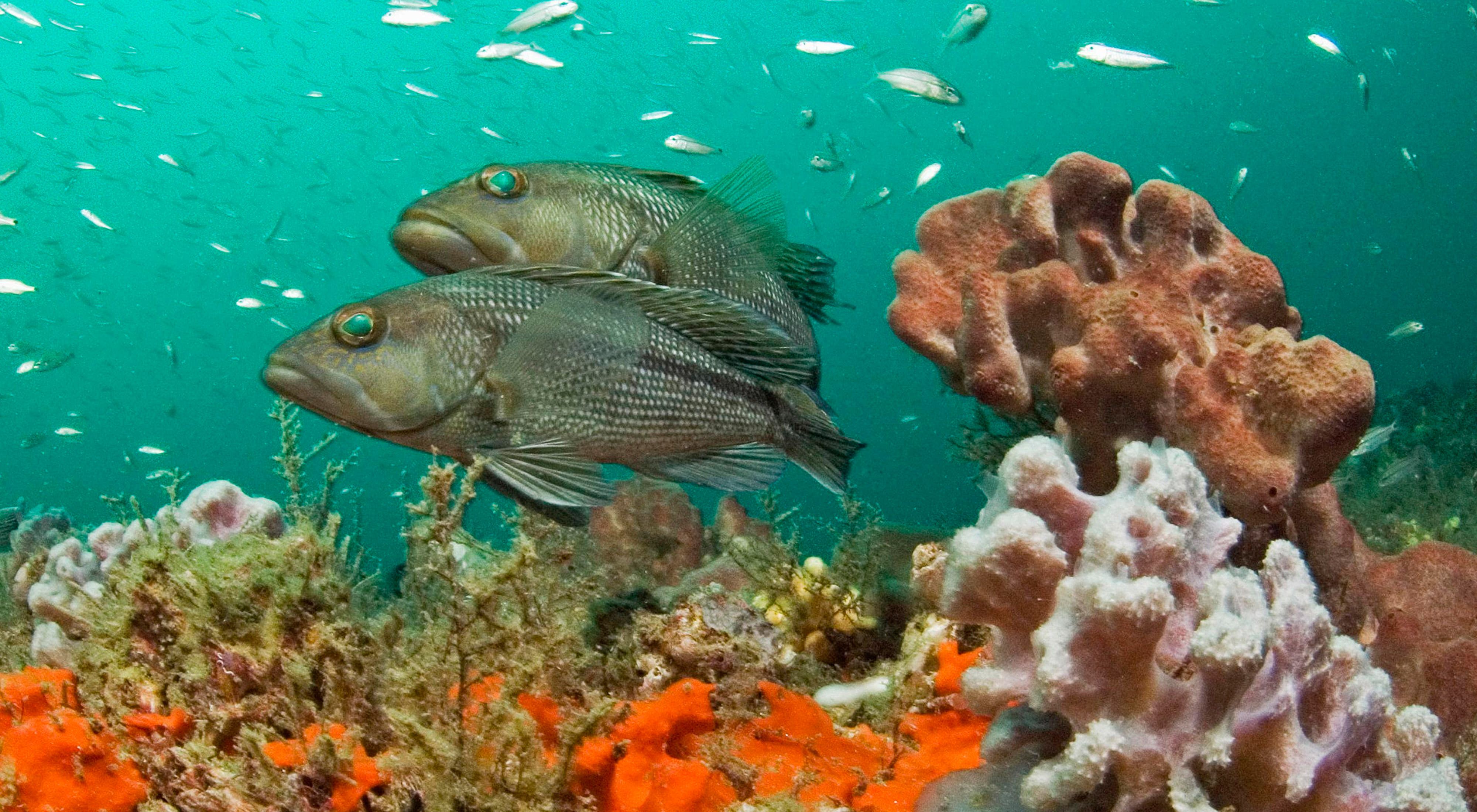
A significant gap in the data was how much fish habitat was available. Were we recognizing all the areas fish needed to thrive in each stage of their lives? For example, newly hatched gag grouper—a popular sport fish—prefer shallow waters with low cover, such as oyster beds. As they grow, the fish move to deeper waters with larger cover, such as deep-water coral reefs. “A broken link anywhere on the chain can devastate a species,” Conley says.
That incomplete data suggested critical habitats were going unmonitored and unprotected. As a result, the Council couldn’t help towns and communities prioritize which of their coastal habitats to protect or restore.
An Uncertain Future
Without knowing which areas were most important to fish, scientists couldn’t determine in advance how future growth—from shipping lanes to coastal development—might impact local species.
Imagine that a communications company wants to lay a new cable along the sea floor. With only scattered habitat mapping, they might not know if their preferred site is a flat, sandy area with sparse ocean life or a rocky ledge teeming with corals, fish and sea turtles. Unless the habitat’s importance is discovered during the permitting process, that could spell serious consequences for fish and local fisheries.

Turning the Tide
Fortunately for fish and local fishermen, your generous support has given marine life in the South Atlantic a formidable new ally.
With the release of the South Atlantic Bight Marine Assessment (SABMA), the Conservancy and partners are ushering in a new era in ocean planning. The report includes map layers illustrating water depth, migration routes and sea floor features from North Carolina to the Florida Keys. Never before has this data been collected in such a big-picture way.
What Makes SABMA a Game-Changer?
- It combines data from different sources to create a more complete picture of what’s happening under the waves. Layering maps like the one above helps pinpoint critical areas for marine life—similar to a Venn diagram of the sea.
- The report identifies new "lookalike" areas that mimic known important habitats, similar to how astronomers search for life in outer space by looking for planets similar to Earth. These areas now can be targeted for research or protection.
- It is being released during the South Atlantic Fisheries Management Council’s two-year revision of its essential fish habitat designations. Once in place, these guidelines will stand for the next 10 years.
“When companies, town planners and scientists can easily identify which areas are most critical for fish, they’ll know which to target for protection and which to avoid for new development,” says Conley.
Your support is delivering leading-edge science during a short and crucial window for ocean fish. Thank you for making a difference in the waters off South Carolina and to the industries, communities and families that depend on a healthy, thriving coastal culture.
“Seafood is now harder to catch year-round,” says Chef Lata. “If we don’t look at our oceans and coasts as an integral part of our communities and prevent them from being developed, we’re going to lose something very, very special.”
Find out how you can help by contacting Elizabeth Foster at efoster@tnc.org or 843-937-8807 x 14.


