Listening Sessions with a Marsh: Port Susan Bay Preserve's Estuary Restoration
By Sara Adams, freelance writer
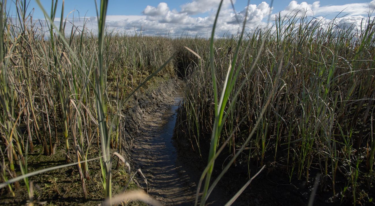
Estuaries—where a river meets the ocean—are some of Washington’s most ecologically and culturally important ecosystems. They provide habitat for a range of plant and animal species throughout their life cycles, including the threatened Chinook salmon. The integrated channel networks filter sediment and nutrients to improve water quality, while bulrushes and sedges stabilize shorelines during flooding events and storm surges and prevent erosion.
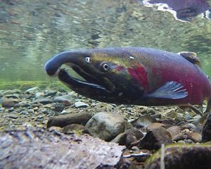
Despite their array of benefits, functioning estuary habitat has declined across Puget Sound, with critical species and local communities feeling the impact. The Stillaguamish River Delta historically supported nearly 20,000 Chinook salmon annually. In 2019, just 500 fish returned. For the Stillaguamish, Swinomish and Tulalip Tribes, whose ancestors have stewarded these lands and waters since time immemorial, addressing declining salmon populations is a key priority. Ensuring juvenile salmon have places to mature is necessary to recover fish stocks for commercial, subsistence, ceremonial and recreational fishing, as well as for the endangered Southern Resident killer whales.
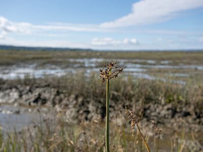
Enter: Port Susan Bay Preserve. Where the freshwater of the Stillaguamish River meets the seawater of Puget Sound lies an expanse of estuarine tidal marsh. Here, The Nature Conservancy has been working to restore ecological function to the Stillaguamish delta’s estuarine habitat. Through years of continuous monitoring, application of lessons learned and now preparation for connection to the Stillaguamish Tribe’s adjacent zis a ba II site, efforts at Port Susan Bay are writing a new page in the estuary restoration handbook to reconnect the estuary bringing benefits across the delta.
A Living Laboratory to Advance Wetland Science
The restoration effort began in 2012, when The Nature Conservancy removed and set back 7,000 feet of sea dike, seeking to reconnect 150 acres of agricultural land to both the river and sea. Since then, Port Susan Bay Preserve has taken the form of a living laboratory for advancing tidal wetland science.
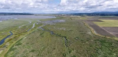
At the time of the sea dike relocation and creation of two outlet channels, large-scale estuary restoration was a nascent science. TNC’s restoration team believed a complex channel network would develop on its own, creating a functional habitat for salmon and other marsh species. After analyzing five years of monitoring data and reviewing additional research, the team decided adaptive management action was needed, assessing progress in real time and intervening accordingly. Results from channel network modeling conducted by the Skagit River System Cooperative were especially compelling. They determined that due to compacted soil layers caused by decades of agricultural tilling, it would take an additional 80 years for the channel network to fully develop—time that the salmon do not have.
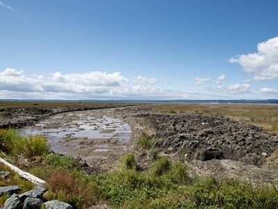
Seeking to compress that timeline, the team decided to excavate a highly connected channel network within the site to improve marsh plant health and increase fish habitat. Large distributary channels were designed to create connectivity across the river, marsh and bay. These channels increase fish access to the site, as well as help distribute freshwater and sediment across the whole of the Stillaguamish delta. Blind tidal channels are smaller, reaching deep into the marsh, connecting fish to marsh-produced food in calmer waters of the marsh. New methods and technologies—from explosives to penetrate the compacted soil to drones to monitor the results and develop models—pushed the needle toward progress and contributed important lessons.
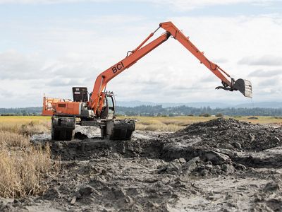
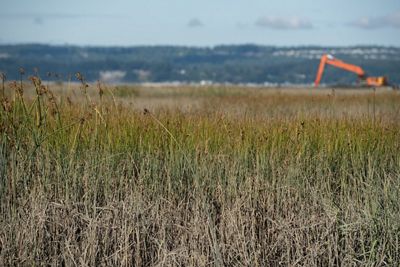
This past summer, an environmental engineering tool moved progress forward by leaps and bounds: amphibious excavators. These excavators exert less surface pressure on the marsh than a person’s footprint and are therefore able to be used in already inundated environments with very soft soils. They are also nimble enough to move within the channels as they dig, allowing them to avoid additional impact to sensitive marsh surface. With carefully designed, data-informed channel network designs in hand, the excavator operators implemented the restoration vision efficiently and with minimal impact to the existing marsh.
Using Data to See the Full Picture
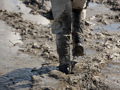
For more than a decade, The Nature Conservancy and a network of partners have collected data on key estuary characteristics, such as vegetation growth, water salinity, channel development, fish community structure and accumulation of sediment at Port Susan Bay. This multi-faceted dataset provides a rich decision-support tool for accelerating estuarine recovery in the Puget Sound, and beyond.
To understand how Chinook salmon are responding to the restoration, The Nature Conservancy and Skagit River System Cooperative are monitoring multiple indicators, at the invitation of the Stillaguamish Tribe. First, the team is comparing Chinook density at the restoration site compared to similar reference areas to determine if restoration improves fish use and access. Second, they are observing whether the distribution of Chinook across the wider delta area changes when restoration actions increase channel connectivity. Third, they are using genetics to identify which populations of Chinook are utilizing the delta. Finally, the team is using bioenergetic models—studying what fish eat and how they grow—to identify how restoration and climate change impact the growth of juvenile Chinook before they enter nearshore marine waters.
Connected Land, Amplified Results
The Port Susan Bay restoration is a piece of a much larger picture of collaboration. The effort helps ensure the integrity and long-term impact of salmon recovery projects upstream by preventing a habitat bottleneck for the out-migrating juvenile salmon at the river’s outlet.
Directly adjacent to Port Susan Bay is zis a ba II and zis a ba III—240- and 500-acre sites, respectively, owned by the Stillaguamish Tribe. The plan is to excavate tidal channel networks across both parcels, with large distributary channels carving across zis a ba II. These channels will connect the Stillaguamish River to the channels at TNC’s restoration site, which were sized to accept the increased volume of water once reconnected. The goal is for all three sites to function as a continuous estuary.
Together, the restoration projects are expected to recover more than 900 continuous acres of self-sustaining tidal wetland that supports a wide range of estuarine-dependent species.
The Future Looks Bright
After a few cold ocean years, fisheries specialists expect to see larger numbers of Chinook returning to the rivers to reproduce. With improved freshwater delivery, channel velocities and foraging access, the estuary can help juvenile salmon grow strong before venturing out into the ocean. This is especially important as we head into an El Niño cycle, when warming ocean conditions typically prove difficult for salmon.
Today, shorebirds and migratory waterfowl dine from a menu of invertebrates, plants and algae in Port Susan Bay. Sedges and bulrushes along the newly created channel network have died back for winter but hold promise for new growth in the spring. In the distance, zis a ba II instills hope for large-scale nature-based solutions. Time (and lots of data) will tell how well the restoration sites recover, but looking out over the marshlands, there are strong positive indications that the Stillaguamish River Delta is headed in the right direction.
Learn more about Port Susan Bay and the impact of estuary restoration in the video below.
We Can’t Save Nature Without You
Sign up to receive monthly conservation news and updates from Washington. Get a preview of Washington's Nature News email.
