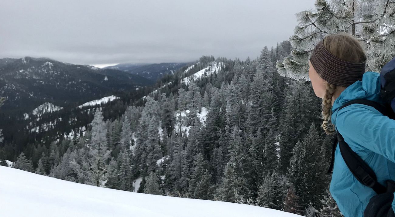
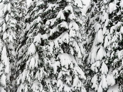
Snow is falling in Western Washington, possibly the most we’ll get this season. The lowlands will get more snow with this system than they have in a decade, and I am taking full advantage by sledding with my kids right out the front door. But I can’t keep my mind off the forests of the Cascade Mountains. I am grateful that snow is piling up in deep drifts. Those drifts will become the lifeblood of our rivers this spring and summer.
Not all winters yield deep snows. In 2015, Washington faced one of the worst droughts on record. Streambeds ran dry, crops failed, and fisheries closed. It felt more like California, but It wasn’t rain we missed. In fact, it rained 7 inches above the norm. This was a snow drought.
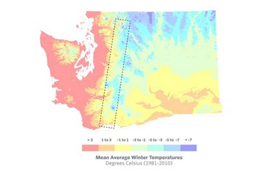
In the Pacific Northwest, recent El Niño events have brought precipitation—and warmer temperatures. El Niño winters are marked by moist systems that drop more rain than snow in the mountains. By the time winter passes, there is not enough snow to stoke meltwaters and feed rivers.
The good news—and the bad news—is that these warmer winters give a crucial glimpse into Washington’s future climate conditions.
Where goes the water?
We don’t often think of Washington as drought-prone. Our moss-drenched coastal towns boast upwards of 117 inches of rain per year. But on the eastern slopes of the Cascade Mountains, it’s a different story. Ponderosa pines give way to sagebrush in the open skies of the Columbia Basin. A good year brings 9 inches of rain.
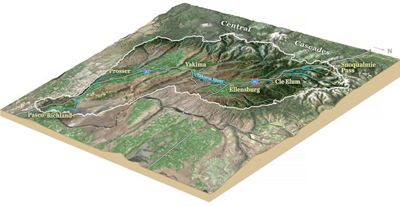
Despite this, water can seem abundant in Eastern Washington, where the Yakima Valley hosts salmon, generates hydropower and sustains a $2 billion tree fruit industry, etched out of the shrub-steppe each year. Eastern Washington doesn’t need much rain—so long as it has snow.
Watersheds in the Eastern Cascades utterly depend on snowpack. Snow supplies 75% of runoff in the Yakima Basin, most of which arrives in the valley with the spring melt to irrigate the season’s crops and shepherd juvenile salmon downstream on their journey to the ocean. Communities of the Yakima Basin are intimately bound to its rivers and tributaries, and thus are highly vulnerable to a warming climate.
Water security is at risk in every snowpack-dependent basin in the western United States. Scientists tapped SNOTEL data back to 1982 from 13 western states and found a 41% decrease in annual snow mass, with a snow season shortened by 34 days.
Science guides the way, but we need more
Knowing that snowpack is dwindling, it’s time to figure out how we can adapt to drier conditions. One place we are exploring our climate adaptation potential is in Washington’s forests. In the Western Cascades, snowpack can be retained by opening up the forest canopy. In colder areas, like the Rockies, the equation flips completely, with an open canopy forest resulting in thinner snowpack, likely due to sunnier skies and brisker winds. Forest managers can apply these connections to maximize snowpack and therefore water.

In the eastern Cascades, there are no data linking the depth and duration of snowpack to tree canopy cover. We don’t know whether it is better to have a dense canopy that shades snow in the spring or an open forest that accumulates snow in the depths of winter.
But we’re on it. For the next two years, we’ll track snowpack depth and duration in different forest types with cameras and temperature sensors alongside SNOTEL stations collecting data on snow depth and density, wind, temperature, precipitation, and irradiance.

Now we cross our fingers that open canopies yield later melt-out dates in Washington’s eastern Cascades. That would mean our forest-thinning prescription for fire resilience matches our needs for water resilience. If they are at odds, well, then we need to get more creative about where we manage for water and where we manage for fire. Ignoring one or the other simply isn’t an option.
I am on the side of the highway in the driving rain, flashers blinking and my collar tugged up to my ears. Trucks full of wooden apple crates roar past in a spray of tire wash. My stash of 10-foot PVC pipes has shifted, and I need to cinch the straps before the whole pile sprawls across the road.

Wrestling the load back into place, I muse that PVC pipes must be the backbone of field science. But ironically, these plastic tubes are essentially giant straws. Cities are banning straws, one after another, to protect aquatic and marine ecosystems. Here I am bringing PVC to a conservation research site.
But this isn’t a story about plastic in the water. This is about water itself.
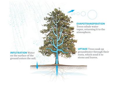
You know what else sucks water like a straw? Trees. They are natural straws that pull water from the ground, draw life from it and transpire it to the atmosphere. We need our trees. They release water, but they also clean it, store it, and in some cases, even create it! But we also need to protect water in a drier, warming climate. We may need to remove some of these natural straws to do that. So crucially, we need to know: How many trees, and which ones?
HUMAN LEGACIES ARE CROSS-WISE WITH CLIMATE
Now planted solidly in the Anthropocene, the Earth overwhelmingly bears the marks of humanity. Some marks are ingenious and beautiful. Some forgotten, long-since folded back into the soils of time. But when the legacies we leave tinker with the natural laws of biophysics, they don’t allow us to forget. What goes around, comes around. For each force, there is an equal and opposite reactive force.
Consider the dry forests of Washington State and the American West. After a century of fire suppression, these once naturally adapted forests are now dangerously overcrowded—with too many trees. This, tragically, fuels more catastrophic wildfires. Add the pressure of a warming climate, and hotter temperatures make for thirstier trees, sucking the soils and streams dry.
CAN FOREST THINNING ALSO SECURE WATER FOR WASHINGTON?
Our prescription to thin overstocked forests and remove fuel for wildfire may present a winning solution for these two pressing climate issues. But also maybe not.
In California’s American River Basin, forest-thinning, wildfire and prescribed burns removed an awful lot of straws and saved 17 billion gallons of water. California’s governor noticed, signing a 2017 bill facilitating watershed thinning to improve water security as well as fire-resilience.
But don’t get too excited to march this technique up the coast just yet.
Remember Washington’s snowpack. It’s a crucial resource for water security in the forests and valleys of the Cascades. But trees’ water consumption is only one piece of the hydrologic puzzle. Tree canopy makes a difference—as an umbrella it can intercept snow and prevent robust snowpack on the forest floor. On the other hand, this umbrella can provide critical shading and wind protection, preventing an early snowmelt. There’s also radiant heat held within the tree bole itself . . . and the list goes on. It’s tricky to determine whether trees are good or bad for snowpack because it so heavily depends on where you are.
We've got the gear, now we need the data
We’re piecing the puzzle together for Washington. This past fall, we packed that PVC load, along with ladders, cameras, straps, t-posts, sledge hammers and temperature sensors, and headed east of the Cascade crest. There you find me, wrestling with plastic pipes.
Racing against impending flurries, we set up a network of monitoring sites to determine whether forest gaps or forest canopies result in a deeper, longer-lasting snowpack. Our sites represent the headwaters of Washington’s most vulnerable watersheds, where rivers depend on snowpack for more than 70% of their flow.
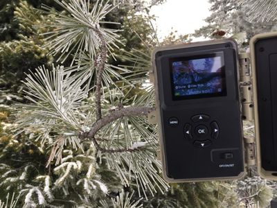
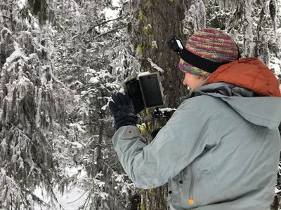
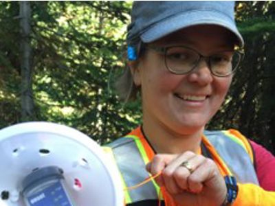
We installed time-lapse cameras and temperature sensors alongside SNOTEL stations to pair our observations with meteorological data. SNOTEL sites provide snow depth calibration points, as well as measurements on wind, temperature, precipitation, irradiance (sunniness), snow density and depth. Time-lapse cameras mounted high in the trees will track snow depth by taking snapshots of measurement poles fashioned from long lengths of PVC.

We’ll relate snowpack data to tree canopy using hemispherical camera shots. Temperature sensors tucked in the duff of the forest floor will track snow melt-out dates: once the snow melts, the ground loses its insulating blanket and temperatures swing wildly.
While I wait to see how this year’s snowpack bears out, I’ll be loading up an avalanche transceiver, a pack full of batteries, and a pair of skis to check on my cameras. Record-breaking snow event or not, we’ve got to get those data.
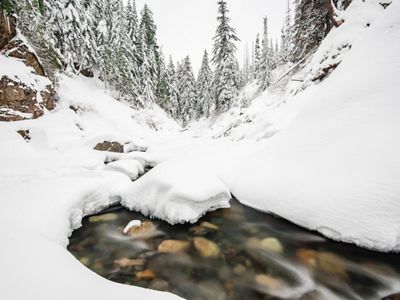
Communities of the Yakima Basin are intimately bound to the river. Flowing like life-giving arteries through the arid landscape, the Yakima River and tributaries provide the majority of water for this vital valley known for its rich agricultural legacy, world-class orchards, and once prolific salmon runs.
Save for its forested headwaters, the landscape is largely scrubland – devoid of rain most of the year. Yet the river provides snaking coils of green floodplains and irrigated crop circles all the way through sagebrush country to the Columbia River confluence. The rivers that sustain the Yakima Valley don’t get their water from the sky in spring. They swell due to melting snowpack from the Cascade Mountains above. And for the most part, water storage in the Yakima Basin isn’t found in the reservoir system, it’s in the snowpack itself.
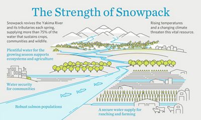

But that snowpack is dwindling. As a result, water security in Yakima and across the American West is increasingly melting away. Data from the SNOTEL network, 700 stations in 13 Western states, reveal a 41% decrease in annual snow mass since 1982, with a snow season shortened by 34 days.
River valleys are thirsting for water—and the climate is warming. This climate-induced water stress compounds with a legacy of fire suppression in upper watershed forests, exacerbating drought symptoms not only in the rivers below, but also for the forests themselves as overstocked trees compete for water. And likewise, water insecurity stresses communities. Water users not protected by reservoir systems or priority water rights increasingly face a hard, dry reality; water curtailments are expected in 75% of years by the end of the century.
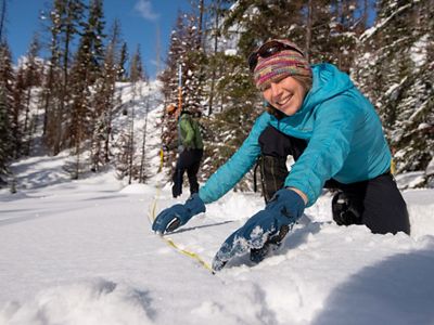
We’re working to identify how tree canopy conditions interact with snowpack in the eastern Cascades so that we can build restoration strategies that both protect snowpack and reduce wildfire risk. This confluence of fire and ice is critical to ecosystem integrity in a changing climate, not only for river ecosystems, but for the people, fish, and wildlife that rely on them.