- Phone: 225-338-1040
- Email: lafo@tnc.org
-
Follow
Louisiana loses an average of 16 square miles of coastal marsh each year.
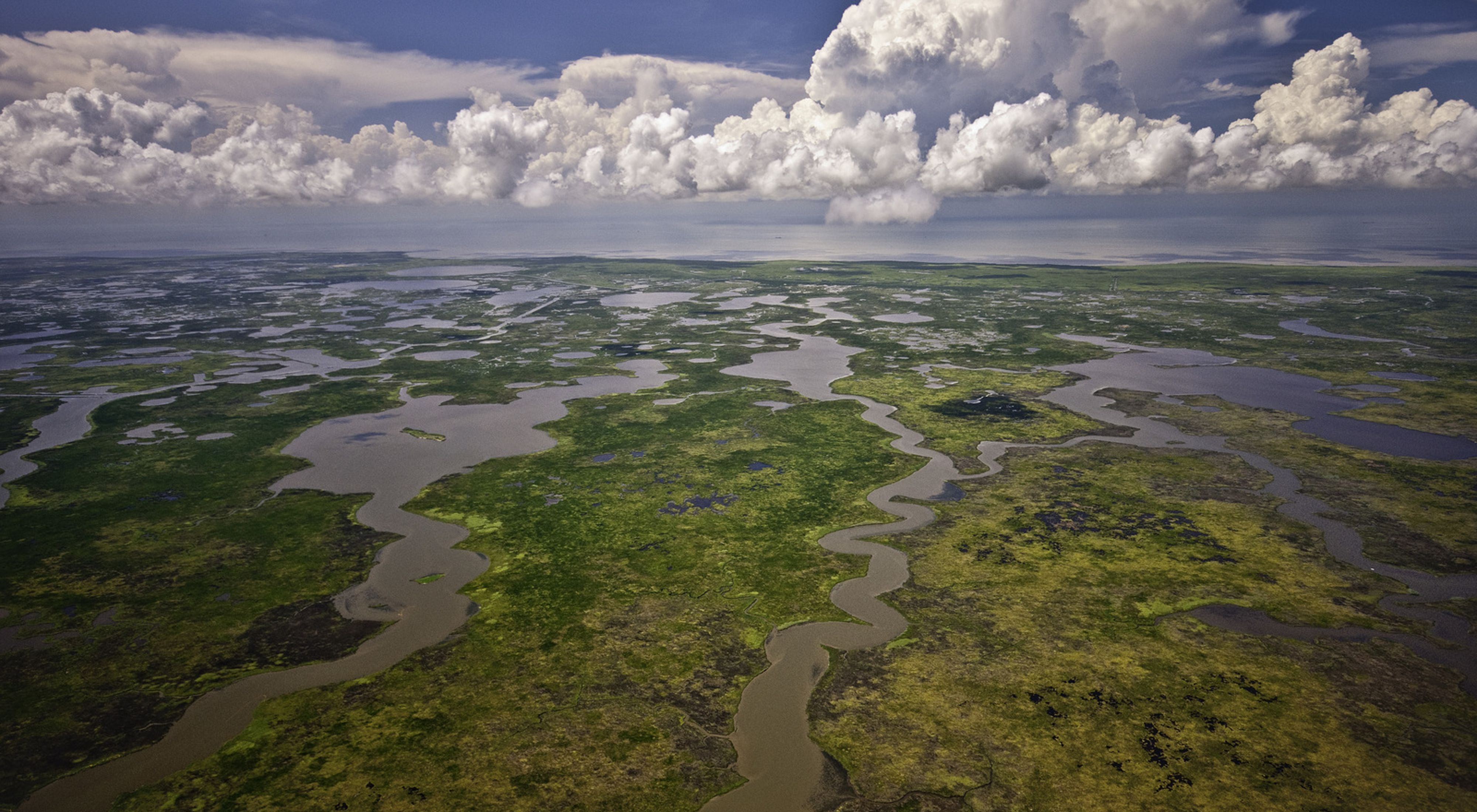
The coastal marshes of Louisiana cover approximately 10,700 square miles and comprise approximately 12% of the nation's coastal wetlands. Sediments carried in the Mississippi River form the foundation for the coastal marshes. Over the past 7,000 years, the Mississippi River created seven major deltas in central and eastern Louisiana. As the river changed channels, new marshes were created while others were lost
What are Coastal Prairies?
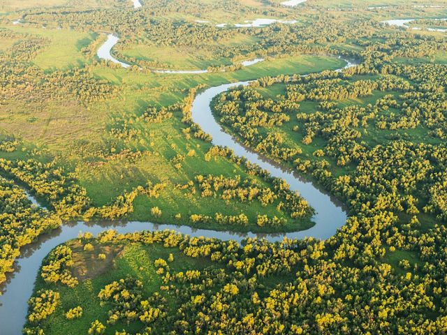
Louisiana coastal prairie is a type of tallgrass prairie somewhat similar in composition to those in the Midwest, where the occurrence of prairies is largely due to lack of sufficient rainfall to support trees. This is obviously not the case in south Louisiana, where average annual rainfall exceeds 50 inches. The vast expanse of coastal prairie was attributed to heavy clay soils and frequent fire. The extreme soil conditions and regular fire made it very difficult for woody vegetation to become established, except near streams.
Low, rounded mounds are scattered throughout the region, and are referred to by geologists as pimple or mima mounds. Pimple mounds are only known west of the Mississippi River in Louisiana. Although there are many theories as to the origin of these mounds, no consensus by geologists or soil scientists has been reached. The mounds range in size from about 30 to 50 feet in diameter, and three to seven feet tall. Soils on the mounds are coarser and more well-drained than between moundss. Small natural ponds or depressions, referred to as marais ponds, have also been noted in the prairie region.
Wetland Types
Several distinct types of wetlands are found in this region. Nearest the coast and subjected to regular tidal inundation is salt marsh. Inland from salt marsh, and subjected to reduced tidal influence, is brackish marsh. Brackish marshes are extremely important as nurseries for fish and shellfish. Other characteristic species include muskrat and shorebirds.
Intermediate marsh is subjected to periodic pulses of salt water. Intermediate marshes are considered extremely important for many wildlife species, such as alligators and wading birds, and serve as important nursery areas for larval marine organisms. Although still a common natural community type in Louisiana, intermediate marsh appears to be declining due to increased salinity levels.
Freshwater marshes support extremely high densities of wildlife, such as migratory waterfowl. However, because of saltwater intrusion, freshwater marshes have undergone the largest rate of reduction in acreage of any of the marsh types in Louisiana over the past few decades.
Other less well-known wetland communities found in this ecoregion include submerged grass beds, coastal mangrove thickets and floating marsh/scrub. Grass beds are extremely important breeding areas for many fish species and support tremendous numbers of wintering diving ducks such as redheads and scaup. Mangrove thickets in Louisiana are periodically killed back during sever winters but provide an important nesting substrate for many species of colonial nesting wading birds
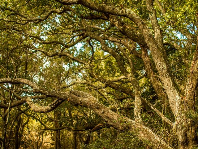
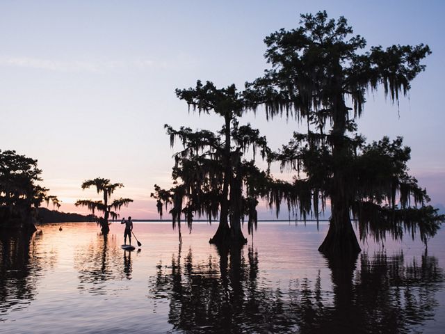
Upland habitats are extremely limited within the marsh region. Natural levees along the main stem of the Mississippi River and its distributaries, such as Bayou Lafouche, were created by sediments deposited during over-bank flooding. Over time, these natural levees were built up so that they were significantly higher than adjacent wetlands. Forests dominated by live oaks formed on these ridges. Additionally, narrow ridges of sand and shell, which were deposited in coastal marsh during storm events mainly in west Louisiana, also developed forest dominated by live oaks and are named cheniers, French for "place of oaks." Cheniers are almost uniquely Louisianan, as there are only a few cheniers that extend into Texas. Cheniers are well-known to birders as important stop-over habitat for migratory songbirds that breed in North America and winter in Central and South America.
Additional upland habitats include coastal dune grasslands and thickets, which develop on stable dunes along the coast or on barrier islands, and salt dome forest, which has formed on the major salt domes that are exposed above surrounding marsh.
HIstory
As recently as 100 years ago the coastal prairie encompassed approximately 2.5 million acres in southwest Louisiana. The region includes portions of 12 parishes and is generally bordered by the Atchafalaya swamp to the east, pineywoods to the north, coastal marshes to the south and the Sabine River to the west. This region also extends into four counties of eastern Texas.
This relatively flat region was once a series of naturally treeless areas, broken only by forested streambanks called gallery forests. Prairies or "coves" between gallery forests were given local names, such as Calcasieu Prairie, Prairie Mamou, Robert's Cove, Vermillion Prairie, and Prairie Swallow.
Historically, this region was only sparsely populated and human alteration of the environment was limited. When de Soto found and named the Mississippi River (originally Rio del Esperitu Santo) in 1543, Native Americans had been living in the coastal areas for 12,000 years. It was not until the late 1600's and early 1700's that Iberville and Bienville conducted extensive surveys of southeastern Louisiana and formed the initial European settlements in this region.
Prior to the turn of this century, this area was essentially an unbroken expanse of marsh, dissected by streams and bayous. Because of the frequency of thunderstorms, fire was a regular component of this system and contributed to the treeless expanse.
Barrier Islands Were Shaped by Hurricanes
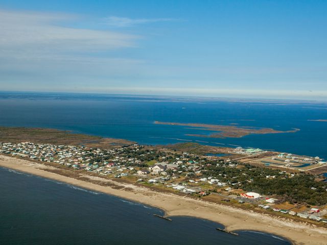
Hurricanes are one of the dramatic forces that created our coastline, creating and destroying barrier islands. In the mid-1800's, Last Island in the Isle Derniers chain was a thriving resort with several hotels, numerous supporting business and a regular schedule of passenger ships bringing visitors from the mainland. The hurricane of 1856 killed many of the residents and visitors and demolished virtually every structure; the community was never rebuilt. Several subsequent hurricanes have gradually eroded the island so that it is today but a fragment of its historic size.
A similar fate visited the 2,000 inhabitants of Grand Isle and Chenier Caminada in 1893; many of the people were killed and most of the structures destroyed in another massive hurricane. Today, Grand Isle is the only permanently inhabited barrier island in Louisiana.
Bison, Wolves and Cranes
Coastal prairie was once home to a myriad of species that no longer reside in Louisiana. Bison (referred to as "boeuf" by French explorers) were known throughout Louisiana during the late 1700's and early 1800's. A subspecies of its northern counterpart, the bison in Louisiana were not as abundant as the vast herds in the Great Plains, but roamed in small groups and were known to overwinter in south Louisiana.
Red wolf was the primary predator in the coastal prairies and marshes. Although red wolves are now considered extripated in Louisiana, hybrid crosses with coyote may still remain. Whooping cranes, the tallest bird in North America, used to nest here, with the last residents noted in the marshes around White Lake in Vermilion Parish in 1939. Sandhill cranes also nested in the prairies and savanna of south Louisiana. The Louisiana vole, a small rodent and an endemic subspecies of the more common prairie vole, once lived in burrows in the pimple mounds of coastal prairie in Louisiana and east Texas. Other former residents include prairie horned lark, ornate box turtle, and Attwaters prairie chicken.
Coastal Wetlands and Prairies are Disappearing
Louisiana is losing coastal wetlands faster than any other part of the U.S. Current data indicate that Louisiana loses an average of 25-30 square miles of coastal marsh each year. Since 1956, nearly 1 million acres of coastal marsh has been lost in Louisiana, most of which has been converted to open water. An additional 800,000 acres have been converted to other uses such as agriculture or urban development.
As shocking as those numbers are, they do not reflect the tremendous acreage of existing wetland that has been altered over time, mostly as a result of saltwater intrusion, which benefits salt-tolerant plant species to the detriment of species, like sawgrass, that are very intolerant of elevated salinity levels.
Causes of marsh loss include:
- Barrier island degradation, which exposes marshes to increased storm damage and saltwater intrusion.
- Natural subsidence, which occurs at a rate of about 1.8 feet per century.
- Sea level rise, which is estimated to be in the range of 1/2 foot per century.
- Excavation of nearly 8,200 miles of canals for navigation and oil and gas exploration.
- Construction of levees, most notable the massive levee system along the Mississippi River.
%20Erika%20Nortemann.jpg?crop=88%2C0%2C1422%2C1067&wid=640&hei=480&scl=2.222916666666667)
Constructed at a cost of $5.9 billion dollars, levees along the entire length of the Mississippi River and its major tributaries have prevented annual flooding of communities and agricultural areas in the valley. Because most of the flow of the Mississippi is now shunted directly into deeper Gulf waters, rather than being allowed to flow across expansive marshes and through estuaries, critically important nutrients and sediments bypass the marshes and flow into the Gulf. The nutrients are vital to maintaining a healthy ecosystem, while the sediments are critically important to counteract natural subsidence and sea level rise. The reduced flow of fresh water into coastal marshes also allows salt water to penetrate deep into fresh marshes..
Coastal Prairie is one of the rarest habitat types in Louisiana, with less than one percent, or about 1,000 acres, of the original 2.5 million acres remaining in a relatively natural condition. When the area was settled in the mid-1800's, the rich productive soils of the coastal prairie proved very suitable for rice production, as well as cattle grazing and other uses.
Coastal Wetlands Are Critical for Seafood and Migratory Birds
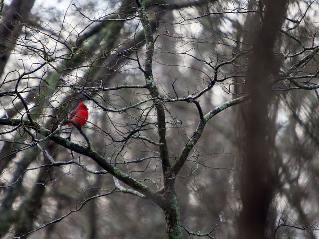
Coastal marshes are critically important to the sea food industry, as most commercially important fish, crabs and shrimp depend upon marshes and estuaries for breeding and nursery grounds. Nearly half of the nations shrimp harvest comes from Louisiana waters. From a recreational perspective, Louisiana's coastal marshes are unrivaled. Nearly 70% of all the ducks and geese that rely on the central and Mississippi flyways use Louisiana marshes.
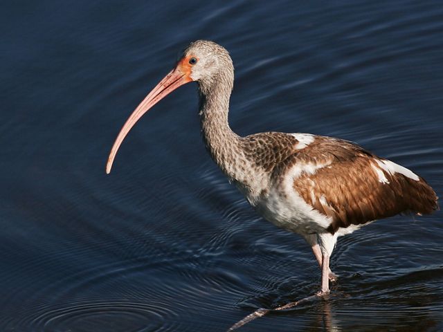
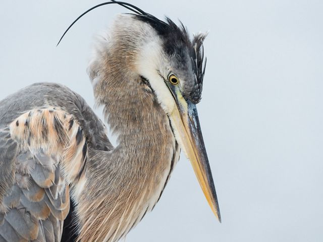
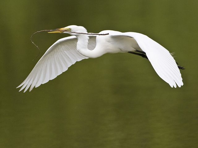
Louisiana coastal wetlands support over 100,000 nesting pairs of wading birds—herons, egrets, ibises and spoonbills—in some 150 different colonies. To put those numbers in national context, Louisiana supports more than 25% of the known U.S. breeding population for 8 of the 11 coastal nesting, colonial wading birds.
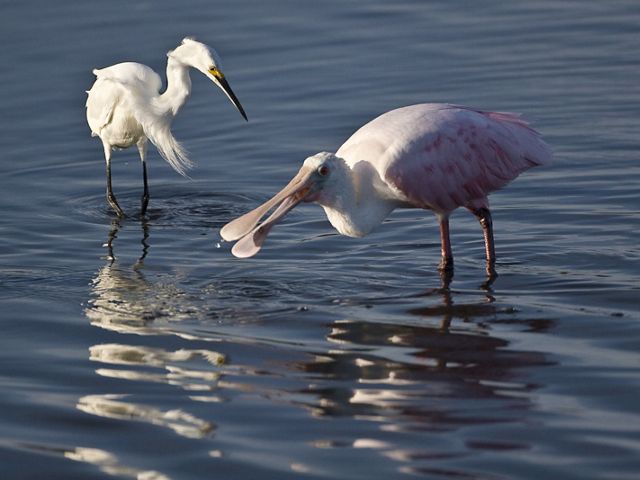
The coastal prairie region is very important to hundreds of thousands of migratory waterfowl, shorebirds, and songbirds, among other species. Ricefields now provide critical migratory and wintering habitat for numerous shorebird species. More than 86 species of dragonflies have been identified from the coastal prairie region in Louisiana.
Rare and Endangered Species
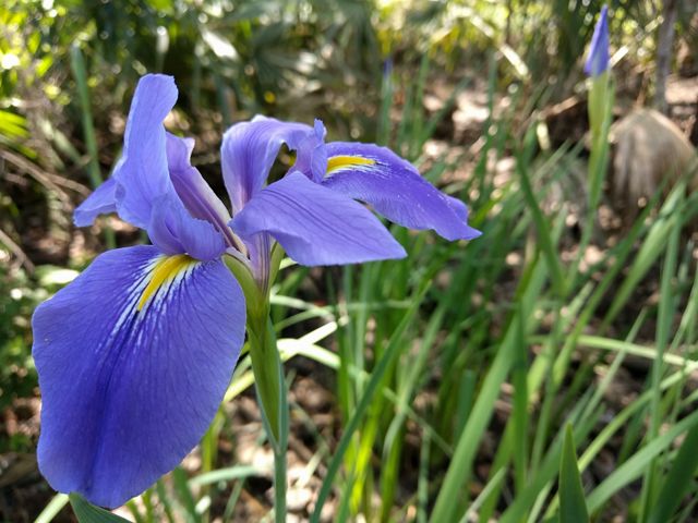
Ten plant species are considered globally rare by the Louisiana Natural Heritage Program. Those species range from giant blue iris, which is apparently endemic to Louisiana and reaches breathtaking abundance at Little Pecan Island in Cameron Parish, to Carex verrucosa, one of the many nondescript sedges that can only be differentiated by experts. An additional fifteen species of plants, including sea oats, the ubiquitous plant of eastern barrier islands, are considered rare in Louisiana even though they may be more common in other parts of their range.
Research on some of the few remaining prairie sites by Dr. Charles Allen and others revealed the coastal prairie of southwestern Louisiana contains over 500 species of plants in a special assemblage that makes it a distinct prairie type. Occurring only in Louisiana and Texas, coastal prairie is considered a globally-rare natural community. Several species of plants including Lindheimer's bee-balm, prairie flatsedge, and Correll's false dragon-head are considered globally rare, and protection of key tracts of coastal prairie may be critical to their long-term survival.
This part of Louisiana also supports eleven species of animals considered globally rare by the Natural Heritage Program. Most of Louisiana's of bald eagles nest in the transition zone between the cypress swamps of the Mississippi Valley and the coastal marshes of this ecoregion. At last count there were over 150 nesting pairs of bald eagles in Louisiana.
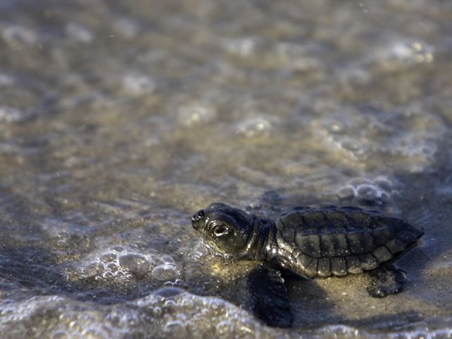
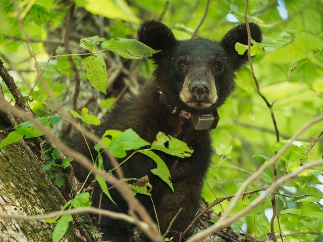
Other threatened or endangered animals include the piping plover, which winters in large numbers on Louisiana's barrier islands, the Kemp's Ridley sea turtle, which depends heavily on Louisiana estuaries as juveniles and sub-adults, and the Louisiana black bear, which inhabits some of the salt dome forests and adjacent marshes.
CONSERVATION EFFORTS
Because of the economic and recreational importance of Louisiana coastal wetlands and the unparalleled rate of loss, hundreds of millions of dollars have been spent on federal and state land acquisition and management programs. The Louisiana Department of Wildlife and Fisheries and the U.S. Fish and Wildlife Service have been leaders in coastal wetland conservation for many decades. To date, nine wildlife management areas and six national wildlife refuges have been established in this region, totaling over 800,000 acres. Included in the list of federal refuges is Mandalay National Wildlife Refuge near Houma, which was originally acquired by TNC. TNC also assisted LDWF with the expansion of Pointe-au-Chien Wildlife Management Area.
In addition to the conservation programs of state and federal agencies, countless millions have been spent by private wetland owners to ensure long-term viability of coastal wetlands under their jurisdiction. Two coastal preserves have been established by national conservation organizations: the 23,000-acre Paul J. Rainey Preserve, owned and managed by National Audubon Society, and Little Pecan Island Preserve, which was initially acquired by TNC and later sold to a conservation buyer with a strong conservation easement.
Due to a dearth of remaining natural prairie sites, most of which are very small, the majority of conservation efforts are now in the form of restoration. The Cajun Prairie Preservation Society spent nearly a decade collecting seeds and plants to restore a ten-acre site leased from Union-Pacific by the city of Eunice. This site was entered into TNC's Natural Areas Registry Program in 1994. The U.S. Fish and Wildlife Service, in cooperation with the National Wetlands Research Center, has embarked on restoring a 90-acre site north of Eunice, and plan to expand their efforts to other sites in the future, some potentially containing several thousand acres. Efforts are being made to collect seeds and plants of local genotypes in southwest Louisiana and Southeast Texas to maintain the unique qualities of the coastal prairie community as much as possible.
OPPORTUNITIES FOR PUBLIC VISITATION
Because our coastal wetlands are inherently difficult to explore, public access is limited. Several of the federal refuges, most notably Sabine, Lacassine, and Bayou Sauvage National Wildlife Refuges, have facilities, such as trails and interpretive centers, for visitors. The Barataria Unit of Jean Lafitte National Historical Park provides a dramatic opportunity to experience the transition between the forested wetlands of the Mississippi River Alluvial Plain ecoregion and the expansive marshes of this ecoregion; the visitors center and trail system are excellent. Although most of the state lands are accessible only by boat and are not developed, Rockefeller Refuge is accessibly by vehicle and a system of levees is maintained as an auto tour route complete with observation tower.
