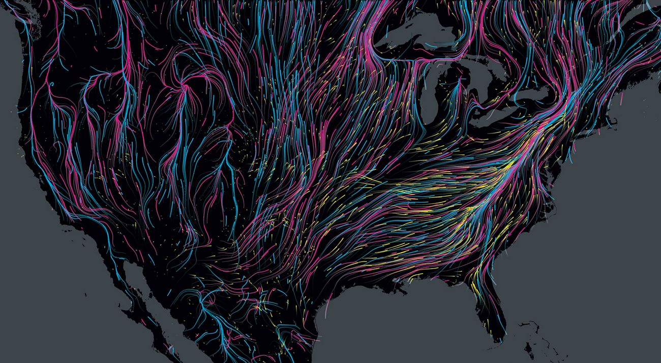
Animal Tracks
Scientists are turning to new technologies to better understand animal migrations and protect critical habitats.
Fall 2017
The Arctic tern can travel more than 49,000 miles every year as it makes its round-trip trek between the Arctic and Antarctica. In contrast, the Jemez Mountains salamander never moves more than 10 feet from its home. Scientists have long known that if you want to protect a species and its habitat, the first step is finding where it is and where it’s going.
“Animals move in all sorts of ways and places and spatial scales,” says David Mehlman, director of The Nature Conservancy’s Migratory Bird Program. “To fully conserve them, we have to protect all the places they go.”
Consider shorebirds such as red knots, which stop in coastal Delaware, New Jersey and Virginia to refuel by gorging on the eggs of spawning horseshoe crabs during their journeys between the Arctic and South America. Although the birds might spend only a few weeks along the shores of the Mid-Atlantic, if they miss the horseshoe crabs or the habitat is somehow disrupted, the result can be devastating.
“We tend to think about biodiversity as a static thing,” says Jorge Brenner, a TNC marine scientist based in Texas. In fact, he says, animals move through space and time, urged on by the need to breed or to feed. And, as many scientists know all too well, they can be surprisingly hard to follow as they flit around a forest or dive beneath the waves.
But that is changing.
Today, technology makes it easier than ever to follow animals large and small. Satellite and GPS monitoring tags get smaller and lighter every year, thanks to battery improvements and solar-powered options, allowing scientists to trail ever more petite species while minimizing animal disturbance. Newer tracking systems are able to forgo satellite monitoring and instead rely on cellular networks, which can handle more data and provide a critter’s coordinates at more frequent intervals.
Understanding the needs of a species will be increasingly important as the world warms. Plants and animals may be forced to shift their ranges as climate change alters their habitats. Tracking data will help guide conservationists as they decide which landscapes to protect now and into the future.
“Tracking boils down to full life-cycle conservation,” Mehlman says. “Without that full picture, we’re not really accomplishing the mission of conserving species and the ecosystems they depend on.”
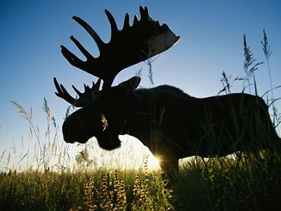
Moose Manhunt
When Nick Decesare's cell phone buzzes, it might be a friend, or it might be a text message from a dead moose. It’s all in a day’s work for a research wildlife biologist studying moose for Montana Fish, Wildlife & Parks.
Moose numbers have plummeted in nearby Minnesota, and anecdotal reports have suggested that these antlered roamers may be in trouble in Montana as well. Since 2013, DeCesare’s team has attached radio collars to more than 100 adult female moose in three regions, including TNC lands in Montana’s Rocky Mountain Front.
When a tracking collar senses that its moose is dead, it sends a cell phone alert, allowing researchers to quickly find, collect and analyze the animal for parasites or other health problems. The collars also record GPS location data so biologists can learn where the moose has been since the collar was placed on it.
So far, the effort has found that one group appears healthy, one seems to be in decline, and the third is stable with hints of higher calf mortality. In other words, it’s complicated. But the collaring data help piece it all together, and will guide the state toward wildlife management practices that will be most effective, DeCesare says. “Tracking gives us a much more powerful picture of the population as a whole."
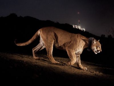
Camera Ready
In a park overlooking the city of Los Angeles, a remote camera trap captured this image of a radio-collared mountain lion in 2013. Working with researchers at the University of California, Davis, TNC scientists used radio collars, camera traps and other tracking methods to monitor mountain lions like this one in Southern California from 2001 to 2017. Through genetic sampling, the researchers were able to document a decline in genetic diversity and, in the process, support efforts to protect additional habitat for the wide-roaming mammals.
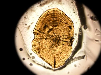
In the Lab
When spring meltwater pours into rivers and streams near Green Bay, Wisconsin, locals gather streamside to watch northern pike migrate. Pike are popular sport fish, but the loss of wetlands and changes to river habitat have taken a toll.
Pike breed in wetlands and other areas with underwater vegetation. Conservationists can restore those habitats—but it’s unclear if pike will use them. “The key question was do adult pike return to spawn in the places they were born?” says Dan Oele, a fisheries biologist at the Wisconsin Department of Natural Resources.
In 2011, Oele and his team turned to pike ears to find the answer. Tiny structures called otoliths are present in the ears of vertebrates. Like tree rings, otoliths record a fish’s life history season by season, taking up telltale chemical markers from the waters they travel and enabling researchers to learn where they've been.
Oele worked with TNC scientists and other partners to analyze otoliths from 185 pike and found the fish have no loyalty to their native waters. That’s good news, since it suggests the fish will happily swim their way to any available breeding ground. That discovery has helped justify restoration projects in waterways around Green Bay, Oele says.
“When we create wetlands or open up a problem culvert,” Oele says, “we can be confident that if it’s suitable, the pike will find it.”
Sniff Test
New Mexico is the only place on Earth you’ll find the Jemez Mountains salamander. But good luck spotting one. They spend most of the year underground, emerging only during the summer rainy season. Even then they mostly stay hidden under logs and rocks.
“They’re darn hard to look for,” says Anne Bradley, TNC’s forest conservation program director in New Mexico. They’re not just elusive; they’re also endangered. The National Park Service and the Forest Service are thinning trees to restore overgrown forests where the salamanders are found, but to do so responsibly, TNC scientists want to know where the at-risk amphibians are hiding.
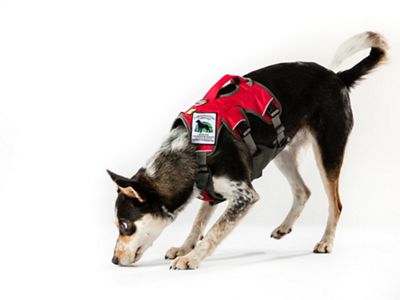
From 2012 to 2014, Bradley recruited some four-legged helpers. A program at the University of Washington trains rescue dogs to sniff out wildlife and their scat. To track salamanders, the crew brought in two specially trained “Conservation Canines”: Frehley and Sampson.
Working as a human-canine team, the dogs and their handlers detected more salamanders than either would alone, Bradley says. Now she’s working with geneticists at the University of New Mexico to determine precisely what bits of salamander DNA the dogs are detecting—a step that Bradley expects will further validate the use of dogs for more salamander sniffing in summers to come.
Eyes in the Sky
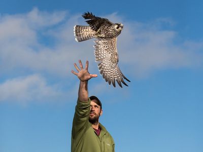
Thirteen miles from the coast of Rhode Island, migrating raptors find refuge on a dollop of land called Block Island. Since 2012, biologists from the Biodiversity Research Institute, facilitated by TNC, have been capturing merlins and peregrine falcons on their island stopovers in order to understand the birds’ migration patterns. They collect blood and feather samples for analysis before harnessing some of the birds with small satellite transmitters—technology only recently light enough to use on certain species.
From his office computer, the research institute’s raptor program director Chris DeSorbo tracks the raptors to their wintering grounds in Central and South America, the Bahamas, and Cuba. In the spring, he follows them on the way to their summer abodes in Greenland, Canada and other northern spots.
The work was initially funded by a federal grant related to offshore wind energy development. DeSorbo is sharing the findings with the scientific community and natural resource agencies to inform decisions related to wildlife conservation and management.
It’s clear that many birds rely on Block Island as a migratory stopover, he says. “It’s pretty striking when you see the maps of these squiggly lines all over the open ocean. That’s basic info nobody really had much of a handle on.”