Tool Protects Floodplains in the Mississippi River Basin
TNC's interactive Floodplain Prioritization Tool helps stakeholders make decisions about water quality, wildlife habitat and flooding.
Overview
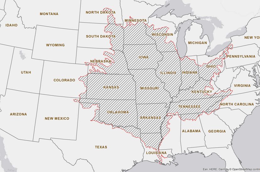
The Nature Conservancy developed the Floodplain Prioritization Tool (FP Tool) to identify critical opportunities for floodplain protection and restoration in the Mississippi River Basin. Utilizing data developed by TNC and provided by several partners, the new FP Tool is interactive, web-based and designed to help decision-makers—like federal, state and local governments, county planners, land trusts, and businesses—optimize their protection and restoration investments and minimize the impacts of development. The tool allows stakeholders to make decisions related to water quality, wildlife habitat, flooding and other goals.
For decades, The Nature Conservancy has worked in floodplains—work that has helped improve water quality, reduce flood risks for communities and enhance wildlife habitat and recreational opportunities in places throughout North America and beyond.
Restoring Floodplains to Improve Water Quality
The Wabash River, which winds through much of Indiana before reaching the Ohio River, flows through the heart of one of the nation’s most fertile agricultural regions. While farmlands in the Wabash’s floodplain contribute a significant portion of the crops produced within this incredibly important region, they are also known for producing a disproportionate amount of nutrients that make their way into the Mississippi River and eventually to the Gulf of America.
When they flow into rivers, lakes or bays, excess nutrients—nitrogen and phosphorus—support the growth of algal blooms that can consume the water’s oxygen, degrade water quality and cause widespread fish kills, along with other wildlife impacts.
Nutrients enter waterways from a number of sources including cities, wastewater treatment plants and residential areas, but agriculture production is a major contributor. And while the Wabash River accounts for just 1 percent of the flow into the Gulf of America, it’s responsible for 11 percent of the nutrients that make it there. This is why the Wabash is a priority for TNC.
“The Wabash gives us a chance to demonstrate that restored floodplains—those restored to wetlands or forests—can do a really good job of absorbing nutrients before they make it to our waterways,” says Matt Williams, TNC’s director of conservation in Indiana. “The monitoring of nutrients in streams that flow into the Wabash show that our restoration projects are helping reduce the amount of nutrients in the water.”
Quote: Matt Williams
The Wabash gives us a chance to demonstrate that restored floodplains—those restored to wetlands or forests—can do a really good job of absorbing nutrients before they make it to our waterways.
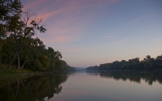
TNC’s nutrient-reducing project sites along the Wabash were selected before the development of the Floodplain Prioritization (or FP) Tool. But Matt says he can see how the tool will help TNC and others involved in floodplain or conservation projects moving forward.
“It’s good to see that the FP Tool validates the selection of our restoration sites, most of which were on marginal farmlands that regularly flood,” says Matt. “This new tool will make it much easier to work with farmers to select areas to reduce the amount of in-stream nutrients while producing other benefits, like improved wildlife habitat.”
Fortunately, Matt says finding farmers willing to work with TNC isn’t difficult.
Mars Harlan, a farmer from Terre Haute, Indiana, who has worked with TNC and its partners to restore parts of his marginal croplands, says, “You want to be a good steward. We all have responsibilities to do what we can. I think all farmers realize that.”
Mars agrees that focusing on marginal farmlands is smart not only because they are responsible for much of the nutrient runoff, but also because they are usually among the least profitable for farmers. “Marginal land in the river bottoms is actually very good soil. If you can just keep the water off of it, it’s some of the best soil in the world. You just can’t count on it every year when the river comes in and takes your crops out. That’s what makes it ‘marginal.’ It’s very risky ground to farm.”
Like most of the nutrient-reducing projects in floodplains in the Mississippi River Basin, TNC works with partners, like the U.S. Natural Resource Conservation Service to find funding that compensates farmers when they restore marginal croplands and take them out of production.
The Floodplain Prioritization Tool’s Potential
From mitigation and disaster relief funding to improving water quality or wildlife habitat to reducing flood risk, federal, state and local governments and even businesses are becoming increasingly interested in investing in the protection or restoration of critical habitats like floodplains.
“We wanted to provide a science-based tool that can help guide these investments and assess tradeoffs. The FP Tool does just that,” says Kris Johnson, who is TNC’s deputy director of agriculture for North America and who led the development of the tool. “The FP Tool is unique in that it's the first time so many different data layers have been combined and made available in one place.”
Reducing Flood Risks for Communities
In addition to helping stakeholders achieve goals related to water quality and wildlife habitat, the Floodplain Prioritization Tool also enables them to select sites where nature itself can help reduce flood risks for communities.
“The foundation of this tool is first-of-its-kind comprehensive floodplain mapping,” TNC’s Kris Johnson says.
The flood mapping was generated by a new flood model developed by TNC and colleagues at the University of Bristol in the United Kingdom. Collaborating with them and with Fathom, a flood analytics company, TNC published a recent flood-risk study showing that three times as many people in the U.S. are vulnerable to riverine flood risk than previously thought.
With a focus on flood-risk reduction, the FP Tool is helping inform a collaborative floodplain management plan for Missouri’s Lower Meramec River that’s being guided by an integrated, multi-disciplinary planning process through the U.S. Army Corps of Engineers’ Silver Jackets program. Here, the partners have created a pilot, localized version of the FP Tool that demonstrates the potential to adapt the basin-scale version to local partnerships and local floodplain management projects.
TNC’s Work to Reduce Flood Risks
Missouri’s Meramec River is just one of many places where TNC has worked in floodplains to help reduce flood risks for people. Other notable projects include:
At the Mollicy Farms Unit of the Upper Ouachita River National Wildlife Refuge in Louisiana, TNC worked with the USFWS to reconnect 25 square miles of floodplain habitat to the Ouachita River.
At more than 6,000 acres, TNC’s Emiquon Preserve in Illinois is one of the largest floodplain restoration projects in the Midwest.
The Land of the Swamp White Oak project area is a 300,000-acre floodplain landscape at the confluences of the Cedar, Iowa and Mississippi Rivers in Iowa. Some 40,000 acres of public and private lands have been voluntarily protected here.
In 2009, severe flooding on the Puyallup forced one of the largest urban evacuations in the state’s history—26,000 people. After this flood, 1.5 miles of a levee were set farther back from the river’s channel to give the Puyallup more room. The restoration work was put to the test in November 2014, when similar heavy rains pounded the area. The new, setback levee passed with flying colors, as the same communities that were inundated in 2009 avoided flooding in 2014.
America's Watershed Initiative
TNC spearheaded the creation of America’s Watershed Initiative, which is now its own non-profit organization that works with hundreds of business, government, academic, and civic organizations to find solutions for the challenges of managing the Mississippi River and the more than 250 rivers that flow into it. In 2016, AWI released its “Report Card” for the basin, and it is now working to update the report card for 2020.
Naturally Resilient Communities
The Naturally Resilient Communities partnership has created an online guide of nature-based solutions and included case studies of successful projects from across the nation to help communities learn more and identify which nature-based solutions might work for them, with an emphasis on flood-risk reduction. The Resources page on the Naturally Resilient Communities website includes links to dozens of valuable resources related to flood-risk reduction.
Learn More
Check out the Floodplain Prioritization Tool
Check out the Floodplain Prioritization ToolFP Tool Partners
Partners that contributed data that’s used in the basin-wide version of the FP Tool include: University of Bristol, UK*; Fathom*; Univ. of Iowa*; US Geological Survey; US Army Corps of Engineers; US Environmental Protection Agency; National Fish Habitat Partnership; US Fish and Wildlife Service; American Bird Conservancy; Natural Resources Conservation Service; and USA National Phenology Network.
*Partners that provided data that was previously unavailable online.
